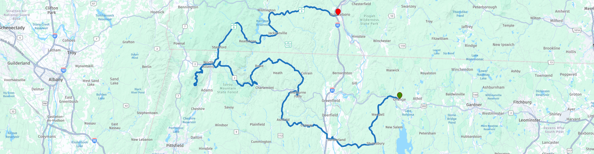
Orange to Brattleboro

This route was brought to you by:
RouteXpert Paul Hedges - Adv RouteXpert
Last edit: 07-01-2020
 Route Summary
 Along which you will find some of the best New England roads and some of the best New England views. The roads and scenery alone make this a 4 star ride
 Share this route


Animation

Verdict


Duration
5h 19m

Mode of travel
Car or motorcycle

Distance
264.06 km

Countries

 RouteXpert Review
 Arriving in Shutesbury take a right and continue along towards Leverett Pond (WP6)
Head across the Connecticut River (WP8) and then turn right and ride to the top of Sugarloaf Mountain (WP9). Back on the road and it is a quick coffee break at Subway (WP10)
Continue the 116, after passing through Conway look out for one of the covered bridges New England is famous for (WP13) keep riding the winding 116 passing through Ashfield until turning right onto the 112. Trees line the curves as you head north to Shelburne Falls. Here take some time to view the famous potholes in the river (WP19). Continue north on the 112 until taking a right onto the quiet Adamsville Road. Ride the twisting back roads until you meet up again with the Mohawk Trail. This road is a continually curving road that makes it’s way through the Florida State Forest. There are plenty of opportunities to take photographs across the mountain views before stopping for lunch at the Golden Eagle (WP34) while enjoying the views across the valley. Heading down the hillside ride through North Adams before turning left and heading towards Mount Greylock. Ride up the twisting road to the highest point in Massachusetts and take time to visit the Veterans War Memorial Tower and look out across the countryside. 90 miles visibility is possible if the weather is good. $10 to park at the top but the views alone make that feel inexpensive.
Head back down the mountain, back through North Adams and take the 8 heading north. This road is made of long easy curves as it leads you through the surrounding hills. Take a left on the 100 towards Whitingham and pass the huge Harriman Reservoir. Pass through Whitingham and continue north until reaching the Molly Start Trail. Pull over at the Hogback overlook and take in the views (WP49). There is also a chance to visit the Vermont Distillery and see what is on offer. The easy flowing road continues until you reach the Vermont Maple Museum (WP50) where there is never a reason not to buy maple good maple syrup. Follow the road along until you reach the town of Brattleboro and a stop at the Flamingo Diner for a coffee to finish the days riding (WP53)


 Links
Links  Usage
Usage Want to download this route?
You can download the route for free without MyRoute-app account. To do so, open the route and click 'save as'. Want to edit this route?
No problem, start by opening the route. Follow the tutorial and create your personal MyRoute-app account. After registration, your trial starts automatically.  Disclaimer
Use of this GPS route is at your own expense and risk. The route has been carefully composed and checked by a MyRoute-app accredited RouteXpert for use on TomTom, Garmin and MyRoute-app Navigation.
Changes may nevertheless have occurred due to changed circumstances, road diversions or seasonal closures. We therefore recommend checking each route before use.
Preferably use the route track in your navigation system. More information about the use of MyRoute-app can be found on the website under 'Community' or 'Academy'.