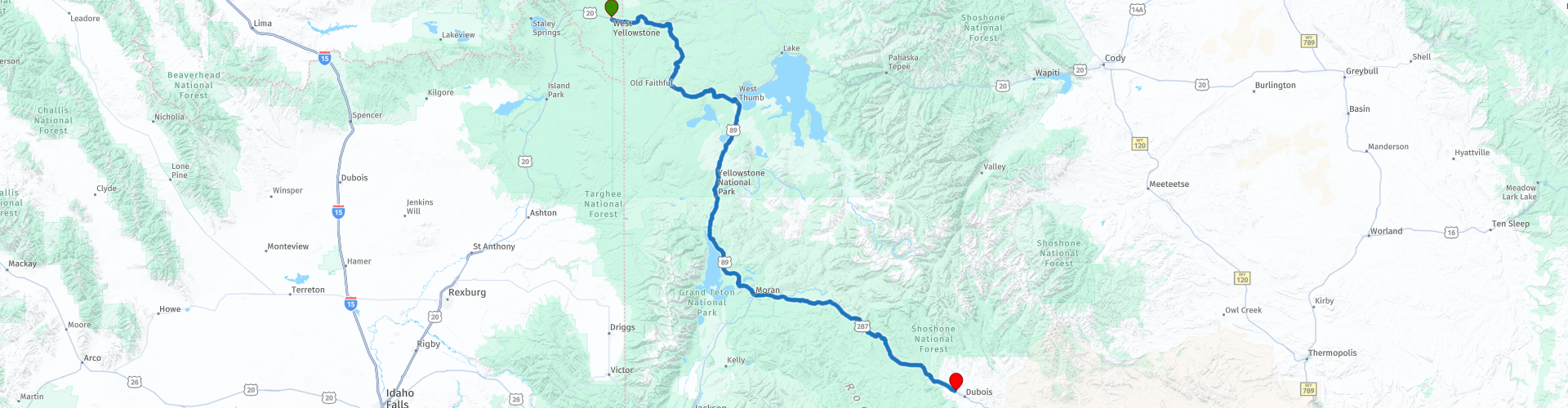
D09 Yellowstone NP Dubois

This route was brought to you by:
RouteXpert Hans van de Ven (Mr.MRA)
Last edit: 26-12-2019
 Route Summary
 The roads are good and the views beautiful the geysers blue and green, but always very beautiful, another day to expand the photo collection.
Starting point: Best Western Weston Inn.
End point: Super 8-Dubois.
The route has been made the same for TomTom, Garmin and MyRoute-app Navigation users.
Thanks to Richard & Lisa for the information!
 Share this route


Animation

Verdict


Duration
3h 30m

Mode of travel
Car or motorcycle

Distance
243.03 km

Countries

 RouteXpert Review
 We start the route again in Yellowstone National Park (NP), with its colored hot springs, sulfur fumes and geysers. Followed by the Teton National Forest, the Bridger-Teton is located in West Wyoming and offers more than 3.4 million acres of public land for your enjoyment in outdoor recreation. The Bridger-Teton National Forest consists of pristine river basins, an abundance of wildlife and immense wildlife lands. It consists largely of the Greater Yellowstone Ecosystem - the largest intact ecosystem. The park contains nearly 1.2 million acres of wilderness, more than 3,000 miles of roads and trails and thousands of miles of pristine rivers and streams, the Bridger-Teton offers something for everyone.
Then it goes through the Shoshone National Forrest. The Shoshone National Forest offers beautiful scenery and endless recreational opportunities! The Shoshone National Forest was reserved in 1891 as part of the Yellowstone Timberland Reserve, making the Shoshone the first national forest in the United States. It consists of approximately 2.4 million hectares of varied terrain, ranging from sagebrush flats to rugged mountains. The higher mountains are covered with snow most of the year. Immense areas of exposed rock are interspersed with meadows and forests. With Yellowstone National Park on the western border, the Shoshone covers the area from the Montana State Line in the south to Lander, Wyoming, and includes parts of the Absaroka, Wind River and Beartooth Mountains.
In this 4-star route you will drive along beautiful good roads, a stop at the Oxbow Bend Overlook and the Senic Overview over the Lunch Tree Hill is a must.
History:
The city of Dubois was founded in 1914. In the same year, Wyoming Tie and Timber Company opened woodworking activities here and eventually became the largest source of railroad ties in the country. The "tie hack" operations ended in 1949, after which Louisiana Pacific operated a sawmill in the city until 1988.


 Links
Links  Usage
Usage Want to download this route?
You can download the route for free without MyRoute-app account. To do so, open the route and click 'save as'. Want to edit this route?
No problem, start by opening the route. Follow the tutorial and create your personal MyRoute-app account. After registration, your trial starts automatically.  Disclaimer
Use of this GPS route is at your own expense and risk. The route has been carefully composed and checked by a MyRoute-app accredited RouteXpert for use on TomTom, Garmin and MyRoute-app Navigation.
Changes may nevertheless have occurred due to changed circumstances, road diversions or seasonal closures. We therefore recommend checking each route before use.
Preferably use the route track in your navigation system. More information about the use of MyRoute-app can be found on the website under 'Community' or 'Academy'.

Wyoming
About this region
Wyoming is a state in the Mountain West subregion of the Western United States. The 10th largest state by area, it is also the least populous and least densely populated state in the contiguous United States. It is bordered by Montana to the north and northwest, South Dakota and Nebraska to the east, Idaho to the west, Utah to the southwest, and Colorado to the south. The state population was 576,851 at the 2020 United States census, making it the least populated U.S. state. The state capital and the most populous city is Cheyenne, which had an estimated population of 63,957 in 2018.Wyoming's western half is mostly covered by the ranges and rangelands of the Rocky Mountains, while the eastern half of the state is high-elevation prairie called the High Plains. It is drier and windier than the rest of the country, being split between semi-arid and continental climates with greater temperature extremes. Almost half of the land in Wyoming is owned by the federal government, leading the state to rank 6th by area and fifth by proportion of a state's land owned by the federal government. Federal lands include two national parks—Grand Teton and Yellowstone—two national recreation areas, two national monuments, several national forests, historic sites, fish hatcheries, and wildlife refuges.
Original inhabitants of the region include the Arapaho, Crow, Lakota, and Shoshone. Southwest Wyoming was claimed by the Spanish Empire and then as Mexican territory until it was ceded to the U.S. in 1848 at the end of the Mexican–American War. The region acquired the name "Wyoming" when a bill was introduced to Congress in 1865 to provide a temporary government for the territory of Wyoming. The name had been used earlier for the Wyoming Valley in Pennsylvania, and is derived from the Munsee word xwé:wamənk, meaning "at the big river flat".Wyoming's economy is driven by tourism and the extraction of minerals such as coal, natural gas, oil, and trona. Agricultural commodities include barley, hay, livestock, sugar beets, wheat, and wool. It was the first state to allow women the right to vote and become politicians, as well as the first state to elect a female governor. Due to this part of its history, its main nickname is "The Equality State" and its official state motto is "Equal Rights". It has been a politically conservative state since the 1950s, with the Republican presidential nominee carrying the state in every election since 1968. A notable exception is Teton County, which has achieved notability for being Wyoming's most Democratic county and the only county in the state to be won by a Democrat in every election since 2004.
Read more on Wikipedia
Original inhabitants of the region include the Arapaho, Crow, Lakota, and Shoshone. Southwest Wyoming was claimed by the Spanish Empire and then as Mexican territory until it was ceded to the U.S. in 1848 at the end of the Mexican–American War. The region acquired the name "Wyoming" when a bill was introduced to Congress in 1865 to provide a temporary government for the territory of Wyoming. The name had been used earlier for the Wyoming Valley in Pennsylvania, and is derived from the Munsee word xwé:wamənk, meaning "at the big river flat".Wyoming's economy is driven by tourism and the extraction of minerals such as coal, natural gas, oil, and trona. Agricultural commodities include barley, hay, livestock, sugar beets, wheat, and wool. It was the first state to allow women the right to vote and become politicians, as well as the first state to elect a female governor. Due to this part of its history, its main nickname is "The Equality State" and its official state motto is "Equal Rights". It has been a politically conservative state since the 1950s, with the Republican presidential nominee carrying the state in every election since 1968. A notable exception is Teton County, which has achieved notability for being Wyoming's most Democratic county and the only county in the state to be won by a Democrat in every election since 2004.
View region
 Statistics
  20
20Amount of RX reviews (Wyoming)
 20526
20526Amount of visitors (Wyoming)
 340
340Amount of downloads (Wyoming)
 Route Collections in this region
 Top car and motorcycle tour through the Midwest of the USA
By car or motorcycle through the Midwest of America is a journey that you do not just make, so it is not a 13-day drive and then back home. No, book a stay of several days in Denver, Cheyenne, Rapid City (In August the Sturgis Bike Ralley, stay there for a day or 4), Yellowstone National Park, Estes Park and again Denver to also visit several places of interest in these cities, so that this tour becomes an unforgettable tour that you can remember with pleasure.
Do not forget to arrange and pack the following items:
*This is only a summary and completely personal and may differ per person.
Take out travel insurance, +31 for numbers in GSM, (partially) take out gas, Health insurance coverage at destination?, Switch off electrical appliances, Lighting (time clock), Check passport validity, Antenna from radio/TV due to lightning, Residence address for those left behind, Remote control house alarm, Book Smart Parking.
Hand luggage:
Liquids in packaging of max. 100 ml, Liquids in hand luggage in transparent plastic bag.
For on the road:
Candy, Book, Earplugs, Country and road map(s), Directions, Maps in your navigation system
Money & Securities:
Bank card / giro card, Credit card (think pin code), Cash, Calculator for Internet banking, Medical insurance card, Travel insurance card.
Travel documents:
Passport, (International) Driver's License, Ticket(s), Reservation Tickets, Hotel Vouchers, Arrival/Departure Time, Check-in & Check-out Times, Valid Visa (ESTA), Travel Guide.
Clothing:
Underwear, Belt, Shirts/ T-shirts, Shorts, Long pants, Shoes, Socks, Swim trunks, Towel, Slippers.
Personal stuff:
Watch, House Keys, Wallet, Sunglasses.
Toiletries:
Deodorant, Shower gel / Soap, Comb / brush, Shaving equipment, Shampoo, Toothbrush, Toothpaste, Sanitary pads
Health & Medicine:
Own medicines, Insect repellent, Cold sore ointment, Ointment for insect bites, Sunscreen, Norit, Paracetamol, Suction cup for insect bites, First aid bag.
Miscellaneous:
Travel bag / waist bag, Leatherman (= checked luggage), Pen or pencil, Headlamp, Lighter, Tools & Electronics, Mobile phone & charger, Photo/video camera & charger, Memory card(s), World plug / adapter, Ipod & charger, Adapter cable Ipod, Headphones, iPad & charger, Navigation & charger/plug, Plug socket, Fuelpack battery.
Engine (accessories):
Helmet, Motorcycle clothing, Motorcycle boots, Chain lock / disc brake lock, Gloves, Bandana, Inner bags (plastic shopping bag), Insulation bag, Tension straps, Tie wraps, Rain suit, Rainaway.
Addresses:
Address list, Embassy telephone number, Telephone number to block (bank) card(s), Telephone number (airline tickets).
View Route Collection
The 10 most downloaded routes in the USA from RouteXpert Hans van de Ven
Hello and welcome to this collection of the Top 10 MyRoute app downloaded routes in USA.
There will be a great new event to be announced soon, where all these routes can be driven.
Download them all now and place them in a new "Top 10" folder, so that you always have them at hand.
If you are going to drive one of these routes in the meantime, track them with the MRA Mobile App or with MRA Navigation. Take some photos (moments) along the way as these will come in handy.
Create a travelogue of your Top 10 driven routes and add the recorded track to it.
There will also be some great prizes on offer, so keep an eye on the MRA-RouteXperts page and your mail.
The 10 routes are:
1. D13 Estes Park Denver
2. D03 Chadron Custer
3. D01 Pigeon Forge round trip through the Smokey Mountains
4. D08 Kalispell Sandpoint
5. D10 Colville Wenatchee
6. D09 Sandpoint Colville
7. D04 Custer Wall
8. D11 Wenatchee Seattle
9. D08 Cody Yellowstone NP
10.R13 San Francisco Monterey
View Route Collection