R16 QLD NT Mount Isa to Ilperle

This route was brought to you by:
RouteXpert Hans van de Ven (Mr.MRA)
Last edit: 24-01-2021
 Route Summary
 Australia is very large; 8 million km2, which is more than 226 times larger than the Netherlands! Has a diversity of flora and fauna; the most diverse types of plants, trees and animals, especially birds and a lot of typical Australian marsupials, which you will not find anywhere else in the world!
Enjoy all the beauty immensely: From the evergreen tropical rainforests, to the vast Outback; from the desert to the countless and peaceful idyllic palm beaches; from the winter sports areas in the southeast to the vibrant and impressive metropolis of Melbourne, Sydney and Perth.
You will see it all and experience it in this amazing tour through Australia, a tour to remember!
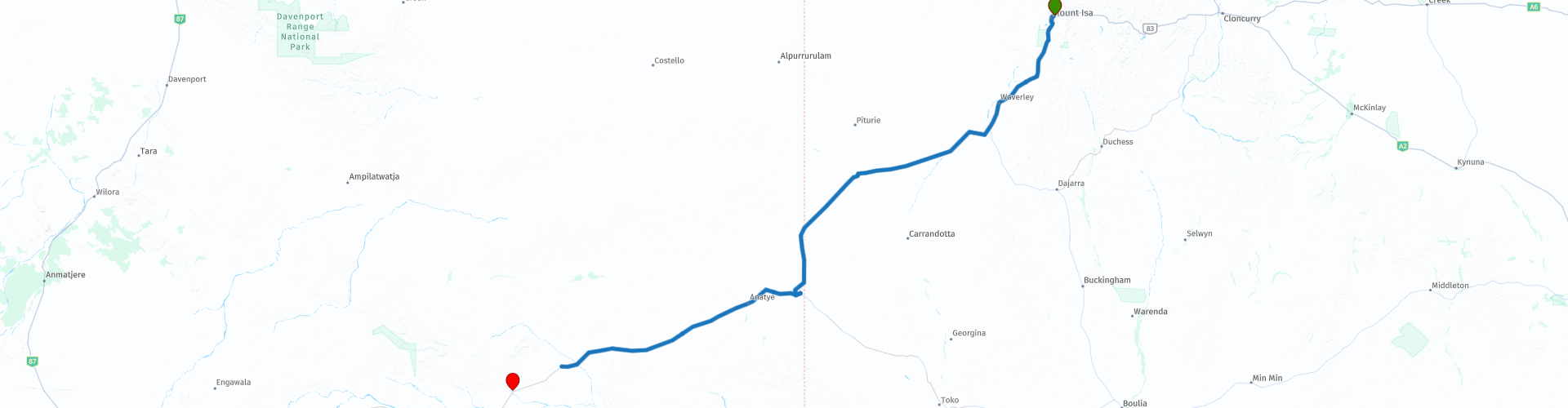
Starting point: Mount Isa, Copper City Motel
End Point: Ilperle, Jervois Station Campground
The route has been created for TomTom, Garmin and MyRoute-app Navigation users.
ATTENTION: DRIVE LEFT!
 Share this route


Animation

Verdict


Duration
5h 53m

Mode of travel
Car or motorcycle

Distance
504.06 km

Countries

 RouteXpert Review
 The Plenty Highway, although called a 'highway', is a dirt track. You MUST make sure you have a very suitable vehicle (4wd, motor home, motorbike) to traverse this road, whether traveling east or west!
This route also goes through the outback, these are the regions that are far from civilization. The outback covers nearly three-quarters of Australia and extends mainly across the Northern Territory and Western Australia, and parts of the states of Queensland, New South Wales and South Australia.
The term outback includes various landscapes and climatic zones. Large parts of the outback in Western Australia are inaccessible: sometimes there is no rain here in years, while in summer the temperature rises above 50 ° C. The Queensland outback, on the other hand, consists partly of tropical rainforest.
The characteristics of the outback are:
- Only a few paved roads are present. Farms (stations) are often located on sandy paths that can only be driven with off-road vehicles. It is no exception when a farm is 80 kilometers from the paved road.
- Farms are self-catering. It is no problem if a supermarket cannot be visited for weeks.
- Settlements with several houses, a gas station, a supermarket, a garage, a bank and catering facilities are hundreds of kilometers apart.
- Children receive remote education via radio (School of the Air) and the Internet.
- In the event of serious illness and accident, the Royal Flying Doctor Service (RFDS) is called upon.
Camels were imported from the Middle East in 1870. They live partly on farms, partly in the wild.
- Of the approximately 300,000 Aborigines (approximately 1.5% of Australia's total population), approximately 20% live in the outback, most of them in reservations.
The first route with a campsite as the end point, make sure you have your things in order and that you have enough food and drinks with you. No cities this time, but Tobermorey Station & Roadhouse. The Tobermorey Roadhouse has both unleaded gasoline and diesel fuel, a shop stocked with a small variety of small goods, souvenirs, tire repairs, and camping and cabin accommodations.
This 4-star rated route will push your limits and drive on paved and unpaved roads. Take your time when you are at Tobermorey Station & Roadhouse, you can refuel here and have some food and drink.
General info:
Queensland (literally translated: Queensland) is a state in northeastern Australia. Queensland is the second largest in area and Australia's third largest state in terms of population. The state was named after Queen Victoria, the monarch at the time of the settlement of the former colony. The capital and largest city of Queensland is Brisbane, located in the southeast of the state. The northern portion of the state, separated by the Tropic of Capricorn, is tropical. The south is subtropical. Queensland was originally a British crown colony that emerged in 1859 after secession from New South Wales. The city of Brisbane originally started as the Moreton Bay penal colony, which held convicts who again committed errors while serving their sentences in New South Wales.
Brisbane is located about 100 kilometers north of the border between Queensland and New South Wales. Southeast Queensland also has two larger population centers: the Gold Coast south of Brisbane, and the Sunshine Coast north of Brisbane. Along the approx. 2000 km long coast (from south to north) are the following cities: Coolangatta - Gold Coast - Brisbane - Sunshine Coast - Gympie - Maryborough - Hervey Bay - Bundaberg - Gladstone - Rockhampton - Mackay - Townsville - Cairns. The following cities are inland (counterclockwise): Warwick - Toowoomba - Roma - Charters Towers - Mount Isa. The world's largest city by surface, Mount Isa is located in northwestern Queensland. The area of the city is 42,904 km² (approximately the area of the Netherlands!), But the city has a population of approximately 20,000 (2003).
The state is home to five World Heritage Sites: Australian Mammal Fossil Sites (Riversleigh / Naracoorte),
Gondwana rainforests, Fraser Island, The Great Barrier Reef and the Tropical wetlands of Queensland.
Queensland can be roughly divided into three parts:
1.The eastern coastal strip, dominated by the Great Australian Separation Mountains. From north to south there are also the Darling Downs, the Bunya Mountains, the Carnarvon Gorge, the Whitsunday Islands, Hinchinbrook Island and the Atherton Tableland. Off the coast, north of Fraser Island, the Great Barrier Reef begins.
2.The tropical Cape York Peninsula in the north. To the north of this is the Straits Torres with the Straits Torres Islands and to the east most of the Great Barrier Reef.
3 Most of the dry interior, called the Queensland outback, with the Channel Country in the southwest.
The Northern Territory consists of the originally northern part of the state of South Australia. However, this is again contested by the state of Western Australia, as the heir to New Holland. It is now an area with limited self-government, has an area of 1,349,129 km² and a quarter of a million inhabitants. The population density is extremely low with one inhabitant on five square kilometers. The capital is Darwin, the northernmost city in the country.
The Territory, has the image of a large nature reserve and the few inhabitants like to describe themselves as tough, hardy nature people. Two of the most visited natural areas in Australia are located in the Northern Territory: the tropical Kakadu National Park in the north and the world-famous Uluṟu-Kata Tjuṯa National Park in the south (Uluṟu used to be known as Ayers Rock). The province is also home to the wonderful Devils Marbles Conservation Reserve.
Most of the Simpson Desert is in the southeast corner, while the Tanami Desert is in the west. The MacDonnell Mountains extend east and west from Alice Springs. Arnhemland, a large area belonging to the Aboriginal population, is located to the north of the territory, and the Barkly Plateau to the northeast.
The entire Northern Territory has only two cities: Darwin and Palmerston. Other places include Alice Springs, Katherine, Tennant Creek, and Jabiru.
The Northern Territory is home to only 1% of Australia's total population, more than half of whom live in the capital, Darwin. 32.5% of these are Aborigines.


 Links
Links  Usage
Usage Want to download this route?
You can download the route for free without MyRoute-app account. To do so, open the route and click 'save as'. Want to edit this route?
No problem, start by opening the route. Follow the tutorial and create your personal MyRoute-app account. After registration, your trial starts automatically.  Disclaimer
Use of this GPS route is at your own expense and risk. The route has been carefully composed and checked by a MyRoute-app accredited RouteXpert for use on TomTom, Garmin and MyRoute-app Navigation.
Changes may nevertheless have occurred due to changed circumstances, road diversions or seasonal closures. We therefore recommend checking each route before use.
Preferably use the route track in your navigation system. More information about the use of MyRoute-app can be found on the website under 'Community' or 'Academy'.