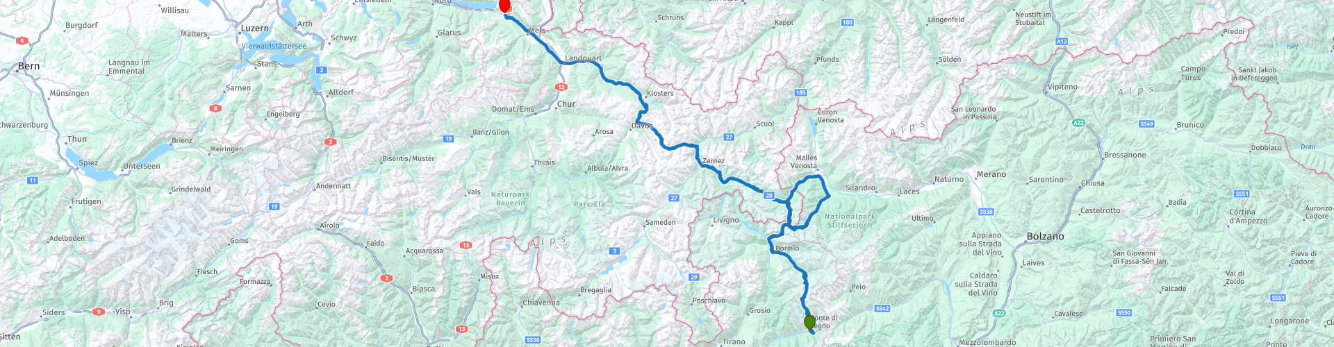
Ponte di Legno Stelvio Flums

This route was brought to you by:
RouteXpert René Plücken (MRA Master)
Last edit: 12-02-2021
 Route Summary
  Share this route


Animation

Verdict


Duration
5h 31m

Mode of travel
Car or motorcycle

Distance
273.24 km

Countries


 RouteXpert Review
 The first pass is the Passo di Gavia (RP3), a mountain pass in the Italian Alps in the Lombardy region. It is one of the highest pass roads in Europe and the highest point is 2621m. The road leads right through the pristine Stelvio National Park and is very narrow, often no wider than three meters. Overtaking on the route is almost impossible, for which alternative places have been created. The Frigidolfo River flows deep into the valley. In some places there is no guardrail and next to the road there is an abyss of more than 500 meters deep. This makes this road one of the most dangerous mountain passes. So be careful, don't drive too fast and enjoy the beautiful surroundings.
Via Bormio we drive the Passo dello Stelvio, a well-known, heavy, notorious and high mountain pass in Europe. At RP10 there is an opportunity to shop and eat or drink something. Note that it can be busy, especially on weekends.
The highest point is at 2758 meters altitude (RP11). The Stelvio has 39 hairpin bends on the south side (Bormio) and 48 hairpin bends on the north side (Prato). We drive a round and the descent of the Umbrailpass (RP12) we ride twice, this narrow mountain pass also has many hairpin bends and a number of tunnels, note these are unlit.
The ride through Switzerland also goes through a number of passes, including the Flüela Pass (RP16), in the Canton of Graubünden between Davos and Susch. This pass, with a height of around 2400 meters, forms the main connection between the north of the Engadine and Davos. Next to the mountain pass is a small lake, the Schottensee (RP16). We also pass the Davosersee on the way to the Wolfgangpass (RP18) in Switzerland, located in the canton of Graubünden, this pass lies at an altitude of 1,631 meters.
We drive through the Gotschna tunnel (RP19), a two-lane tunnel in a tunnel tube of 4,207 meters long that makes a 180-degree bend on the south side and turns into the Sunnibergbrücke (RP20) on the north side, a beautiful span bridge of over 500 meters long. A beautiful view when you exit the tunnel.
We continue our way to our hotel in Flums along the Landquart river on a fairly quiet, flat valley road with nice gentle curves.
The Hotel is situated among the vineyards on a mountain with a beautiful view over the valley. Very friendly staff, spacious rooms (no air conditioning) and a good restaurant.
This route is worth 5 stars because of the beautiful passes and beautiful areas.


 Links
Links  Usage
Usage Want to download this route?
You can download the route for free without MyRoute-app account. To do so, open the route and click 'save as'. Want to edit this route?
No problem, start by opening the route. Follow the tutorial and create your personal MyRoute-app account. After registration, your trial starts automatically.  Disclaimer
Use of this GPS route is at your own expense and risk. The route has been carefully composed and checked by a MyRoute-app accredited RouteXpert for use on TomTom, Garmin and MyRoute-app Navigation.
Changes may nevertheless have occurred due to changed circumstances, road diversions or seasonal closures. We therefore recommend checking each route before use.
Preferably use the route track in your navigation system. More information about the use of MyRoute-app can be found on the website under 'Community' or 'Academy'.