De Zuidelijke Dolomieten vanuit Bolzano

This route was brought to you by:
RouteXpert Hans van de Ven (Mr.MRA)
Last edit: 11-02-2023
 Route Summary
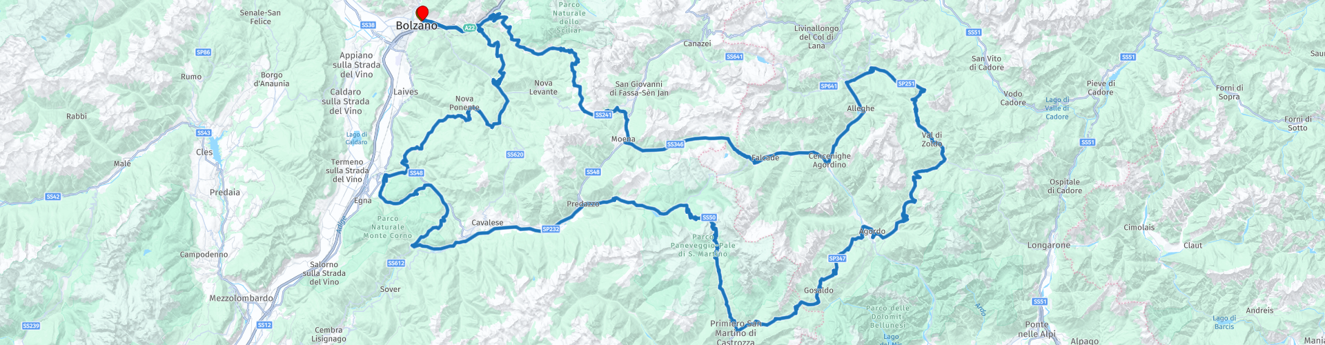
 Start: Bolzano
Finish: Bolzano
 Share this route


Animation

Verdict


Duration
5h 47m

Mode of travel
Car or motorcycle

Distance
337.31 km

Countries

 RouteXpert Review
 - Passes and mountain roads: Passo di Rolle (1989 m), Passo di Valles (2032), Passo di Cereda (1369 m), Forcella Aurine (1299 m), Passo Duran (1601 m), Forcella Staulanza (1773 m), Passo di S. Pellegrino (1918 m), Karer pass (1745 m), Niger pass (1688 m)
- Winter closing: A few passes are closed for a short time, depending on the weather.
- Alternative routes: You can shorten the route to an eight.
- Ideal months: Late spring. You should avoid the month of August.
- Roads: Many narrow roads and tight hairpin bends.
- Riding pleasure: The south side of the Passo di Rolle, Passo di Valles, Passo di Cereda, Forcella Aurine, Passo Duran and Forcella Staulanza offer the most beautiful curves and hairpin bends.
- Landscape: The tour leads you through an impressive mountain landscape. In no case should you forget a stop in Cavalese and the crystal clear Lake Karermeer.
This 5-star route is one of the 24 most beautiful Alpine routes in recent years!
Colored route points:
rp 1 - Starting point in Bolzano at Hotel Regina A.
rp 4 - Passo di Costalunga - Karerpass
rp 6 - Passo San Pellegrino
rp 7 - Coffee stop at Hotel Stella Alpina
rp 9 - Passo Staulanza
rp 10 - Passo Duran
rp 12 - Tank stop at Agip
rp 13 - Lunch stop at Pizzeria da Silvio
rp 16 - Forcella Aurine
rp 17 - Accommodation option at Rifugio Cereda on the Passo Cereda
rp 20 - Belvedere photo point
rp 21 - Passo Rolle
rp 24 - Coffee stop at Pizzeria Bar Al Lago
rp 27 - Passo di San Lugano - San-Lugano-Sattel
rp 33 - Lunch stop at Garnischgerhof
rp 38 - Tank stop at Q8
rp 39 - End point in Bolzano at Hotel Regina A.


 Links
Links  Usage
Usage Want to download this route?
You can download the route for free without MyRoute-app account. To do so, open the route and click 'save as'. Want to edit this route?
No problem, start by opening the route. Follow the tutorial and create your personal MyRoute-app account. After registration, your trial starts automatically.  Disclaimer
Use of this GPS route is at your own expense and risk. The route has been carefully composed and checked by a MyRoute-app accredited RouteXpert for use on TomTom, Garmin and MyRoute-app Navigation.
Changes may nevertheless have occurred due to changed circumstances, road diversions or seasonal closures. We therefore recommend checking each route before use.
Preferably use the route track in your navigation system. More information about the use of MyRoute-app can be found on the website under 'Community' or 'Academy'.