TTT 2003 06 De Hoge Veluwe

This route was brought to you by:
RouteXpert Hans van de Ven (Mr.MRA)
Last edit: 26-02-2021
 Route Summary
 The 173 ANWB Promoter TankTasTochten (TTT) were scanned by Henry ten Dam and signed by Leon Stolk in Mapsource and later placed as a Track in a .gpx file. These have been made available with the approval of ANWB Promotor via the website of MrGPS so that everyone can enjoy it. The 1st TTT is from 1992, so the route may be slightly different from the original.
I checked all route points and placed them neatly on the road. Also, if necessary, I have put the start point and end point of the route a bit further apart to avoid navigating directly to the end point and I have added the POI files from the start and end point just like a possible stopping point.
Finally, I created the route for TomTom, Garmin and MyRoute-app Navigation users.
With thanks to Henry, Leon, MrGPS and Promoter.
 Share this route


Animation

Verdict


Duration
3h 47m

Mode of travel
Car or motorcycle

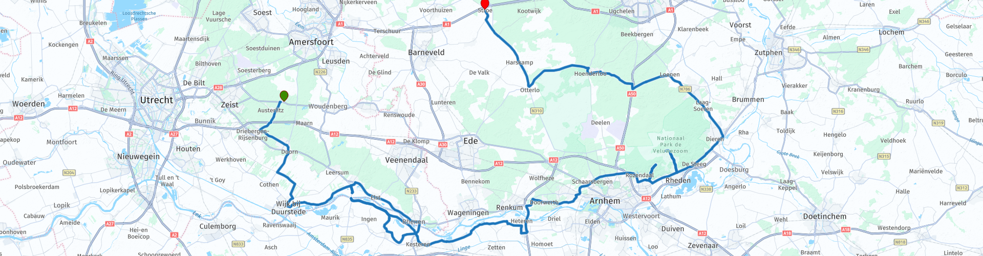
Distance
138.30 km

Countries

 RouteXpert Review
 * The Pyramid of Austerlitz is a 36 meter high pyramid of earth, built in 1804 by Napoleonic soldiers at the Botterstop, one of the highest points of the Utrechtse Heuvelrug, in the municipality of Woudenberg. On top of the pyramid is a stone obelisk from 1894. (Source: Wikipedia).
In the National Park the Veluwezoom you go over the Posbank **, at the pavilion you can stop for a cup of coffee or a lunch or just enjoy the surroundings and take some pictures.
** The Posbank at Rheden is the name of a monumental bank and a neighboring tea house, on the edge of the Herikhuizerveld, an overgrown moraine on the southern Veluwe. The site has a height of 90 meters above sea level with a view over the IJsseldal, Arnhem, the Achterhoek and the Liemers to Germany. (Source: Wikipedia).
Because I have driven large parts of this route myself, this route gets 4 stars.
Route details:
In the weekend it can be very busy on the Posbank with cyclists, therefore this TTT is ideal to ride on a weekday.
rp 17 - Stop at the McDonalds in Heteren.
rp 23 - View Veluwe and Posbank.


 Links
Links  Usage
Usage Want to download this route?
You can download the route for free without MyRoute-app account. To do so, open the route and click 'save as'. Want to edit this route?
No problem, start by opening the route. Follow the tutorial and create your personal MyRoute-app account. After registration, your trial starts automatically.  Disclaimer
Use of this GPS route is at your own expense and risk. The route has been carefully composed and checked by a MyRoute-app accredited RouteXpert for use on TomTom, Garmin and MyRoute-app Navigation.
Changes may nevertheless have occurred due to changed circumstances, road diversions or seasonal closures. We therefore recommend checking each route before use.
Preferably use the route track in your navigation system. More information about the use of MyRoute-app can be found on the website under 'Community' or 'Academy'.