Rondje Alkmaar Wieringen

This route was brought to you by:
RouteXpert Marco Ursem
Last edit: 09-09-2024
 Route Summary
 All in all, a nice driving route through the Kop van Noord Holland that gets 4 stars from me because it is wonderful to drive on these beautiful roads through the polders.
Start and end point: McDonald's Alkmaar East
 Share this route


Animation

Verdict


Duration
5h 16m

Mode of travel
Car or motorcycle

Distance
160.49 km

Countries

 RouteXpert Review
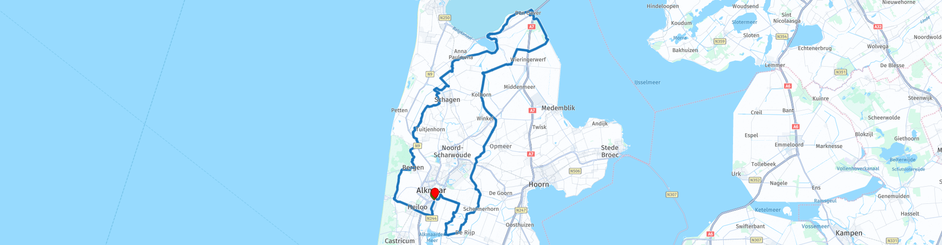
 The McDonalds restaurant on the southeastern ring road of Alkmaar is the meeting/gathering place for this route. Nearby is another petrol station where you can also fill your motorbike with the necessary juice. The start of the route goes past the same petrol station. Then a short distance along the North Holland Canal. That doesn't take long and you turn towards Egmond aan Zee. You drive along the forests of Bergen and Schoorl in search of the first dike; the Westfriesedijk. You follow this to Sint Maarten and after a nice winding road you drive towards Schagen. On the way you will also come across the Ruïne van Nuwendoorn. This is a main castle from 1282 that has been made visible again. If we are ready for it, there are many pleasant terraces in the centre of Schagen, this is not included in the route. Further along the Westfriesedijk and over the special Ruigeweg the route goes to Oudesluis.
After Oudesluis you will go in search of the Wadden Sea. First a bit along the Amstelmeer after which you drive onto the former island of Wieringen. The route includes a viewpoint with a view over the Wadden Sea. The route then continues over the former island which is somewhat hilly and there may also be sheep on the road so watch out. Afterwards there is a nice opportunity to eat a herring or kibbeling in the fish cafeteria in Den Oever. Even for those who do not like fish there is plenty of choice at restaurant de Basalt. You continue your way along the Robbenoordbos and you will pass the point where the Germans blew up the dike in WW2 with all the consequences; many deaths and misery among the population. Take some time to visit the monument. You continue through the Wieringerpolder and then arrive at the Westfriesedijk again. You follow this until past Winkel and then you will encounter many other dike roads. We continue along some beautiful dike roads in the Schermerpolder and finally return to the starting point in Alkmaar.
This route through North Holland is one that seeks out the dikes and water features. If you pay attention along the way, the differences in the dikes should also stand out. Because of the periods that the dikes were built, and also the goal, there are also different dike roads.


 Links
Links  Usage
Usage Want to download this route?
You can download the route for free without MyRoute-app account. To do so, open the route and click 'save as'. Want to edit this route?
No problem, start by opening the route. Follow the tutorial and create your personal MyRoute-app account. After registration, your trial starts automatically.  Disclaimer
Use of this GPS route is at your own expense and risk. The route has been carefully composed and checked by a MyRoute-app accredited RouteXpert for use on TomTom, Garmin and MyRoute-app Navigation.
Changes may nevertheless have occurred due to changed circumstances, road diversions or seasonal closures. We therefore recommend checking each route before use.
Preferably use the route track in your navigation system. More information about the use of MyRoute-app can be found on the website under 'Community' or 'Academy'.