08 Fox Glacier to Westport

This route was brought to you by:
RouteXpert Nick Carthew - (MRA Master)
Last edit: 28-04-2021
 Route Summary
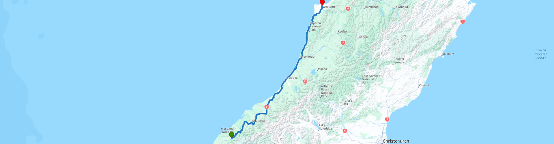
 After leaving the glacial fields this route follows the coast as it heads north passing through beautiful native forest and stunning coastal scenery, with some great attractions along the way. For these reasons I award this route 4**** stars.
 Share this route


Animation

Verdict


Duration
7h 18m

Mode of travel
Car or motorcycle

Distance
294.42 km

Countries

 RouteXpert Review
 Leaving Fox Glacier on the Fox Glacier Highway, (the local name for SH6) you will enter the Westland National Park where the road twists and turns and climbs and descends through beautiful lush native forest as it takes you to Franz Josef. You can stop off here to visit the Franz Josef glacier. The glacier is five kilometres from the town of the same name, and a 1.5 hour walk from the car park will take you to within 750m of its terminal face.
Next to see is Lake Mapourika, a kettle lake. It was formed when a large block of ice that was left behind by the retreating Franz Josef Glacier some fourteen thousand years ago. There's a great viewpoint of the lake from MacDonalds Recreation area.
A short distance on is Lake Wahapo. Due to the silty rivers and wetlands around, the lake has coloured murky water but sustains a great numbers of fish, from brown trout, eels and even salmon. It is however it’s settings which make this lake a hot spot to photograph. Surrounded by rare kahikatea grove and with Mt. Adams, most westerly mountain of the Southern Alps in the background, there is no chance to pass the lake without taking a photo.
I have suggested a coffee stop at the next town called Whataroa. Whataroa is predominantly a dairy farming area is located on the western bank of the Whataroa River, on which you can take adventurous heli-rafting trips. The Whataroa River is one of the best one-day whitewater experiences in New Zealand. Deep green water has carved its way through three stunning gorges, with canyons set amongst amazing river scenery.
Another road name change now, this time the SH6 becomes the Whataroa Highway amd another twisty section as you travel through the Mount Hercules Scenic Reserve to Hari Hari.
Hari Hari is where swashbuckling Australian aviator Guy Menzies crash-landed his trusty biplane into a swamp after completing the first solo trans-Tasman flight from Sydney in 1931. There is a museum here where you can read all about this epic tale and se a replica of his biplane.
The route gets closer to the coast now and you'll be able to smell the sea as you pull into Ross.
Ross was established in the 1860s, during the West Coast Gold Rush, where it became an important centre for miners. At its largest, the town had around 4,000 inhabitants, but the population declined after local goldfields were depleted in the early 1870s.
I've suggested a lunch stop at the historic town Hokitika.
Historic Hokitika is a place to appreciate the fascinating history of the West Coast. Hear about the ship wrecks, gold miners and pounamu (greenstone) hunters.
Hokitika was first settled in 1860, after the discovery of gold on the West Coast. It was an important river port, but many ships came to grief on the notorious ‘Hokitika Bar’ – a sandbar that shifts with every tide.
Nowadays Hokitika is known as the Cool Little Town. There are some lovely old buildings on the town’s historic walk. You’ll also notice galleries specialising in pounamu jewellery and art works. The Arahura River, which enters the sea just north of Hokitika, is a traditional source of pounamu (greenstone). Gold jewellers, wood turners and potters provide other souvenir opportunities.
30 km on from Hokitika is an attraction called Shantytown.
Shantytown Heritage Park, usually known as Shantytown, is a tourist attraction consisting of 30 recreated historic buildings making up a 19th-century gold-mining town. The town is surrounded by native forest, and is one of the region's most popular attractions.
Greymouth, the West Coast's largest town is next and then you'll soon be travelling on what 'Lonely Planet' recently voted as one of the top 10 coastal drives in the world. Interestingly, at this point the SH6 is just known as Coast Road. Breathtakingly beautiful views lead you to Punakaiki where you must visit the Pancake Rocks. The Pancake Rocks at Punakaiki are thin layers of limestone that have been eroded to form a distinctive pattern resembling stacks of pancakes. This area of limestone is part of a sheet that extends into the surrounding hills, where it forms spectacular cliffs. There are many caves and tunnels, and large waves cause spectacular blowholes close to the coast. I've allowed an hour here so enjoy a coffee at the cafe too.
3 km further on and there's another fascinating part of the coast to explore by using the Truman Track. The track begins at the roadside where there is ample parking and you're immediately into the beautiful sub-tropical rain forest of ferns, nikau palms, rimu, etc. Nearing the coast you pass through typical West Coast coastal flax flats before emerging onto a coastal headland with stunning views up and down the local coastline. A stairway leads down on the north side of the headland to a fine gravel beach featuring cliffs, caves, a waterfall and amazing rock formations. The coast is about 500 m from the road.
Rejoining the route and there are several viewpoints to stop off at to admire this wild and rugged coastland.
The last suggested stop on this route is at Mitchells Gully Historic Goldmine, just 15 minutes from the end of the route at Westport.
Mitchells Gully Historic Goldmine:
Step back in time and get a true understanding of how gold was recovered by the first miners here in Charleston between 1866 and the early 1900s. Follow the trolly track, explore the old tunnels, enjoy the beauty of the glow worms and native plants, see the only remaining waterwheel and stamping battery in Charleston.
Gold miners around Charleston worked ancient marine sandstone with finely dispersed gold. The sand is cemented with iron, so the miners used crushing equipment developed for quartz mines to crush the sand and recover the gold. Mitchells Gully gold mine is a partly restored mine run by descendants of the original miners. This crushing battery is powered by a waterwheel. Westport is only 15 minutes up the road so it might suit you to come back and book a glow worm tour through the goldmine – it is an unforgettable experience.
Westport.
Westport was first a gold town and then a coal town. The coal mining museum provides a glimpse of what it's like to work underground. Westport is also a centre for outdoor adventures – jet boating, underground rafting, caving, white water rafting and kayaking. There is a seal colony nearby at Cape Foulwind. Depending on the season, there can be up to 100 New Zealand fur seals in the vicinity. Browse the local arts and crafts galleries – much of the work is produced locally.
There is a good choice for accommodation in Westport and I have included a selection below.
Enjoy.


 Links
Links  Usage
Usage Want to download this route?
You can download the route for free without MyRoute-app account. To do so, open the route and click 'save as'. Want to edit this route?
No problem, start by opening the route. Follow the tutorial and create your personal MyRoute-app account. After registration, your trial starts automatically.  Disclaimer
Use of this GPS route is at your own expense and risk. The route has been carefully composed and checked by a MyRoute-app accredited RouteXpert for use on TomTom, Garmin and MyRoute-app Navigation.
Changes may nevertheless have occurred due to changed circumstances, road diversions or seasonal closures. We therefore recommend checking each route before use.
Preferably use the route track in your navigation system. More information about the use of MyRoute-app can be found on the website under 'Community' or 'Academy'.