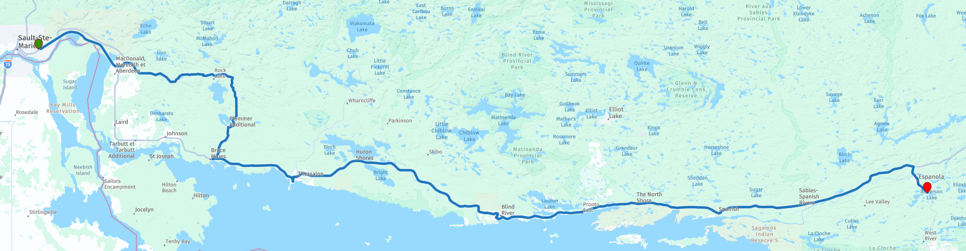
Day 18 TCH Sault Ste Marie to Espanola

This route was brought to you by:
RouteXpert René Plücken (MRA Master)
Last edit: 10-11-2025
 Route Summary
 This is section 18 that runs from Sault Ste Marie to Espanola.
The Trans-Canada Highway passes through all of the country's southern provinces. The route can be driven in various ways, as there are several alternative routes that also belong to the Trans-Canada Highway. The total distance is around 8,000 km. We won't be driving solely the Trans-Canada Highway, but will be taking as much of the country's back roads as possible, as highway driving alone is too boring, and Canada boasts many beautiful roads through its stunning landscape.
You'll drive through all the provinces and through very diverse and picturesque landscapes, from the Rockies in the west, the Central Prairies to the eastern Maritimes and the northern forest.
The riding season is generally from April to October with longer seasons on the west coast and southern Ontario.
Make sure you have good all-season clothing or bring rain gear. Depending on the province and the season, the weather can change suddenly and you might be surprised by a rain shower, or even a snow or hail shower, so be prepared.
In Canada, the metric system is used, so speeds are indicated in km/h. Helmets are mandatory throughout Canada (DOT approved).
Throughout Canada, you'll see plenty of wildlife. Similar animals vary from province to province, including deer, buffalo, moose, caribou, wolves, cougars, bears, mountain goats, sheep, lynx, coyotes, foxes, raccoons, badgers, various rodents, and a variety of birds.
Even though it is very tempting to stop for a photo, don't do it, it can be very dangerous.
I rate this route 5***** stars for its beautiful roads, scenery, waterfalls, and several interesting museums. For hikers, there are also several trailheads along the route; these are clearly marked but not included in this review.
 Share this route


Animation

Verdict


Duration
7h 7m

Mode of travel
Car or motorcycle

Distance
256.32 km

Countries


 RouteXpert Review
 After a few days along Lake Superior, we're heading further inland today. The drive from Sault Ste. Marie to Espanola is a mix of quiet provincial roads and stretches of Trans-Canada Highway, sometimes four-lane and straight, sometimes narrow and winding through forests and along rivers. A stretch full of little surprises and beautiful panoramas.
We avoid the boring first section of the TCH and choose Highway 17B, which runs parallel to the railway line, until Echo Bay. With a bit of luck, you'll see one of those iconic Canadian freight trains thundering past—a magnificent sight. Then we follow Highway 638, a two-lane road that winds through a green landscape, past forests and meadows.
Our stops along the way:
• Loon Dollar Monument (Echo Bay)
An impressive monument honoring Robert R. Carmichael, the artist behind the design of the Canadian "Loonie" coin. A fun photo stop and a taste of Canadian culture.
• Thessalon River Bridge
A narrow steel bridge with a metal deck—be careful in the rain! On the other side, we stopped for a photo of the bridge and the dam in the river. A spot that perfectly captures the charm of Northern Ontario.
• Bruce Mines Museum
Housed in a former church dating back to 1894, this museum tells the story of the region's mining history. Small but authentic, it's a must-see for anyone interested in local history.
• Sinton Tavern (Thessalon)
A pleasant spot for a quick refreshment break before continuing towards Iron Bridge. From here, the TCH meanders along the Mississagi River, offering beautiful views at regular intervals.
• Picnic Stop at Woman Island
A small parking lot with picnic tables and views of the river and island. Perfect for a short break.
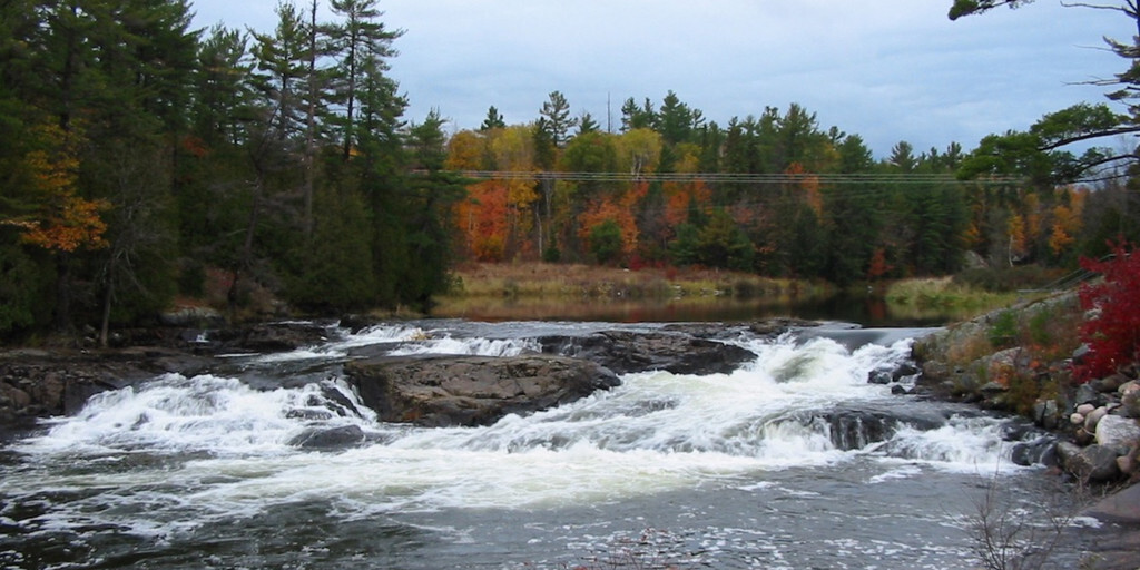
• Mississagi Falls
A photogenic rapid in the river, surrounded by rocks with a warm red glow. One of those places where you just want to pause for a moment.
• Blind River
Here we'll visit the Timber Village Museum, a charming museum with art, history, and a gift shop stocked with local products. Afterward, we'll have lunch at one of the restaurants along the TCH, with plenty of choices for a hearty meal.
• Kennebec Falls (Serpent River)
Another waterfall, this time in the Serpent River. From the bridge, you can see the water cascading down, but if you take the path down, you'll get an even more stunning view.
After this last stop, it's another 70 kilometers of enjoying forests, rivers, and quiet roads until we arrive in Espanola, where we spend the night at the Lake Apsey Resort.
My rating: ★★★★★, Five stars for a varied section: from historical museums to photogenic waterfalls and quiet country roads. For hikers, there are several clearly marked trailheads along the route, so those with time can explore even more.

 Links
Links  Usage
Usage Want to download this route?
You can download the route for free without MyRoute-app account. To do so, open the route and click 'save as'. Want to edit this route?
No problem, start by opening the route. Follow the tutorial and create your personal MyRoute-app account. After registration, your trial starts automatically.  Disclaimer
Use of this GPS route is at your own expense and risk. The route has been carefully composed and checked by a MyRoute-app accredited RouteXpert for use on TomTom, Garmin and MyRoute-app Navigation.
Changes may nevertheless have occurred due to changed circumstances, road diversions or seasonal closures. We therefore recommend checking each route before use.
Preferably use the route track in your navigation system. More information about the use of MyRoute-app can be found on the website under 'Community' or 'Academy'.