Nesselwang Garda meer

This route was brought to you by:
RouteXpert Gerard Martens Route Expert
Last edit: 04-02-2019
 Route Summary
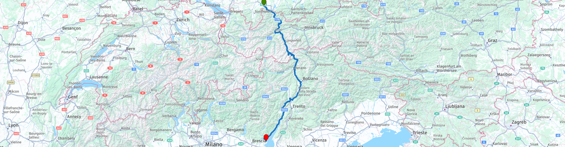
 Along the way there are beautiful mountain passes and beautiful views.
 Share this route


Animation

Verdict


Duration
7h 4m

Mode of travel
Car or motorcycle

Distance
390.71 km

Countries


 RouteXpert Review
 After about 10 km we pass the Austrian border.
Halfway through Austria we drive over the Fernpass. The Fern Pass is a 1212 meter high mountain pass in the Austrian state of Tyrol. The pass forms a fast connection between Imst in the Inn Valley and Reutte in the north of Tyrol. In Solden we will refuel before we drive into Italy. On the border of Oosterijk Italie we come across the Timmelsjoch where we also take a break. The Timmelsjoch is a 2474 meter high mountain pass on the border between the Austrian Tyrol and the Italian South Tyrol. On the other side of the border we go down again, and you can see that you are driving into Italy because the weather is getting better and better. And then we see water Lake Garda? no it is Lago di Molveno. North of the busy Lago di Garda [Lake Garda] and west of the city of Trento, there is a beautiful lake that is mainly visited by Italians in summer. It is the Lago di Molveno surrounded by the Dolomiti, Dolomite mountain peaks. You can watch the lake for hours and its wooded slopes.
Again, there are plenty of opportunities for a nice break, and just enjoy the view of the Dolomites we just drove through.
Then we arrive at Lake Garda which we descend on the west side through beautiful views and tunnels. Our destination is in sight Hotel Romantica which is almost in Lake Garda in the bay of Menerba del Garda.
The route gets 4 stars from me because this route to Lake Garda is really a pleasure for the motorcyclist.
From this route I made a video https://youtu.be/zQETJ6puy9Y
The photos have been removed from the video.


 Usage
Usage Want to download this route?
You can download the route for free without MyRoute-app account. To do so, open the route and click 'save as'. Want to edit this route?
No problem, start by opening the route. Follow the tutorial and create your personal MyRoute-app account. After registration, your trial starts automatically.  Disclaimer
Use of this GPS route is at your own expense and risk. The route has been carefully composed and checked by a MyRoute-app accredited RouteXpert for use on TomTom, Garmin and MyRoute-app Navigation.
Changes may nevertheless have occurred due to changed circumstances, road diversions or seasonal closures. We therefore recommend checking each route before use.
Preferably use the route track in your navigation system. More information about the use of MyRoute-app can be found on the website under 'Community' or 'Academy'.