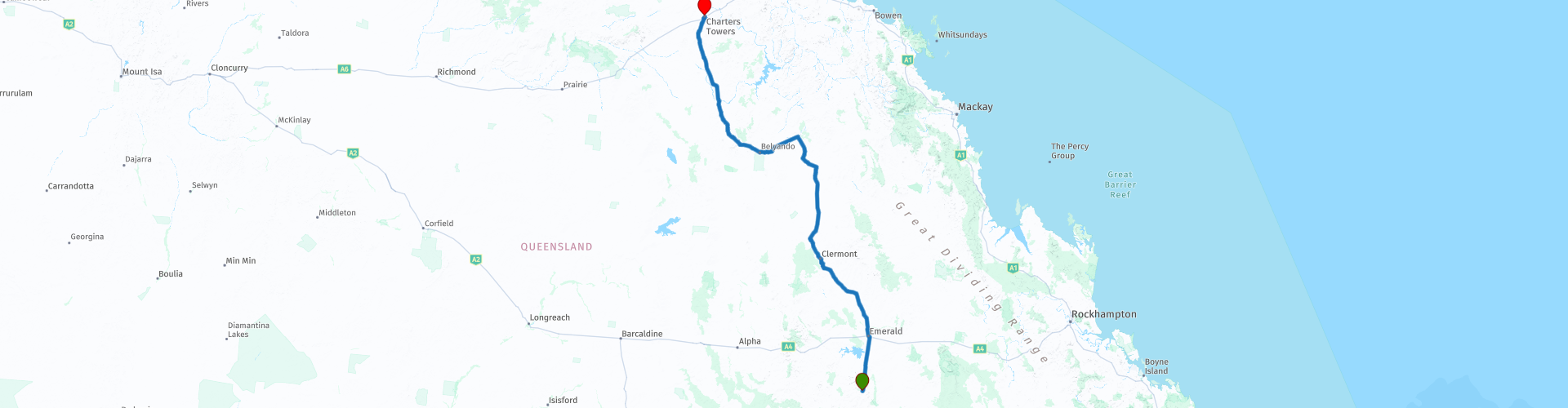
R11 QLD Springsure to Charters Towers

This route was brought to you by:
RouteXpert Hans van de Ven (Mr.MRA)
Last edit: 11-01-2021
 Route Summary
 Australia is very large; 8 million km2, which is more than 226 times larger than the Netherlands! Has a diversity of flora and fauna; the most diverse types of plants, trees and animals, especially birds and a lot of typical Australian marsupials, which you will not find anywhere else in the world!
Enjoy all the beauty immensely: From the evergreen tropical rainforests, to the vast Outback; from the desert to the countless and peaceful idyllic palm beaches; from the winter sports areas in the southeast to the vibrant and impressive metropolis of Melbourne, Sydney and Perth.
You will see it all and experience it in this amazing tour through Australia, a tour to remember!
Starting point: Springsure, Dooleys Tavern & Motel
End Point: Charters Towers, Cattlemans Rest Motor Inn
The route has been created for TomTom, Garmin and MyRoute-app Navigation users.
ATTENTION: DRIVE LEFT!
 Share this route


Animation

Verdict


Duration
8h 10m

Mode of travel
Car or motorcycle

Distance
619.66 km

Countries

 RouteXpert Review
 The Borough of Charters Towers was declared on June 21, 1877 under the Municipal Institutions Act 1864, with John McDonald elected as the city's first mayor. The local government area would later become known as Town of Charters Towers and City of Charters Towers, before being incorporated into the Charters Towers region. Charters Towers Post Office opened on May 17, 1872.
Before starting this long drive, you can refuel opposite the hotel and buy some sandwiches for the road at the bakery.
The first town you come through is Emerald, you can do some shopping here at the supermarket for on the way. The next town is Capella, here you have the opportunity to refuel and visit the Pioneer village, this piece of heritage contains more than 5000 individual items which can be roughly grouped in the following exhibitions:
1. Settlers - 1869, 1883, 1900, 1907, 1927, 1948, 1956
2. Central Highlands Wool Industry and Origin of the Great Shearers Strike
3. The railway
4. Wartime Memories
5. The Peak Downs scheme (Queensland-British Food Corporation)
6. Broadacre Grain Farming
7. Capella and Surrounds Country Life, including the Central Queensland Country Cinema
The annual Heritage Day of Capella Pioneer Village is held on the second Saturday of September in the village grounds on the north side of the main street of Capella. There is something for everyone with artisan stalls, entertainment, food, cinema, blacksmithing and vintage motorbikes and tractors rallies.
You can then refuel on the outskirts of the town of Clermont before going to Mount Coolon. The route to Mount Coolon is largely on unpaved roads. After Mount Coolon, where you can refuel again, go to Charters Towers where the end of this route is located.
This 4-star rated route, you mainly go on beautiful roads, but also a lot unpaved. You pass through nature reserves and some nice places, where you can stop for a snack or to refuel.
General info:
Queensland (literally translated: Queensland) is a state in northeastern Australia. Queensland is the second largest in area and Australia's third largest state in terms of population. The state was named after Queen Victoria, the monarch at the time of the settlement of the former colony. The capital and largest city of Queensland is Brisbane, located in the southeast of the state. The northern portion of the state, separated by the Tropic of Capricorn, is tropical. The south is subtropical. Queensland was originally a British crown colony that emerged in 1859 after secession from New South Wales. The city of Brisbane originally started as the Moreton Bay penal colony, which held convicts who again committed errors while serving their sentences in New South Wales.
Brisbane is located about 100 kilometers north of the border between Queensland and New South Wales. Southeast Queensland also has two larger population centers: the Gold Coast south of Brisbane, and the Sunshine Coast north of Brisbane. Along the approx. 2000 km long coast (from south to north) are the following cities: Coolangatta - Gold Coast - Brisbane - Sunshine Coast - Gympie - Maryborough - Hervey Bay - Bundaberg - Gladstone - Rockhampton - Mackay - Townsville - Cairns. The following cities are inland (counterclockwise): Warwick - Toowoomba - Roma - Charters Towers - Mount Isa. The world's largest city by surface, Mount Isa is located in northwestern Queensland. The area of the city is 42,904 km² (approximately the area of the Netherlands!), But the city has a population of approximately 20,000 (2003).
The state is home to five World Heritage Sites: Australian Mammal Fossil Sites (Riversleigh / Naracoorte),
Gondwana rainforests, Fraser Island, The Great Barrier Reef and the Tropical wetlands of Queensland.
Queensland can be roughly divided into three parts:
1.The eastern coastal strip, dominated by the Great Australian Separation Mountains. From north to south there are also the Darling Downs, the Bunya Mountains, the Carnarvon Gorge, the Whitsunday Islands, Hinchinbrook Island and the Atherton Tableland. Off the coast, north of Fraser Island, the Great Barrier Reef begins.
2.The tropical Cape York Peninsula in the north. To the north of this is the Straits Torres with the Straits Torres Islands and to the east most of the Great Barrier Reef.
3 Most of the dry interior, called the Queensland outback, with the Channel Country in the southwest.


 Links
Links  Usage
Usage Want to download this route?
You can download the route for free without MyRoute-app account. To do so, open the route and click 'save as'. Want to edit this route?
No problem, start by opening the route. Follow the tutorial and create your personal MyRoute-app account. After registration, your trial starts automatically.  Disclaimer
Use of this GPS route is at your own expense and risk. The route has been carefully composed and checked by a MyRoute-app accredited RouteXpert for use on TomTom, Garmin and MyRoute-app Navigation.
Changes may nevertheless have occurred due to changed circumstances, road diversions or seasonal closures. We therefore recommend checking each route before use.
Preferably use the route track in your navigation system. More information about the use of MyRoute-app can be found on the website under 'Community' or 'Academy'.