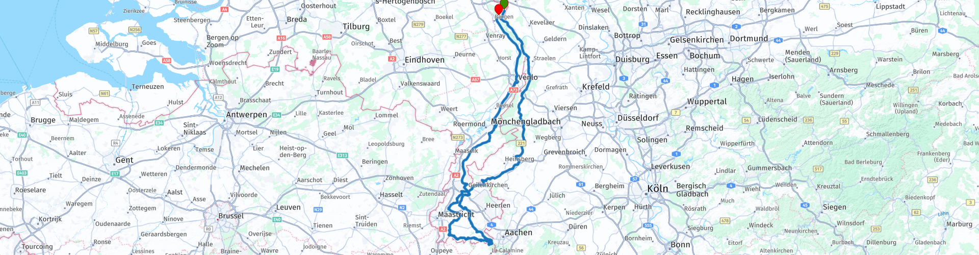
Roundtrip Siebengewald Mergellandroute Vaals Valkenburg

This route was brought to you by:
RouteXpert René Plücken (MRA Master)
Last edit: 20-08-2025
 Route Summary
 Start and end point Camping de Hei in Siebengewald. I rode this route in 2017 and 2018.
There are a number of opportunities to take a break included in the route.
I give this route 4 stars because of the beautiful winding roads in the Limburg hills.
 Share this route


Animation

Verdict


Duration
10h 34m

Mode of travel
Car or motorcycle

Distance
315.43 km

Countries


 RouteXpert Review
 Camping de Hei was our base for a weekend of touring (in 2017 and 2018).
You drive through National Park Maasduinen, one of the three national parks in North Limburg. It is a forest and heathland area, located on an elongated sand ridge between the Maas and the German border. The road through it has beautiful long bends.
You drive on small country roads and provincial roads through Germany and Limburg. Along the way you pass several small villages and a few large cities, such as Venlo, where you can take a break to eat or drink something.
You can plan a lunch stop at restaurant de Bokkenrijder in Vaals, here you can enjoy a good lunch with a beautiful view from the terrace. Lock your motorcycle well and park it so that you have a view of it because the thieves' guild is very active here. The restaurant is close to the Drielandenpunt where the borders of Germany, Belgium and the Netherlands meet, this is also the highest point in the Netherlands. There is a small monument, watchtower, labyrinth, playground for children and a restaurant. It can be very busy here, drive quietly and pay attention to pedestrians and cyclists.
After the Drielandenpunt you drive via a wonderfully winding road that is part of the Mergellandroute through Belgium and the Netherlands towards Valkenburg. Valkenburg is a tourist village with many interesting sights, cafes, terraces and restaurants, so it is definitely worth a stop. It is very busy in the weekend.
Then the journey continues towards Sittard, another truly Burgundian Limburg city with many good restaurants, so you can go into the centre for a cup of coffee.
We drive back to Siebengewald via Roermond and Venlo.
The route has some nice winding parts and in South Limburg also nice hilly area to ride through. I have ridden large parts of this route twice and I rate it with 4 stars. Preferably ride on a weekday because of the crowds in the weekend.


 Links
Links  Usage
Usage Want to download this route?
You can download the route for free without MyRoute-app account. To do so, open the route and click 'save as'. Want to edit this route?
No problem, start by opening the route. Follow the tutorial and create your personal MyRoute-app account. After registration, your trial starts automatically.  Disclaimer
Use of this GPS route is at your own expense and risk. The route has been carefully composed and checked by a MyRoute-app accredited RouteXpert for use on TomTom, Garmin and MyRoute-app Navigation.
Changes may nevertheless have occurred due to changed circumstances, road diversions or seasonal closures. We therefore recommend checking each route before use.
Preferably use the route track in your navigation system. More information about the use of MyRoute-app can be found on the website under 'Community' or 'Academy'.