Rondrit Weerribben en Giethoorn vanuit Rossum Ov

This route was brought to you by:
RouteXpert Arno van Lochem - Senior RX
Last edit: 27-05-2023
 Route Summary
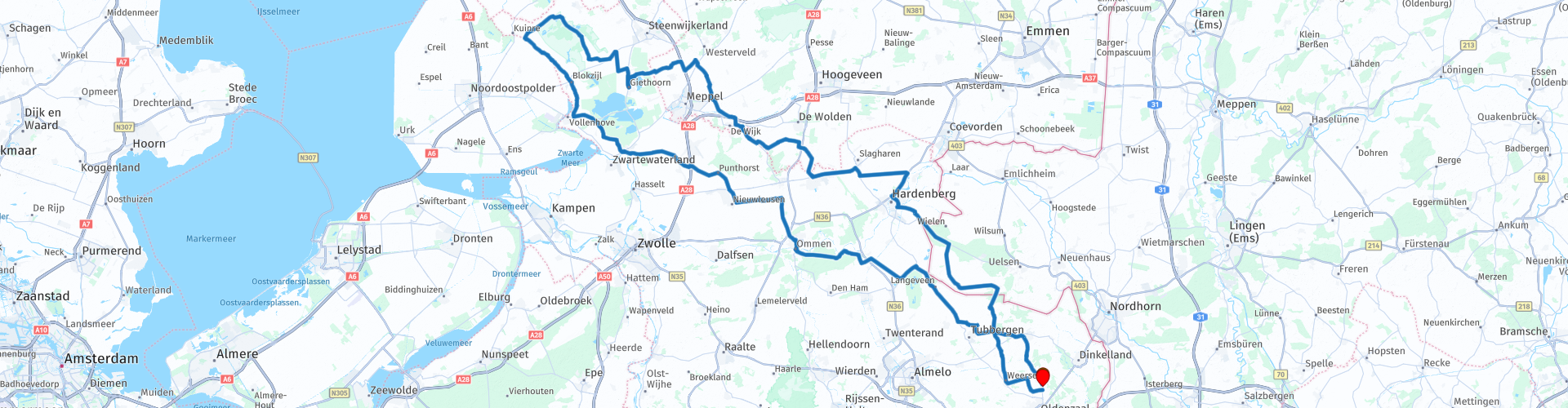
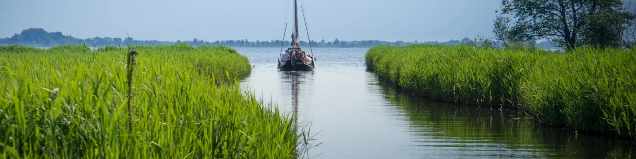
 Giethoorn, or 'Dutch Venice' or 'The Venice of the North' is a small village in the head of Overijssel.
The route leads from Rossum on mainly small roads to the Weerribben and Giethoorn, avoiding the built-up area most of the time.
I drove this route in April 2020. The weather gods were favorable to me, so luckily the many water during this route did not come from above. Because of the specific part of the Netherlands, I rate this route with 3 stars.
 Share this route


Animation

Verdict


Duration
7h 55m

Mode of travel
Car or motorcycle

Distance
245.58 km

Countries


 RouteXpert Review
 The route starts and ends at Bistro Tram 2, located between Oldenzaal and Rossum in a beautiful location, where a delicious cup of coffee is served.
The route mainly runs on small roads towards the Weerribben and Giethoorn, located in the Kop van Overijssel.
Places where the route passes include Ootmarsum, Zwartsluis, Blokzijl and Ossenzijl and of course Giethoorn. Even a piece of Germany is visited.
Do not hesitate to visit Blokzijl and see how authentic this place is. The nice harbor or, in the middle of the center, the drawbridge. Nice backdrop for a photo!
Also interesting to see is the Tjasker Ossenzijl at RP19. With the windmill, the reed lands in the back are supplied with water. It's amazing how such a seemingly simple mill can be so effective.
At RP31 there is the possibility to take a look at the center of Giethoorn on foot. Surprising to see how the many whisper boats, called punts, often loaded with tourists, are steered through the narrow inland waterways of this picturesque town.
All in all a nice route towards a beautiful part of the Netherlands with a rich history!


 Links
Links  Usage
Usage Want to download this route?
You can download the route for free without MyRoute-app account. To do so, open the route and click 'save as'. Want to edit this route?
No problem, start by opening the route. Follow the tutorial and create your personal MyRoute-app account. After registration, your trial starts automatically.  Disclaimer
Use of this GPS route is at your own expense and risk. The route has been carefully composed and checked by a MyRoute-app accredited RouteXpert for use on TomTom, Garmin and MyRoute-app Navigation.
Changes may nevertheless have occurred due to changed circumstances, road diversions or seasonal closures. We therefore recommend checking each route before use.
Preferably use the route track in your navigation system. More information about the use of MyRoute-app can be found on the website under 'Community' or 'Academy'.