Part 4 Cangas de Onis to Oviedo

This route was brought to you by:
RouteXpert Peter Moerman - RouteXpert
Last edit: 01-03-2024
 Route Summary
 Spanish border to Lisbon. The purpose of the trip is to find the most beautiful roads, nature and sights of northern Spain and Portugal.
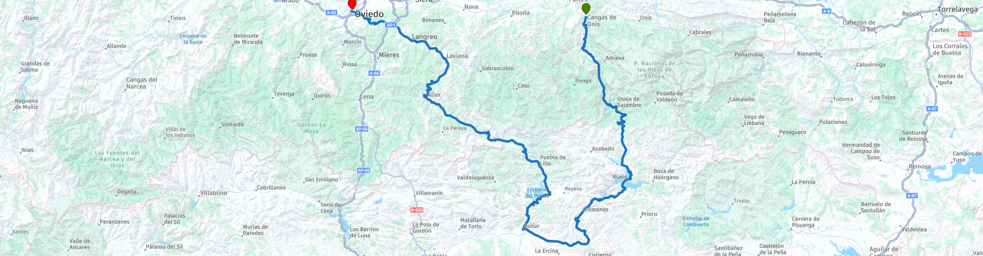
Part 4 covers the mountains of the Picos de Europa between Cangas de Onís and the hinterland of Oviedo
It is not a particularly long route so there is enough time to stop regularly and enjoy the beautiful viewpoints. Oviedo is a good place to be and there are plenty of hotels and restaurants.
I rate this route through the Picos de Europa and the hinterland of Oviedo with 4 stars because of the beautiful roads. beautiful views and many sights.
 Share this route


Animation

Verdict


Duration
6h 33m

Mode of travel
Car or motorcycle

Distance
233.50 km

Countries

 RouteXpert Review
 Spain has been struggling with a lack of water since time immemorial, so it is not surprising that embalses or pantanos (reservoirs) have been built in many places to collect melt and rainwater for irrigation and electricity generation. The embalse de Riaño is one of them and it has a remarkable and long history.
There are more than 350 embalses in Spain with a total capacity of more than 55,000 cubic hectometers or 55 billion liters of water. That may seem like a lot, but Spain still has major problems and the somewhat megalomaniac plan of the Aznar government at the beginning of this century to divert water from the north (the Ebro River) directly to the south is testimony to this. This plan was shelved by Zapatero's socialist government for environmental reasons. In the seventies, after the death of Franco, love for the environment was less popular among socialists, because the plans for the construction of a large reservoir near the town of Riaño, which had already been developed before Franco's dictatorship, were the reign of the first socialist prime minister after Franco, Felipe González, was neatly executed. The Embalse de Riaño is located south of the Picos de Europa at more than 1100 meters above sea level. The dam was built on the Esla River and created a lake with a coastline of 103 kilometers and a volume of more than 650 cubic hectometers, placing it in the top twenty in terms of size on the list of embalses in Spain. The largest are five times as large as those of Riaño, but there are also many smaller ones with a volume of less than 50 cubic hectometers. In any case, the Embalse de Riaño is an impressive lake.
A little further on you will also drive past Embalse del Porma, a reservoir with a volume of 317 hm2, making it the third largest reservoir in the province of Leon. It has been in use since 1968,
Don't forget to fill up as soon as you get the chance, because gas stations are few and far between in this region.
Today the Puerto de San Isidro is the highest point of the route at 1520 meters. This mountain pass is also the border between the provinces of Castile and Leon and Asturias. Apart from a few houses there is little to do.
Just before Cabañaquinta there is a restaurant called Mesón La Panoya, and in Cabañaquinta there are a few bars. A little further on in Pola de Laviana there are also options for something to eat, drink or refuel.
You now slowly return to civilization and with Oviedo as the end point of this route you reach the capital of the province of Asturias. The city was founded in the year 761 and therefore has a long history. Oviedo currently has approximately 217,552 inhabitants.
In the 9th century, an innovative pre-Romanesque architectural style was developed in Asturias. The highlights are the churches in and around the city such as Santa María del Naranco, San Miguel de Lillo, Santa Cristina de Lena, Cámara Santa and San Julián de los Prados. The Asturian architectural style has had a major influence on the religious architecture of the peninsula. Many of these special buildings are protected as UNESCO World Heritage Sites.
Santa Maria del Naranco is located in a green area about three kilometers north of the city. On the hill is the former summer palace of Asturian king Ramiro I built in 842. This was later converted into the pre-Romanesque church of Santa Maria del Naranco. The pre-Romanesque church of San Miguel de Lillo is also nearby.
The Cathedral of San Salvador was built in a late Gothic style. Construction began in 1388 and was completed in 1587. It is a basilica with a nave and two aisles. The roof of the nave is 20 meters high and is divided into five cross-vaulted sections.
The Plaza del Fontan is a rectangular square surrounded by arcades with restaurants and sidrerías (cider houses). The blue-painted Casa Ramón cider house is the only original building and next to the square is the El Fontán covered market.
Museo de Bellas Artes de Asturias is located on the square with the cathedral. The collection is housed in three old buildings and includes works by Spanish and Flemish painters such as Francisco Goya, El Greco and Pablo Picasso.
Campo de San Francisco is a city park in the center of the city.
The Palacio de Congresos de Oviedo is a large exhibition and conference space designed by the architect Santiago Calatrava.


 Links
Links  Usage
Usage Want to download this route?
You can download the route for free without MyRoute-app account. To do so, open the route and click 'save as'. Want to edit this route?
No problem, start by opening the route. Follow the tutorial and create your personal MyRoute-app account. After registration, your trial starts automatically.  Disclaimer
Use of this GPS route is at your own expense and risk. The route has been carefully composed and checked by a MyRoute-app accredited RouteXpert for use on TomTom, Garmin and MyRoute-app Navigation.
Changes may nevertheless have occurred due to changed circumstances, road diversions or seasonal closures. We therefore recommend checking each route before use.
Preferably use the route track in your navigation system. More information about the use of MyRoute-app can be found on the website under 'Community' or 'Academy'.

Asturias
About this region
Asturias (, Spanish: [asˈtuɾjas]; Asturian: Asturies [asˈtuɾjes; -ɾjɪs]), officially the Principality of Asturias (Spanish: Principado de Asturias; Asturian: Principáu d'Asturies; Galician-Asturian: Principao d'Asturias), is an autonomous community in northwest Spain.
It is coextensive with the province of Asturias and contains some of the territory that was part of the larger Kingdom of Asturias in the Middle Ages. Divided into eight comarcas (counties), the autonomous community of Asturias is bordered by Cantabria to the east, by León (Castile and León) to the south, by Lugo (Galicia) to the west, and by the Cantabrian sea to the north.
Asturias is situated in a mountainous setting with vast greenery and lush vegetation, making it part of Green Spain. The region has a maritime climate. It receives plenty of annual rainfall and little sunshine by Spanish standards and has very moderated seasons, most often averaging in the lower 20s celsius. Heatwaves are rare due to mountains blocking southerly winds. Winters are very mild for the latitude, especially near sea level.
The most important cities are the communal capital, Oviedo, the seaport and largest city Gijón, and the industrial town of Avilés. Other municipalities in Asturias include Cangas de Onís, Cangas del Narcea, Gozón, Grado, Langreo, Llanera, Laviana, Lena, Llanes, Mieres, Siero, Valdés, Vegadeo and Villaviciosa (see also List of municipalities and comarcas in Asturias).
Asturias is also home of the Princess of Asturias Awards.
Read more on Wikipedia
It is coextensive with the province of Asturias and contains some of the territory that was part of the larger Kingdom of Asturias in the Middle Ages. Divided into eight comarcas (counties), the autonomous community of Asturias is bordered by Cantabria to the east, by León (Castile and León) to the south, by Lugo (Galicia) to the west, and by the Cantabrian sea to the north.
Asturias is situated in a mountainous setting with vast greenery and lush vegetation, making it part of Green Spain. The region has a maritime climate. It receives plenty of annual rainfall and little sunshine by Spanish standards and has very moderated seasons, most often averaging in the lower 20s celsius. Heatwaves are rare due to mountains blocking southerly winds. Winters are very mild for the latitude, especially near sea level.
The most important cities are the communal capital, Oviedo, the seaport and largest city Gijón, and the industrial town of Avilés. Other municipalities in Asturias include Cangas de Onís, Cangas del Narcea, Gozón, Grado, Langreo, Llanera, Laviana, Lena, Llanes, Mieres, Siero, Valdés, Vegadeo and Villaviciosa (see also List of municipalities and comarcas in Asturias).
Asturias is also home of the Princess of Asturias Awards.
View region
 Statistics
  16
16Amount of RX reviews (Asturias)
 21987
21987Amount of visitors (Asturias)
 1261
1261Amount of downloads (Asturias)
 Route Collections in this region
 Three tours in and around Picos de Europa Northern Spain
The Picos de Europa is a mountainous area in northern Spain, next to the Basque Country. In the middle is the village of Posada de Valdeon, which cannot be reached by motorbike from the north: you have to drive around the Picos via Potes or Sames. We stayed overnight in Posada de Valdeon in Hostal Casa Abascal. A great hotel with breakfast option. You can eat in a restaurant in the village with usually a choice of two menus.
There are all kinds of nature reserves around the Picos. These three routes take you through some of them. There are gorges to see, viewpoints, reservoirs and you can walk more than fine. If you like walking, bring your walking shoes.
But we come to ride and it's going great. Excellent roads with the occasional piece of unpaved so that you do not have to detour far for another attraction. You can eat delicious food and the people are very nice and hospitable. And because the route to Lourdes goes above the Picos, there are also pilgrimage sites and very beautiful churches and monasteries. The most beautiful thing in this area is the nature: breathtakingly beautiful with wild animals, rugged mountains and wild rivers.
All in all, you can spend at least 4 days here if you take a day of rest or go for a walk.
View Route Collection
Santander to Roscoff via Picos de Europa Pyrenees West coast of France
A tour with 9 routes that all link up, starting from the ferry port of Santander to Potes using lots of twisty roads. The next route is a truly memorable round tour from Potes of the ever popular Picos de Europa. Then the tour heads south and east past reservoirs and picking up the mighty Ebro river and follow it to Miranda de Ebro. Route 4 carries on east towards the Pyrenees with more twisty roads to the destination of Sos del Rey Catolico, a fantastic fortified hilltop village. The next route takes you over the Pyrenees with the chance of a cable car ride up a mountain for lunch. Route 6 is the first day in France and it is a pleasant ride past fields of sunflowers and maize, pine forests and through the Landes de Gascogne Regional Natural Park. Then you cross over the mighty Gironde estuary by ferry and head to the finish at the popular costal town of La Rochelle. We stayed for two night in La Rochelle to sample the delights of this delightful town. Route 7 hugs the coast as it travels north and then crosses the mighty Loire river for a night in Saint Nazaire. Route 8 starts off with a visit to the U boat submarine pens in Saint Nazaire, then through the salt production 'fields' of Guerande and onto Concarneau, another historic walled city that must be visited. The final route takes you to Pointe du Raz then onto Locronan, a medieval village listed as one of the most beautiful villages of France. Then it travels over the Térénez bridge, the world's first curved cable-stayed bridge. Then you enter and travel through the Armorique Regional Natural Park to spend the night at a B&B hotel in Morlaix ready for a short ride in the morning to catch the ferry at Roscoff.
View Route Collection