Day 05 North Cape Tour Bronnoysund Furoy

This route was brought to you by:
RouteXpert René Plücken (MRA Master)
Last edit: 14-04-2021
 Route Summary
 You drive longer distances in Norway without encountering a gas station or restaurant, keep this in mind before you drive. Make sure your tank is full and bring food and drinks. Bring a few bottles of water or Camel bag and fill it up when you stop to refuel. A number of breaks have been planned along the way for refueling, eating and drinking.
You have the choice to spend the night at campsites or in hotels. Hotel prices in Norway are not particularly high and breakfast is usually included. Camping is free almost everywhere, except on private property or where camping is prohibited, indicated by prohibition signs. If you don't want to camp, there are often cabins for rent on the campsites. For a trip through Norway it is always advisable to bring a tent and other camping gear.
I rate this route with 3 *** Stars, you have lost a lot of time on the ferries. You do drive on beautiful roads, such as the Fv17 with beautiful panoramas. There are no other sights along the route, but there are a number of points where you can safely stop to take a few photos.
 Share this route


Animation

Verdict


Duration
10h 38m

Mode of travel
Car or motorcycle

Distance
266.65 km

Countries

 RouteXpert Review
 Information about the ferry services can be found on the website included in the links of this review. Pay attention to the departure times, they vary, the costs are low. On board the ferries you have a beautiful view of the fjords in good weather.
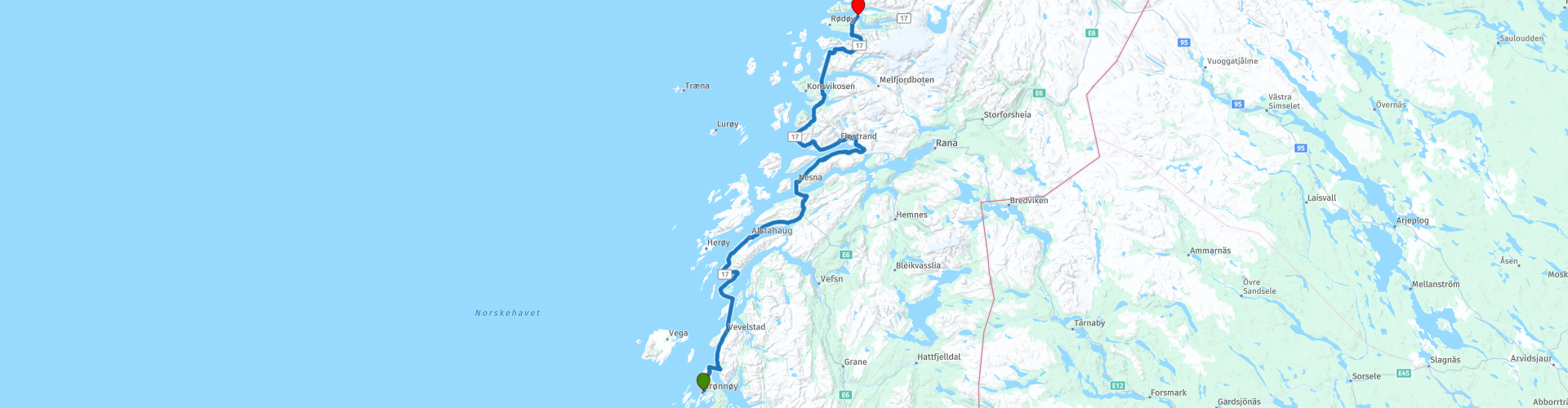
From the start in Brønnøysund we drive in just 10 minutes to the harbor in Horn (RP2). From Horn we sail to Andalsvåg, the crossing takes about 20 minutes and the price is about € 15.25.
From Andalsvåg we drive on the beautiful provincial road Fv17 in about 20 minutes to Forvik (RP4) where we take the ferry to Tjøtta, the crossing takes 1 hour and the price is between € 10 and € 14. On board it is also possible to have a drink and / or snack. We sail through the fjords along the island of Mindlandet and Halsen with truly beautiful panoramas.
We continue on the beautiful Fv17 with beautiful panoramas to Levang-Ferjekai. On the way we cross over a number of bridges that connect the small islands. With really beautiful panoramas of the fjords.
In Levang-Ferjekai (RP9) we take the ferry to Nesna. This ferry departs once every hour and the crossing takes approximately 25 minutes. The costs are between € 8 and € 12. In Nesna (RP10) there is an opportunity to have lunch at the small harbor café. You can also refuel at the petrol station opposite the café.
After lunch we drive through a winding route around the Sjonafjord, enjoy the beautiful road and surroundings. The Hellåga parking lot (RP11) on the Sjonafjord is an ideal place to stop and enjoy the view. You can walk down to the water via stairs along the steep rocks. You can also stop well at RP12 and 13 to photograph the Trondheimsfjord.
We continue to Kilboghamn ferjekai, where we take the ferry to Jektvik ferjekai. The crossing takes 1 hour and the costs are € 15. From Jetvik we drive to the final destination, you can choose from a hotel stay in hotel Tjongsfjord Gjestegård, turn left at RP16. If you want to camp, keep following the route to Furøy to spend the night at the camp site of the same name.


 Links
Links  Usage
Usage Want to download this route?
You can download the route for free without MyRoute-app account. To do so, open the route and click 'save as'. Want to edit this route?
No problem, start by opening the route. Follow the tutorial and create your personal MyRoute-app account. After registration, your trial starts automatically.  Disclaimer
Use of this GPS route is at your own expense and risk. The route has been carefully composed and checked by a MyRoute-app accredited RouteXpert for use on TomTom, Garmin and MyRoute-app Navigation.
Changes may nevertheless have occurred due to changed circumstances, road diversions or seasonal closures. We therefore recommend checking each route before use.
Preferably use the route track in your navigation system. More information about the use of MyRoute-app can be found on the website under 'Community' or 'Academy'.