Mount Rainier National Park Circuit

This route was brought to you by:
RouteXpert Paul Hedges - Adv RouteXpert
Last edit: 26-06-2020
 Route Summary
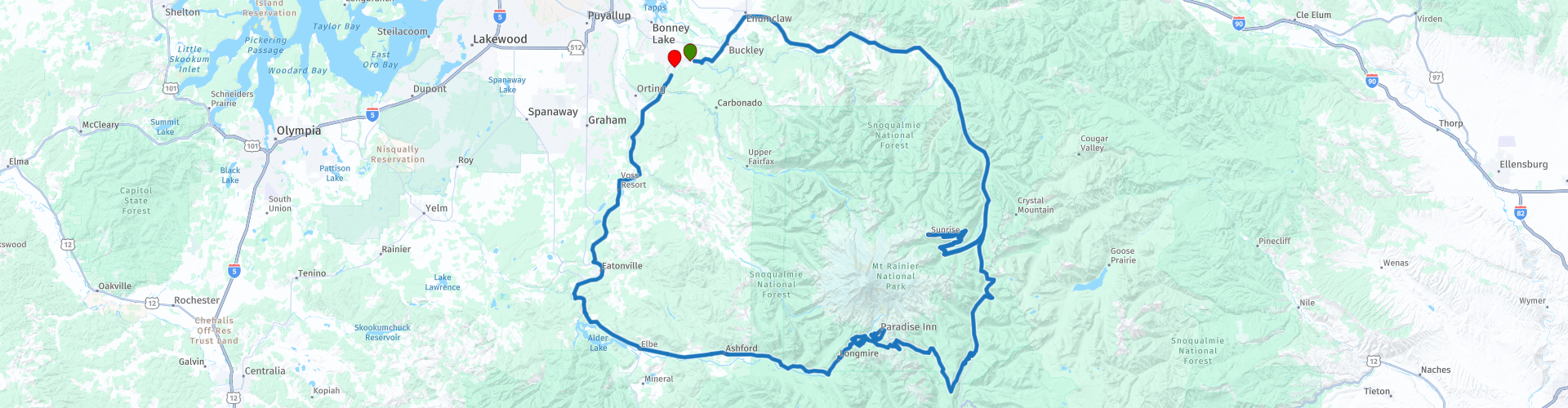
 Start and ending in South Prairie this 183 mile trip will offer ever changing views of Mt Rainier as well as many other peaks within in the National Park.
Today is not about speed. Enjoy the roads and scenery in tandem but be aware of the road conditions. Many of these roads have no guard rails.
So take several layers of clothing, liquid to keep hydrated and make sure you have enough space to store all of the photographs you will want to take.
Enjoy this 4 star riding adventure
 Share this route


Animation

Verdict


Duration
10h 31m

Mode of travel
Car or motorcycle

Distance
502.40 km

Countries

 RouteXpert Review
 This 180 mile round trip can take a day or a few hours depending on if you are going to see it all or just enjoy the roads. This trip is however, weather dependent. There might be snow, high winds or even localised lightening, so plan and be prepared.
Start the trip with a full tank of fuel, this is a National Park and Gas stations are not around each corner. Also plan your hydration as well,, the roads are at elevation and this could effect different people in different ways.
Begin your spin leaving on Highway 410 out of Enumclaw heading southward. Soon you'll be riding through the Federation Forest and onward to Greenwater.
The next stretch of road will lead you to the park entrance (free at this point) and you'll know you've entered the park when the road starts presenting you the National Park's inability to keep pace with road resurfacing.
Five miles up the road is the turnoff for the White River entrance and Sunrise - take it. Here you'll be required to pay the park entrance fee, which may seem a bit pricey, but hold onto your receipt as it's good for 7 days and you'll need it to re-enter the park again later today.
The road to Sunrise is steep and twisty, but the reward is well worth it. You'll enjoy some spectacular views of the northeast face of Mt. Rainier. There are no guard rails here so watch the centre line and traffic around you, keeping your eyes off the steep drop offs and of course, still enjoy the scenery.
Coming back down from Sunrise as exciting and enjoyable, this is not a racetrack so enjoy the riding and take in the sights. Take a right and continue south on 410 three miles where you'll stay left and ascend into Chinook Pass which is your first taste of some great sweeper turns to come today. Someone has spent a lot of time making the next few miles just for the motorcycle. Stevens Canyon Road will lead you to Paradise, literally!
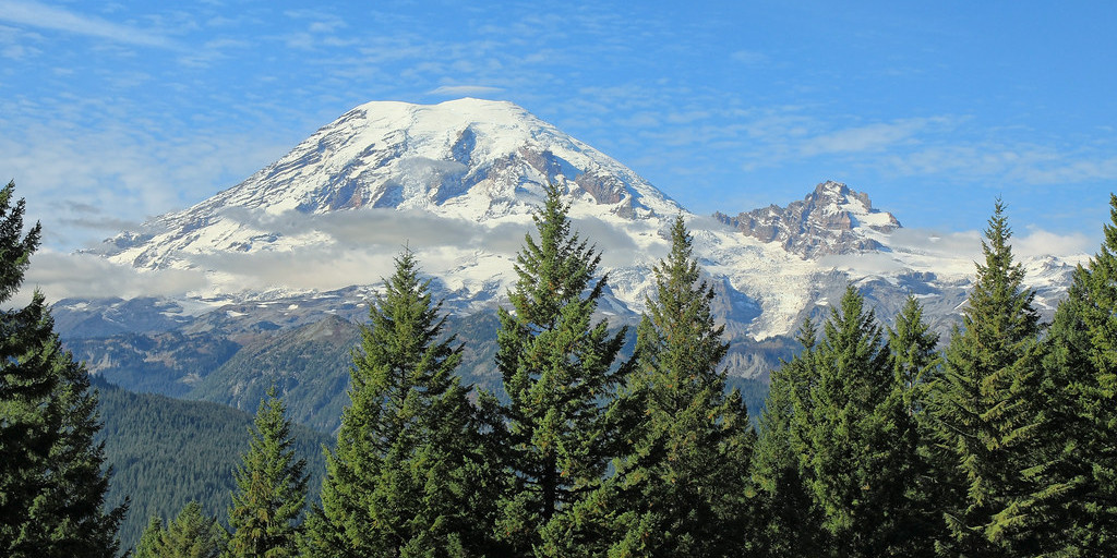
Paradise resides at an elevation of 5,400-feet sat amongst glistening snowfields and forests of firs tree, there are few locations within the entire national park system this stunning. However be aware that this area of the National Park also receives, on average, 643 inches (53.6 feet/16.3 meters) snow a year
Leaving Paradise continue along the National Park Highway until you arrive at Elbe.
With a population of fewer than fifty residents, Elbe is the small town that’s big on trains! The small town boasts a tourist railroad, a diner in a converted train car, roadside motel made entirely out of carriages, and there’s even a pizzeria in a train car!
Leaving Adler Lake the road turns north and we begin the final third of the journey. This is the way to finish the day, quiet backroads with little or no traffic as you travel from Eatonville to Orting along Orville Rd E before making one last turn and arriving back in South Prairie following the South Prairie Creek.
A great days riding with Mount Rainier being at the centre of it all, constantly in view as is stands over 14000 feet above sea level.
This is a 4 star riding and many more stars for the scenery you will pass through

 Links
Links  Usage
Usage Want to download this route?
You can download the route for free without MyRoute-app account. To do so, open the route and click 'save as'. Want to edit this route?
No problem, start by opening the route. Follow the tutorial and create your personal MyRoute-app account. After registration, your trial starts automatically.  Disclaimer
Use of this GPS route is at your own expense and risk. The route has been carefully composed and checked by a MyRoute-app accredited RouteXpert for use on TomTom, Garmin and MyRoute-app Navigation.
Changes may nevertheless have occurred due to changed circumstances, road diversions or seasonal closures. We therefore recommend checking each route before use.
Preferably use the route track in your navigation system. More information about the use of MyRoute-app can be found on the website under 'Community' or 'Academy'.