
Day 33 TCH Clarenville to St John

This route was brought to you by:
RouteXpert René Plücken (MRA Master)
Last edit: 24-11-2025
 Route Summary
 This is the last section that runs from Clarenville to Canada's easternmost point in St John.
The Trans-Canada Highway passes through all of the country's southern provinces. The route can be driven in various ways, as there are several alternative routes that also belong to the Trans-Canada Highway. The total distance is around 8,000 km. We won't be driving solely the Trans-Canada Highway, but will be taking as much of the country's back roads as possible, as highway driving alone is too boring, and Canada boasts many beautiful roads through its stunning landscape.
You'll drive through all the provinces and through very diverse and picturesque landscapes, from the Rockies in the west, the Central Prairies to the eastern Maritimes and the northern forest.
The riding season is generally from April to October with longer seasons on the west coast and southern Ontario.
Make sure you have good all-season clothing or bring rain gear. Depending on the province and the season, the weather can change suddenly and you might be surprised by a rain shower, or even a snow or hail shower, so be prepared.
In Canada, the metric system is used, so speeds are indicated in km/h. Helmets are mandatory throughout Canada (DOT approved).
Throughout Canada, you'll see plenty of wildlife. Similar animals vary from province to province, including deer, buffalo, moose, caribou, wolves, cougars, bears, mountain goats, sheep, lynx, coyotes, foxes, raccoons, badgers, various rodents, and a variety of birds.
Even though it is very tempting to stop for a photo, don't do it, it can be very dangerous.
This is a 5***** Finale of the Trans-Canada Highway Roadtrip with beautiful roads, views and a number of sights.
 Share this route


Animation

Verdict


Duration
12h 48m

Mode of travel
Car or motorcycle

Distance
396.12 km

Countries

 RouteXpert Review
 Today we conclude our epic road trip of over 9,000 kilometers along the Trans-Canada Highway. From the west coast to the southeasternmost point of North America, this is the crowning achievement of the adventure. And we're doing it in style: not the short 200 km route, but a beautiful loop of almost 400 km along coastal roads, historic villages, and rugged landscapes.
We start early in Clarenville, fill up the tank, and ride the TCH (NL-1) to just above Whitbourne. The road winds through a green, hilly area with streams and small lakes. Stop wherever you can to take photos—this is Newfoundland at its finest.
At Cross Roads, we turn onto NL-80, Trinity Road, a coastal road that winds along Trinity Bay. This is where the real enjoyment begins: small bays, fishing villages, and breathtaking panoramas.
On the way we stop at
• Dildo Brewing Co. & Museum
Taste the local beer and discover the history of Dildo in a charming museum.
• Jimmy's Ponds Walking Trail
A mountain lake with a 9.5 km hiking trail, ideal for a short hike.
• Heart's Content Cable Station
The western terminus of the first transatlantic telegraph cable (1866). Now a museum and nominated for UNESCO status.
• Wooden Boat Museum
Discover the art of wooden boat building and hear stories from residents connected to the sea.
We continue our ride to Old Perlican for lunch at Jungle Jim's Eatery, a casual spot with burgers, pasta, and more. If you'd like, you can continue on to Grates Cove for an additional loop.
After lunch, we'll take NL-70 along the coast of Conception Bay. Expect winding roads, fishing villages, and beaches, with possible stops at:
• Northern Bay Sands Park
Large sandy beach with a waterfall flowing into the bay.
• Salmon Cove Sands
A beach with a spectacular rock formation, a photo opportunity.
• The shipwreck SS Charcot
A rusty 1923 whaling ship, visible from CBS Highway. A piece of maritime history.
The last kilometers of this beautiful route we drive on the NL-60 along the bay, we stop at:
• Manuel's River Little Canyon
A rugged gorge with small waterfalls, a short walk is recommended.
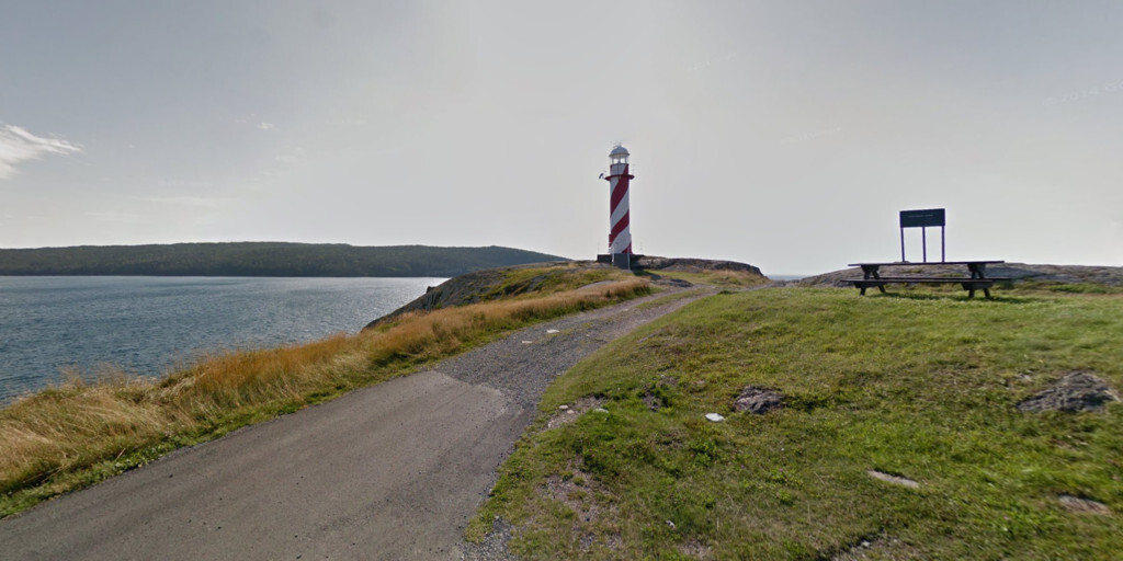
• Fort Amherst Lighthouse
An iconic lighthouse overlooking the Atlantic Ocean.
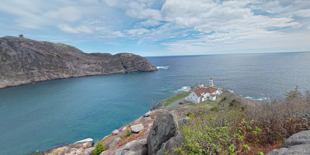
Then we drive the final stretch to Cape Spear, the southeasternmost point of Canada and North America. Here, where the ocean seems endless, our monstrous journey concludes in glory.
From the Rocky Mountains to the red cliffs of Prince Edward Island, from the Cabot Trail to the rugged coast of Newfoundland, this journey was an ode to freedom, nature, and adventure. 9,400 km, 10 provinces, 33 days. An experience you'll never forget.
 Links
Links  Usage
Usage Want to download this route?
You can download the route for free without MyRoute-app account. To do so, open the route and click 'save as'. Want to edit this route?
No problem, start by opening the route. Follow the tutorial and create your personal MyRoute-app account. After registration, your trial starts automatically.  Disclaimer
Use of this GPS route is at your own expense and risk. The route has been carefully composed and checked by a MyRoute-app accredited RouteXpert for use on TomTom, Garmin and MyRoute-app Navigation.
Changes may nevertheless have occurred due to changed circumstances, road diversions or seasonal closures. We therefore recommend checking each route before use.
Preferably use the route track in your navigation system. More information about the use of MyRoute-app can be found on the website under 'Community' or 'Academy'.