Van Thonon les Bains naar Menton over de Routes des Grandes Alpes

This route was brought to you by:
RouteXpert Stijn Claus
Last edit: 10-08-2019
 Route Summary
 Please note, this route contains various Alpine passes and hairpin bends. Adjust your driving style to your abilities and driving conditions.
 Share this route


Animation

Verdict


Duration
14h 6m

Mode of travel
Car or motorcycle

Distance
682.25 km

Countries

 RouteXpert Review
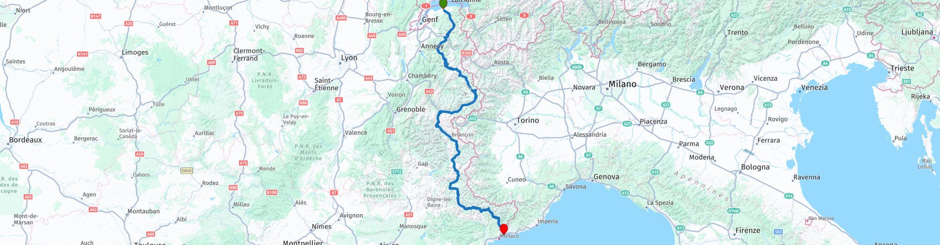
 The road starts at Thonon-les-Bains and climbs via Les Gets and Cluses. Then it goes to Saint-Gervais and Megève, over the Col des Saisies (1,633 m (5,358 ft)). Then it goes through Beaufort, Bourg-Saint-Maurice and to Val-d'Isère. The road then crosses the Col de l'Iseran (2,770 m (9,090 ft)).
The road then goes through Modane and over the Col du Galibier (2642 m (8,668 ft)) and then the Col du Lautaret to La Grave. The road goes to Briançon and then over the Col d'Izoard (2,361 m (7,746 ft)). The road then goes through Embrun and over the Col de Vars (2111 m (6.926 ft)) and via Jausiers on Barcelonnette, where the choice can be made (Rp31) to go south over the Col de la Bonette (2.802 m) turn - with access to the highest paved through road in Europe, the Cime de la Bonette - or continue via the Col de la Cayolle (2,327 m (7,635 ft)).
The original end of the route was Nice, but is now Menton, accessible via the cols of Sainte-Martin (1500 m (4,900 ft)), Turini (1,607 m (5,272 ft)) and Castillon (707 m (2,320 ft)) .
Allow at least 5 days for this trip so that you can take enough time to view everything. The route can be split as you wish, there are more than enough accommodation options along the way.


 Usage
Usage Want to download this route?
You can download the route for free without MyRoute-app account. To do so, open the route and click 'save as'. Want to edit this route?
No problem, start by opening the route. Follow the tutorial and create your personal MyRoute-app account. After registration, your trial starts automatically.  Disclaimer
Use of this GPS route is at your own expense and risk. The route has been carefully composed and checked by a MyRoute-app accredited RouteXpert for use on TomTom, Garmin and MyRoute-app Navigation.
Changes may nevertheless have occurred due to changed circumstances, road diversions or seasonal closures. We therefore recommend checking each route before use.
Preferably use the route track in your navigation system. More information about the use of MyRoute-app can be found on the website under 'Community' or 'Academy'.