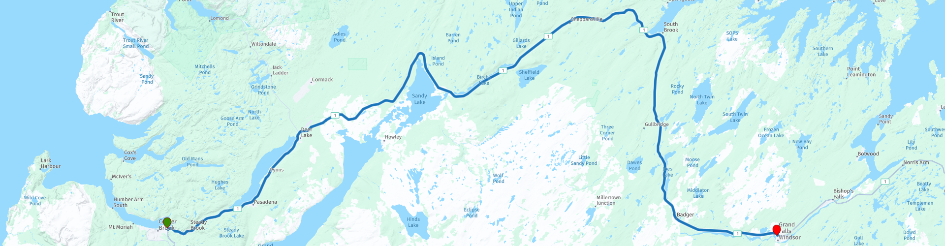
Day 31 TCH Corner Brook to Grand Falls

This route was brought to you by:
RouteXpert René Plücken (MRA Master)
Last edit: 12-02-2021
 Route Summary
 This is part 31 that runs from Corner Brook to Grand Falls.
The Trans Canada Highway passes through all the southern provinces of the country. The route can be driven in different ways. There are namely in various alternative routes that also belong to the TCH. The total distance is around 8,000 km. We not only drive the TCH, but will take the rural roads as much as possible, because only highway driving is too boring and Canada has many beautiful roads through its beautiful landscape.
You drive through all provinces and through very varied and scenic landscapes, from the Rockies in the West, the Central Prairies to the Eastern Maritimes and the Northern Forest.
The riding season is generally April through October with longer seasons on the west coast and southern Ontario.
Provide good all season clothing or bring rain gear, depending on the province and the season the weather can change and you may be surprised by a rain or even a snow or hail shower, so be prepared.
In Canada the metric system is used, so speeds are indicated in Km / h. A helmet requirement (DOT approved) applies throughout Canada.
You will see many wildlife throughout Canada. your similar animals from province to province, such as deer, buffalos, moose, caribou, wolves, pumas, bears, mountain goats, sheep, lynx, coyotes, foxes, raccoons, badgers, various rodents and all kinds of birds.
Even if it is very tempting to stop for a photo, don't do it, it can be very dangerous.
 Share this route


Animation

Verdict


Duration
2h 48m

Mode of travel
Car or motorcycle

Distance
260.24 km

Countries

 RouteXpert Review
 You drive through the beautiful mountainous and green Newfoundland, so you will see many forests, mountains, but also rivers and lakes that shine in the beautiful green landscape. There is possibility to stop in some places to take a picture.
There are no sights to stop on the way. This ride is pure driving through a beautiful landscape with a number of beautiful sights to visit at the end point in Grand Falls.
Just before we arrive at the hotel we can visit the Mary March Regional Museum at RP11. Explore the scope of central Newfoundland's rich and exciting history from ancient indigenous cultures, including the Beothuk, to industrial development in the 20th century. Special exhibitions and programs are presented throughout the season.
Near the hotel across the Exploits River is the Salmonid Interpretation Center. This salmon improvement project is the largest of its kind in North America, marked by a world-class interpretation center. The center has exhibits on the history, biology, ecology and habitat of the Atlantic salmon. Visitors can view the King of Fish through underwater windows as it travels upstream to the spawing habitat, taking in views of the falls and nesting gulls.
I rate this route with 3 *** Stars because of the beautiful nature and the museum and the Salmonid Interpretation Center.


 Links
Links  Usage
Usage Want to download this route?
You can download the route for free without MyRoute-app account. To do so, open the route and click 'save as'. Want to edit this route?
No problem, start by opening the route. Follow the tutorial and create your personal MyRoute-app account. After registration, your trial starts automatically.  Disclaimer
Use of this GPS route is at your own expense and risk. The route has been carefully composed and checked by a MyRoute-app accredited RouteXpert for use on TomTom, Garmin and MyRoute-app Navigation.
Changes may nevertheless have occurred due to changed circumstances, road diversions or seasonal closures. We therefore recommend checking each route before use.
Preferably use the route track in your navigation system. More information about the use of MyRoute-app can be found on the website under 'Community' or 'Academy'.