Baiersbronn Nederweert

This route was brought to you by:
RouteXpert Hans van de Ven (Mr.MRA)
Last edit: 08-06-2019
 Route Summary
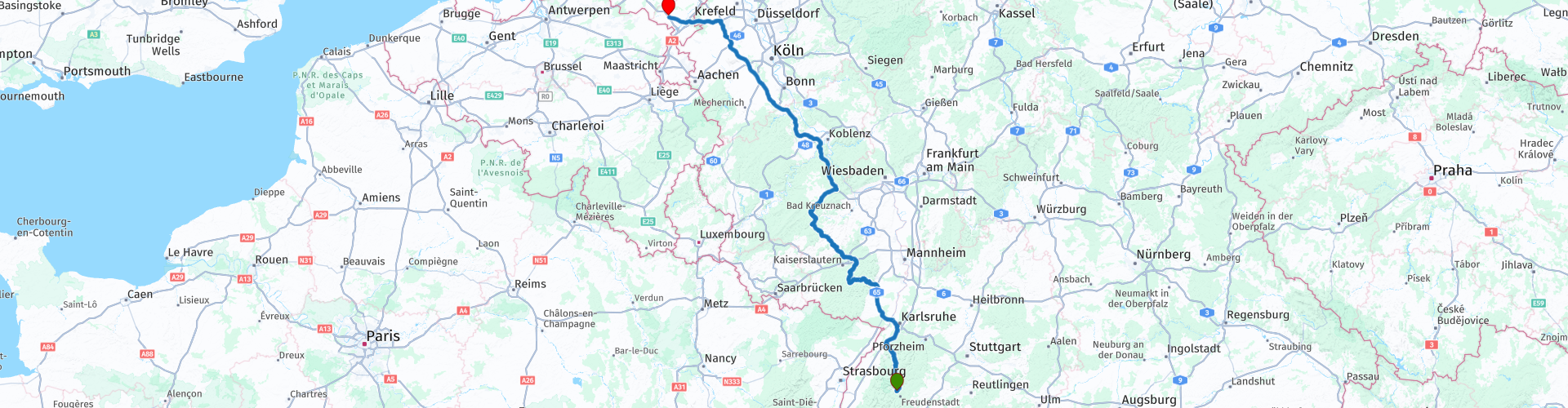
 Starting point: Hotel Falken Baiersbronn.
End point: AC Restaurant Nederweert Zuid
Route made equal for Garmin, TT and MyRoute-app Navigation.
 Share this route


Animation

Verdict


Duration
6h 40m

Mode of travel
Car or motorcycle

Distance
518.99 km

Countries


 RouteXpert Review
 We leave at 8:30 am after we have enjoyed breakfast again. Even today, the route is mainly on beautiful roads, but given the distance that we have to bridge, there is also a considerable stretch of highway. The first part we go inside to enjoy the Black Forest for a while, at Rauental we hurry up the highway to Edenkoben, where we stop at Bäckerei Becker for a cup of coffee. After coffee it goes back inside and we stop in Sien at the gas station for gasoline and a light lunch. We continue further through to Rheinbollen, where we enter the highway. We stop at Peppenhoven-Ost to refuel and stretch our legs and have a drink before continuing to the AC Restaurant Nederweert Noord.
Driving on Sunday from the outward and return journey was very satisfactory, with little traffic on the road so that you can drive on.
Because we have driven this route ourselves, we rate it with 5 stars.
Route details:
rp 1 - Hotel Falken Baiersbronn
rp 3 - Coffee stop at Bäckerei Becker
rp 10 - Coffee / Tank stop in Sien at BFT.
rp 15 - Tank stop Peppenhoven-Ost
rp 17 - Arrival point, AC Restaurant Nederweert Noord


 Links
Links  Usage
Usage Want to download this route?
You can download the route for free without MyRoute-app account. To do so, open the route and click 'save as'. Want to edit this route?
No problem, start by opening the route. Follow the tutorial and create your personal MyRoute-app account. After registration, your trial starts automatically.  Disclaimer
Use of this GPS route is at your own expense and risk. The route has been carefully composed and checked by a MyRoute-app accredited RouteXpert for use on TomTom, Garmin and MyRoute-app Navigation.
Changes may nevertheless have occurred due to changed circumstances, road diversions or seasonal closures. We therefore recommend checking each route before use.
Preferably use the route track in your navigation system. More information about the use of MyRoute-app can be found on the website under 'Community' or 'Academy'.