Villard de Lans door de wilde Vercors

This route was brought to you by:
RouteXpert Hans van de Ven (Mr.MRA)
Last edit: 30-04-2021
 Route Summary
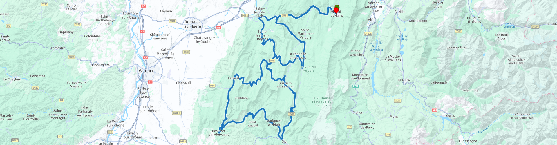
 Start: Villard-de-Lans
Finish: Villard-de-Lans
The route made the same for TomTom, Garmin and MyRoute-app Navigation users.
If you want to ride this TT, keep the info below in mind:
- Average mountain experience
- Tour
- TT from A to B
Source: Promoter 07, September / October 2018.
 Share this route


Animation

Verdict


Duration
7h 38m

Mode of travel
Car or motorcycle

Distance
244.12 km

Countries

 RouteXpert Review
 Passes and mountain roads: Col de Gaudissart (840 m), Col de la Machine (1011 m), Col de la Portette (1175 m), Col de la Bataille (1313 m), Col de Bacchus (980 m), Col de la Croix (745 m), Col de Marignac (743 m), Col de Rousset (1245 m), Col de St.-Alexis (1227 m), Col de la Chau (1337 m), Col de Carri (1202 m)
Specifics route:
- Winter closures: There are no fixed winter closures for the named passes. Nevertheless, you have to take closures into account in winter, especially on passes higher than 1000 m.
- Ideal months: Late April to mid-July, late August to mid-November. August is the holiday month in France, which is something to keep in mind.
- Driving pleasure: The gorge road through the Gorges de la Bourne and the road to Combe Laval. Basically all roads carved into the rocks.
- Landscape: Combe Laval, a road carved into the rock between the Col de Gaudissart passes in the north and the Col de la Machine in the south; the gorges Gorges da la Bourne and Grands Goulets; the rocky village of Pont-en-Royan and the Caves of Brudour.
This 5 star route is one of the 24 most beautiful Alpine routes in recent years!


 Links
Links  Usage
Usage Want to download this route?
You can download the route for free without MyRoute-app account. To do so, open the route and click 'save as'. Want to edit this route?
No problem, start by opening the route. Follow the tutorial and create your personal MyRoute-app account. After registration, your trial starts automatically.  Disclaimer
Use of this GPS route is at your own expense and risk. The route has been carefully composed and checked by a MyRoute-app accredited RouteXpert for use on TomTom, Garmin and MyRoute-app Navigation.
Changes may nevertheless have occurred due to changed circumstances, road diversions or seasonal closures. We therefore recommend checking each route before use.
Preferably use the route track in your navigation system. More information about the use of MyRoute-app can be found on the website under 'Community' or 'Academy'.