MTG1 05 Roundtrip Gerardmer Saint Diedes Vosges

This route was brought to you by:
RouteXpert René Plücken (MRA Master)
Last edit: 20-08-2025
 Route Summary
 This route includes several beautiful passes (cols) such as the Col du Surceneux, Col de Mandray and the Col du Haut Jacques, which are a delight for motorcyclists.
There aren't many sights to visit along the route, but there's plenty to see in St. Die. You'll see beautiful scenery along the way, and the roads are pleasant to drive. I rate this route 4 stars.
 Share this route


Animation

Verdict


Duration
4h 29m

Mode of travel
Car or motorcycle

Distance
108.99 km

Countries

 RouteXpert Review
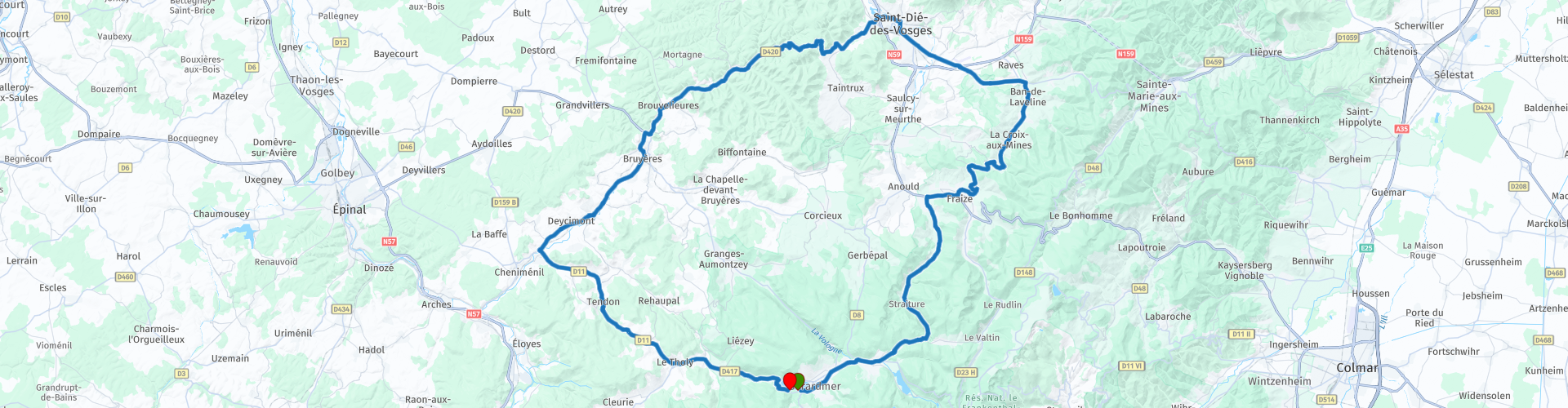
 This is the fifth route in the book and is a circular route north of Gérardmer.
There are hotels and campsites in the vicinity, these are included as POIs.
This route includes several beautiful passes (cols) such as the Col du Surceneux, Col de Mandray and the Col du Haut Jacques.
You pass several small villages where you can also stop for a drink and a bite to eat; there is always a restaurant or café open somewhere.
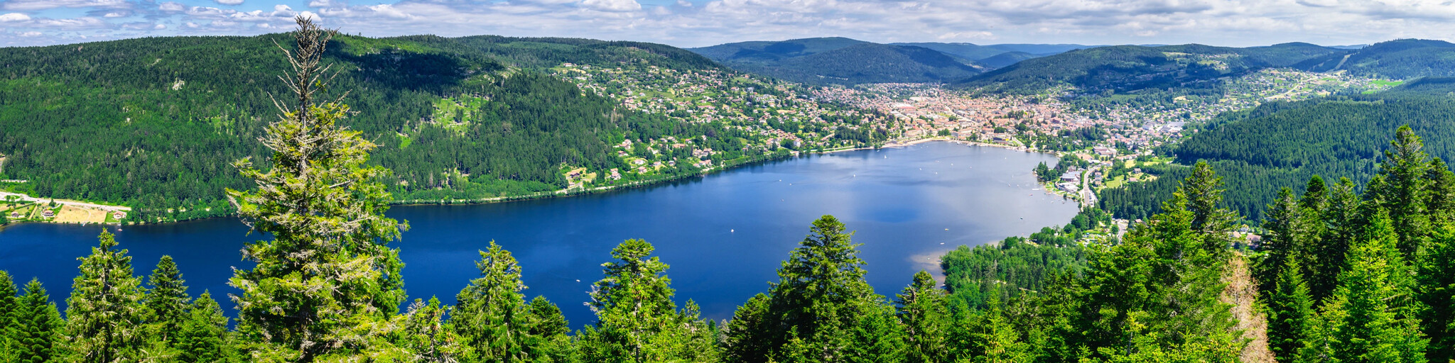
The ride starts and ends in Gérardmer, nestled among mountains covered in dense pine forests on the largest lake in the Vosges, Lac de Gérardmer. It's a great base for several rides, and this is one of three routes that start here.
You first drive to Xonrupt where you take the D23 which turns into the D73. Here you drive along the Petite Meurthe, a small river further north towards Fraise, where you drive a short distance on the D415 to follow the D23 again over the Col de Mandray. This first part of the route takes you over beautiful narrow roads through green valleys and forests with beautiful panoramas along the way.
You continue towards St. Die where you can stop to visit the city with various old buildings and museums.
From St. Die, you'll drive via the Col de Haut Jacques on the D420, a beautiful, winding road to Bruyères. You'll then continue through the lovely Vologne valley to just before Docelles, where you'll turn off and continue on the D11 to Gérardmer, the end of the route. Another beautiful ride on a winding road through the valley and the Rougemont forest.


 Links
Links  Usage
Usage Want to download this route?
You can download the route for free without MyRoute-app account. To do so, open the route and click 'save as'. Want to edit this route?
No problem, start by opening the route. Follow the tutorial and create your personal MyRoute-app account. After registration, your trial starts automatically.  Disclaimer
Use of this GPS route is at your own expense and risk. The route has been carefully composed and checked by a MyRoute-app accredited RouteXpert for use on TomTom, Garmin and MyRoute-app Navigation.
Changes may nevertheless have occurred due to changed circumstances, road diversions or seasonal closures. We therefore recommend checking each route before use.
Preferably use the route track in your navigation system. More information about the use of MyRoute-app can be found on the website under 'Community' or 'Academy'.