08 Elliniko Oitylo

This route was brought to you by:
RouteXpert Hans van de Ven (Mr.MRA)
Last edit: 22-10-2023
 Route Summary
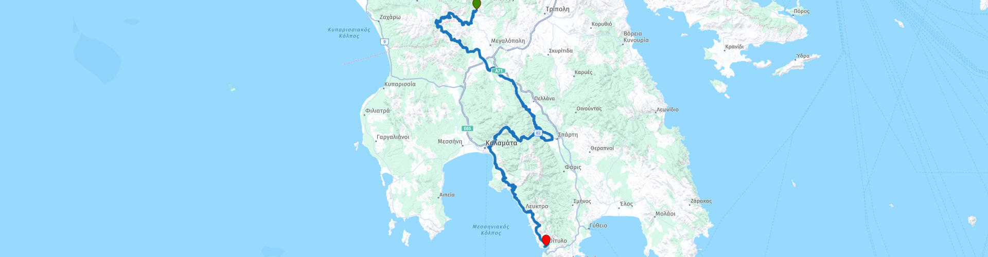
 This route takes you past some old stone bridges and a monastery in the mountains.
This route also offers a variety of roads, from a tight road surface to an unpaved path. But you will notice that it is not a punishment, you get value for your money.
The great surroundings and beautiful views ensure that this route deserves 4 stars.
Starting point: Rocabella, Trikolona
End point: Bratso di Maina, Oitylo
Have a good trip (Καλό ταξίδι)
 Share this route


Animation

Verdict


Duration
9h 33m

Mode of travel
Car or motorcycle

Distance
267.09 km

Countries

 RouteXpert Review
 Also bring water and something to eat for the journey, so that you can stop at one of the many beautiful points along the route to have something to eat and drink while enjoying the view.
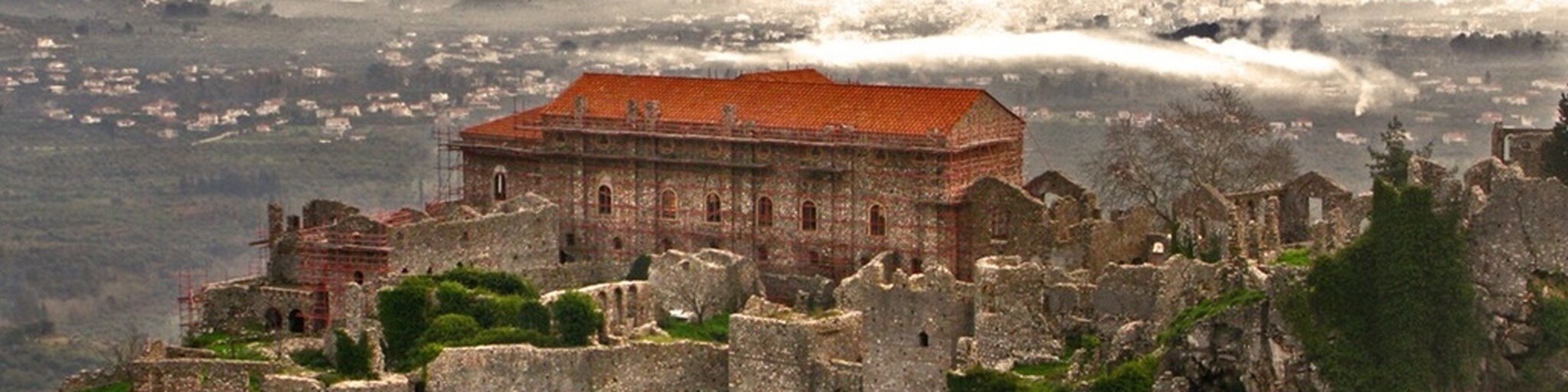
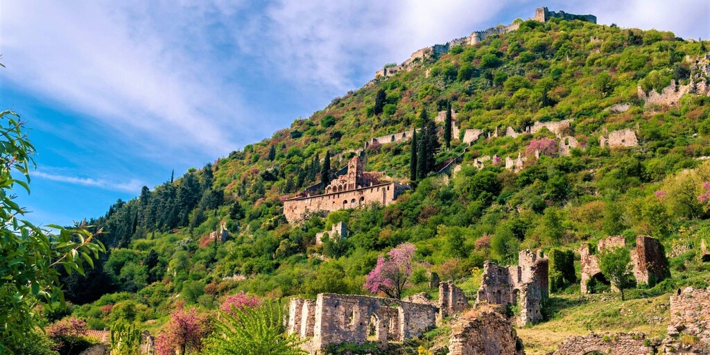
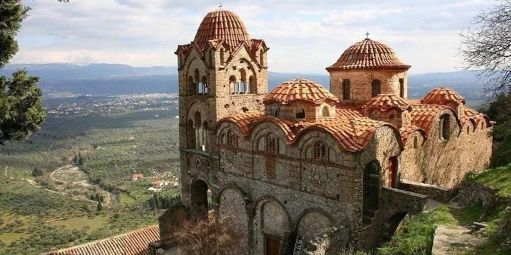
Of course, this route also includes the opportunity to visit a museum, namely the Museum of the emblematic archaeological site of Mystras, a monument declared a World Heritage Site by UNESCO. The exhibition is dedicated to the relations between the Byzantine world and the West. The presentation of selected artifacts and objects from Mystras, a late Byzantine urban center, aims to give the visitor a comprehensive insight into the complex political and social reality, as well as the spiritual life and art of the Palaiologan era. Entrance: €12.00
Then you head towards the coastline and continue to follow it until the end point. Where you can also take a refreshing dip in the pool and enjoy the local dishes.
 Links
Links  Usage
Usage Want to download this route?
You can download the route for free without MyRoute-app account. To do so, open the route and click 'save as'. Want to edit this route?
No problem, start by opening the route. Follow the tutorial and create your personal MyRoute-app account. After registration, your trial starts automatically.  Disclaimer
Use of this GPS route is at your own expense and risk. The route has been carefully composed and checked by a MyRoute-app accredited RouteXpert for use on TomTom, Garmin and MyRoute-app Navigation.
Changes may nevertheless have occurred due to changed circumstances, road diversions or seasonal closures. We therefore recommend checking each route before use.
Preferably use the route track in your navigation system. More information about the use of MyRoute-app can be found on the website under 'Community' or 'Academy'.

Peloponnese
About this region
The Peloponnese () or Peloponnesus (; Greek: Πελοπόννησος, romanized: Pelopónnēsos, IPA: [peloˈponisos]) is a peninsula and geographic region in southern Greece. It is connected to the central part of the country by the Isthmus of Corinth land bridge which separates the Gulf of Corinth from the Saronic Gulf. During the late Middle Ages and the Ottoman era, the peninsula was known as the Morea (Byzantine Greek: Μωρέας), a name still in colloquial use in its demotic form (Greek: Μωριάς).
The peninsula is divided among three administrative regions: most belongs to the Peloponnese region, with smaller parts belonging to the West Greece and Attica regions.
Read more on Wikipedia
The peninsula is divided among three administrative regions: most belongs to the Peloponnese region, with smaller parts belonging to the West Greece and Attica regions.
View region
 Statistics
  9
9Amount of RX reviews (Peloponnese)
 1596
1596Amount of visitors (Peloponnese)
 114
114Amount of downloads (Peloponnese)