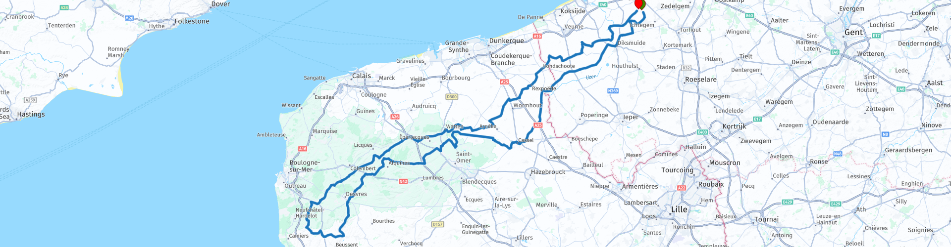
rondrit Moere Hubersent x Doeverentreffen 2012 lang

This route was brought to you by:
RouteXpert Chantal HV
Last edit: 12-04-2020
 Route Summary
  Share this route


Animation

Verdict


Duration
6h 13m

Mode of travel
Car or motorcycle

Distance
296.27 km

Countries


 RouteXpert Review
 RP 5 Westpoort http://www.lauka.be/nl/westpoort-en-caesarsboom-lo
RP 10 Musée de Flandre https://museedeflandre.fr/
RP 12 Moulin de Cassel with a view
The Kasselberg (French: Mont Cassel) is a witness hill in the French Westhoek, in the French North Department. The hill is 176 meters the highest of the Westhoek. On the top of the hill lies the city of Kassel. During the First World War, the French Marshal Ferdinand Foch established his headquarters (1914-1915). From the terrace of the castle he led the First Battle of Ypres and the Battle of the Yser.
RP 15 Maison de la bataille de Noordpeene http://www.musee-noordpeene.eu/
RP 57 The Diksmuidse Trench is the only preserved Belgian trench system from the First World War. In 2014 the corresponding interpretation center was completely renewed. On the basis of fifteen interactive applications, life-size photos, films and more than 100 original objects, you can discover the story of the infamous Disaster.
http://www.ijzerfront1418.be/museum/dodengang
Always remember them!
Extra tip: If you want to make a weekend of it and want to stay at the sea, drive past RP 29 towards Hardelot (see POI Hotel). Then you just pick up the route again.


 Links
Links  Usage
Usage Want to download this route?
You can download the route for free without MyRoute-app account. To do so, open the route and click 'save as'. Want to edit this route?
No problem, start by opening the route. Follow the tutorial and create your personal MyRoute-app account. After registration, your trial starts automatically.  Disclaimer
Use of this GPS route is at your own expense and risk. The route has been carefully composed and checked by a MyRoute-app accredited RouteXpert for use on TomTom, Garmin and MyRoute-app Navigation.
Changes may nevertheless have occurred due to changed circumstances, road diversions or seasonal closures. We therefore recommend checking each route before use.
Preferably use the route track in your navigation system. More information about the use of MyRoute-app can be found on the website under 'Community' or 'Academy'.