10 Amasya to Bolu via Kastamonu

This route was brought to you by:
RouteXpert Yannis Papadiotis (wheelboy)
Last edit: 01-04-2026
 Route Summary
 Turkey isn’t just a country, it’s a rider’s playground. This is the 10th of 12 stage journey takes you from Aegean coastlines through mountains, plains, and fairytale valleys all the way to the Black Sea and back west again.
Each leg has its own flavor, so here’s a deeper look.
Route 10:
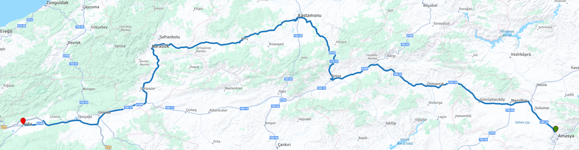
The ride from Amasya to Bolu crosses the heart of northern Anatolia, blending historic towns with gradually changing landscapes. A photo stop at Osmancık reveals the elegant Koyunbaba Bridge and hilltop castle overlooking the Kızılırmak River. After a short stop at Tosya, the road climbs along the D775 to the day’s highest point at 1,650 metres, where forests begin to replace farmland. The highlight comes in Kastamonu, where the castle provide sweeping views over the historic city. The final stretch continues through wooded hills toward Bolu, ending the day in the cooler forests of the western Black Sea region.
A balanced and scenic 4* route combining history, mountain riding, and classic Anatolian countryside.
 Share this route


Animation

Verdict


Duration
8h 14m

Mode of travel
Car or motorcycle

Distance
503.68 km

Countries

 RouteXpert Review
 Shortly after settling into the route, there is an alternative option for those looking for a quieter and more rural experience. Instead of following the main route, you can take the D030 road for approximately 255 km. This variation leads through agricultural landscapes and past two large reservoirs, offering a more remote and less travelled perspective of the region. The road eventually rejoins the main route near Kastamonu, adding around 35 km to the total distance.
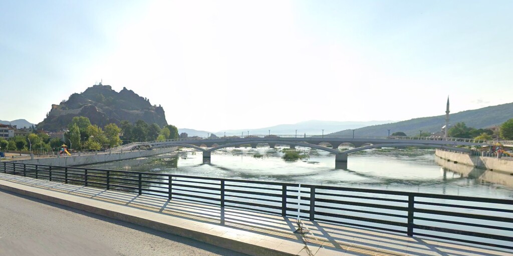
The first notable stop on the main route arrives in Osmancık, a historic town set along the Kızılırmak River. Here you can pause for a photograph of the elegant Koyunbaba Bridge, a monumental 15th-century Ottoman stone bridge that arches gracefully across the river. Rising above the settlement on a rocky hill is Osmancık Castle, whose silhouette completes the classic Anatolian composition of fortress, bridge, and river valley. The viewpoint from the bridge area makes this one of the most picturesque short stops of the day.
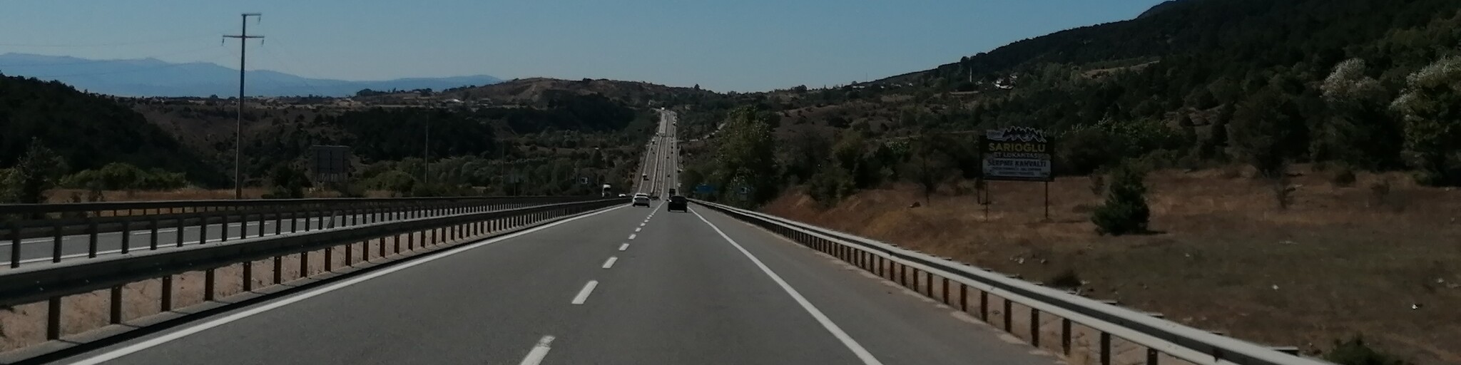
Continuing north, the route passes through wide farmland before reaching Tosya, where the second fuel stop is recommended roughly 180 kilometres after leaving Amasya. From this point the road begins to climb more decisively as it follows the D775 Road into increasingly mountainous terrain. The ascent leads to the highest point of the route at approximately 1,650 metres, where forests begin to dominate the landscape and the temperature noticeably drops. The transition from agricultural plateau to wooded highlands gives this section a more alpine atmosphere and makes the riding progressively more engaging.
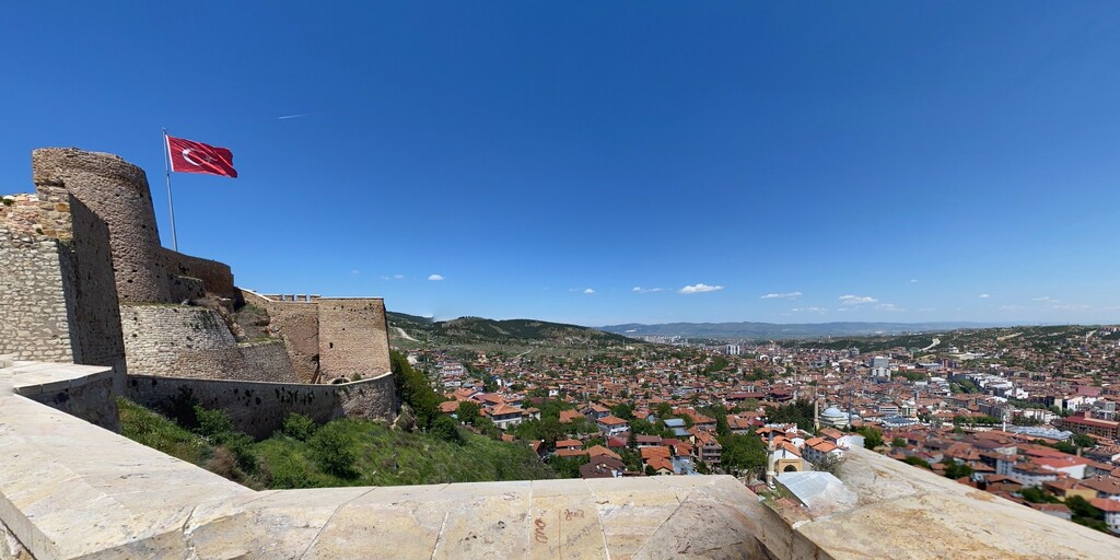
The descent brings you into Kastamonu, the main cultural stop of the day. The highlight here is Kastamonu Castle, dramatically positioned on a rocky outcrop overlooking the historic town. From the castle walls you can enjoy sweeping views across Kastamonu’s red rooftops and surrounding valleys. Just below stands the recognizable Kastamonu Clock Tower, an elegant landmark that has become a symbol of the city. Taking some time here for a short walk and photos provides the main historical visit of the stage.
After leaving Kastamonu, the route continues westward through wooded hills toward Karabük, where a final fuel stop is available before the last kilometres. The road then continues through the western Black Sea mountain belt before reaching the final destination, Bolu, where forested landscapes dominate the surroundings.
After check-in, Bolu offers several worthwhile places for a late-afternoon walk. The Bolu Museum provides a good overview of the region’s ancient Bithynian, Roman, and Ottoman past. The Yıldırım Bayezid Mosque is one of the city’s most important Ottoman monuments, located near the lively central square where cafés and small restaurants make a pleasant evening stop. If daylight allows, a short drive outside the city leads to Lake Abant, a well-known natural attraction surrounded by forests and walking paths.
 Links
Links  Usage
Usage Want to download this route?
You can download the route for free without MyRoute-app account. To do so, open the route and click 'save as'. Want to edit this route?
No problem, start by opening the route. Follow the tutorial and create your personal MyRoute-app account. After registration, your trial starts automatically.  Disclaimer
Use of this GPS route is at your own expense and risk. The route has been carefully composed and checked by a MyRoute-app accredited RouteXpert for use on TomTom, Garmin and MyRoute-app Navigation.
Changes may nevertheless have occurred due to changed circumstances, road diversions or seasonal closures. We therefore recommend checking each route before use.
Preferably use the route track in your navigation system. More information about the use of MyRoute-app can be found on the website under 'Community' or 'Academy'.

Kastamonu
About this region
Kastamonu is the capital district of the Kastamonu Province, Turkey. According to the 2000 census, population of the district is 102,059 of which 64,606 live in the urban center of Kastamonu. (Population of the urban center in 2010 is 91,012.) The district covers an area of 1,834 km2 (708 sq mi), and the town lies at an elevation of 904 m (2,966 ft). It is located to the south of the province.
Read more on Wikipedia
View region
 Statistics
  2
2Amount of RX reviews (Kastamonu)
 101
101Amount of visitors (Kastamonu)
 24
24Amount of downloads (Kastamonu)
 Route Collections in this region
 Riding Across Turkey Route by Route
This route collection offers a complete journey across Turkey, combining iconic landmarks with diverse landscapes.
Starting from the Aegean coast, you explore Ephesus and Pamukkale before heading inland to Lake Salda and Sagalassos. Cappadocia forms a highlight with its unique rock formations and underground cities. The route then crosses central Anatolia’s wide plains toward the rugged east, where quieter roads and dramatic scenery dominate. A major contrast follows along the Black Sea, with green mountains and coastal views. The return west through Bursa and Pergamon adds rich history.
Overall, this is a well balanced itinerary ideal for travelers seeking variety, culture, and scenic driving.
View Route Collection