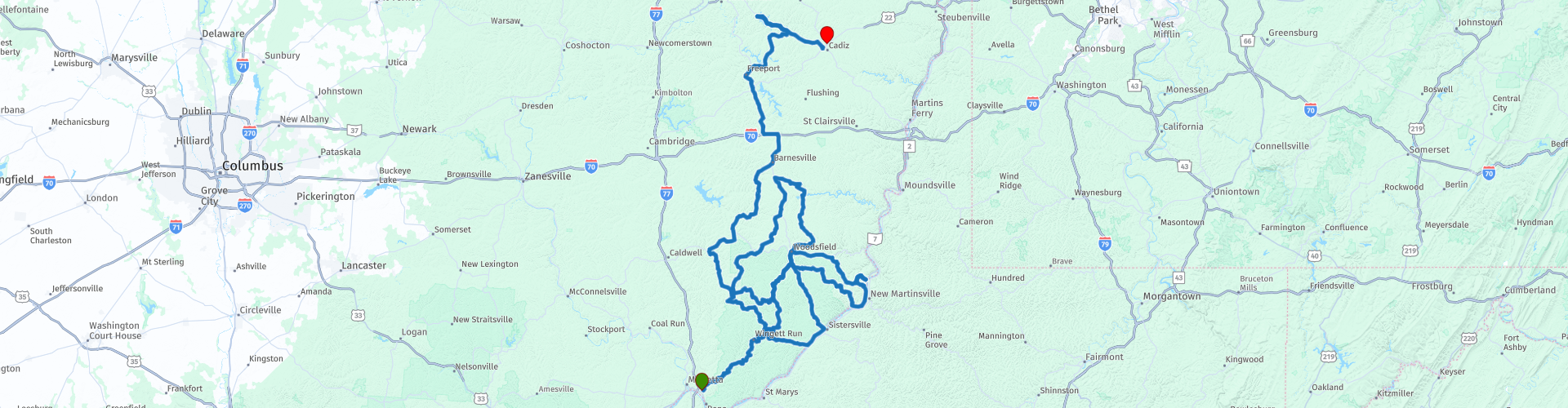
SE Ohio from Marietta to Cadiz

This route was brought to you by:
RouteXpert Brian Liechty
Last edit: 17-04-2020
 Route Summary
  Share this route


Animation

Verdict


Duration
8h 19m

Mode of travel
Car or motorcycle

Distance
503.39 km

Countries

 RouteXpert Review
 We’ll start in the parking area of the Fairmont Inn and jump right into the thick of things—OH-26 is awesome! Car and Driver magazine calls it one of the “best driving roads in America”. If you like covered bridges you’re in for a treat as there are several along the way, as well as Mail Pouch Tobacco painted barns. Oil was discovered here in the middle 1800s and there are numerous functioning wellheads along our route.
As we travel through the Wayne National Forest we’ll pass many examples of old construction nestled alongside brand-new buildings. Landslides caused by torrential rains in the past few years have narrowed some roads to single-lane, but rest assured that these zones are well-marked and traffic well-controlled. Fuel stations are marked at several points because they are not common in the hills.
We’ll pass through the town of Woodsfield twice today. If you’ve not brought a picnic for lunch, on the second time through you can stop and pick something up at a fast food place (or Riesbeck’s Grocery) for whatever pleasures you wish for a bit later. Soon after we’ll take a short diversion to Kiedaisch Point where there are breathtaking views of the Ohio River valley and New Martinsville, WV across the river. Afterward, a short journey down the hill leads to the Hannibal Locks for a peaceful and relaxing lunch. There are facilities and some brief sights here as well as picnic tables and ample parking.
After lunch we’ll meander back to the north through more of the amazing area roads, past the Piedmont, Clendening and Tappan Reservoirs then on to Cadiz where we’ll finish for the night at the Microtel.


 Links
Links  Usage
Usage Want to download this route?
You can download the route for free without MyRoute-app account. To do so, open the route and click 'save as'. Want to edit this route?
No problem, start by opening the route. Follow the tutorial and create your personal MyRoute-app account. After registration, your trial starts automatically.  Disclaimer
Use of this GPS route is at your own expense and risk. The route has been carefully composed and checked by a MyRoute-app accredited RouteXpert for use on TomTom, Garmin and MyRoute-app Navigation.
Changes may nevertheless have occurred due to changed circumstances, road diversions or seasonal closures. We therefore recommend checking each route before use.
Preferably use the route track in your navigation system. More information about the use of MyRoute-app can be found on the website under 'Community' or 'Academy'.