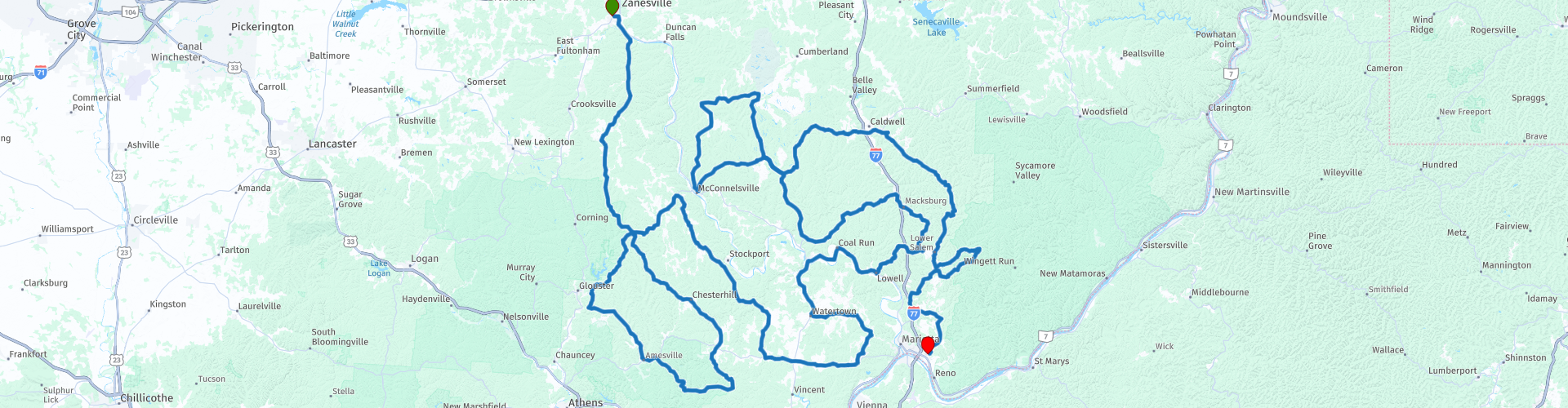
SE Ohio from Zanesville to Marietta

This route was brought to you by:
RouteXpert Brian Liechty
Last edit: 08-02-2021
 Route Summary
  Share this route


Animation

Verdict


Duration
7h 13m

Mode of travel
Car or motorcycle

Distance
484.14 km

Countries

 RouteXpert Review
 We’ll start this exciting drive in the parking lot of the Sheetz fuel station on the south side of Zanesville. Continuing south and out of town on OH-555, the famed “Triple Nickle”, we'll follow this winding collection of hills and curves for about 45 miles then curl up and around to the Route 60 Diner for lunch in Lowell—one of the many quaint little towns along our way. Then we’ll be back on the roads heading north and west and back around, stopping for a rest at Miner’s Memorial Park near McConnelsville. This park memorializes the coal mining industry that sustained this area for many years and is the final resting place for the bucket from Big Muskie—the largest dragline excavator ever built. The 220-cubic-yard bucket is all that remains of the 13,500 ton, 22-story machine. Its an interesting story to learn while taking a short break. There are facilities here, but no fuel or food.
Now we’ll head east into the edges of the Wayne National Forest and then south to our route’s end at the Fairfield Inn on the east side of Marietta. Marietta is nice old town dating back to the late 1700s. There is plenty to do here for a day or two if you’re of the mind including many nice shops downtown, Marietta College and into Parkersburg, West Virginia if you take one of the bridges over the Ohio River. The town’s affection for ghosts is an interesting aside with tours and even haunted mansions to inspect.


 Links
Links  Usage
Usage Want to download this route?
You can download the route for free without MyRoute-app account. To do so, open the route and click 'save as'. Want to edit this route?
No problem, start by opening the route. Follow the tutorial and create your personal MyRoute-app account. After registration, your trial starts automatically.  Disclaimer
Use of this GPS route is at your own expense and risk. The route has been carefully composed and checked by a MyRoute-app accredited RouteXpert for use on TomTom, Garmin and MyRoute-app Navigation.
Changes may nevertheless have occurred due to changed circumstances, road diversions or seasonal closures. We therefore recommend checking each route before use.
Preferably use the route track in your navigation system. More information about the use of MyRoute-app can be found on the website under 'Community' or 'Academy'.