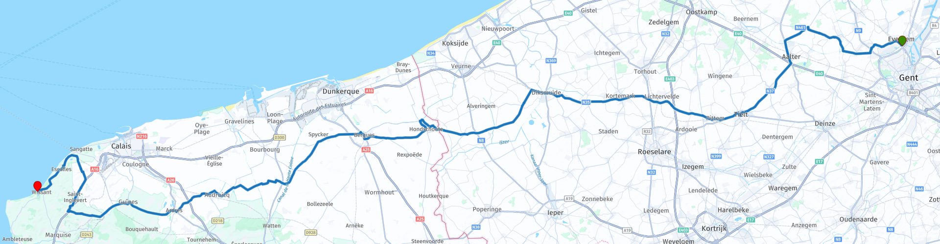
MTG2 23 Gent Tielt Hondschoote Bergues Ardres Mimoyecques Wissant

Esta ruta fue hecha por:
RouteXpert René Plücken (MRA Master)
Última edición: 24-09-2025
 Resumen de ruta
 Esta ruta proviene de la Guía Turística en Motocicleta Francesa Parte 2 y el nombre original es "Nord-Pas de Calais; Descripción de la Ruta 1ra Ruta: Flandes Francés".
En la Guía Turística Francesa en Moto, Parte 2, se distingue entre rutas de aproximación y recorridos dentro de una zona específica. Las rutas de aproximación también pueden utilizarse junto con las rutas de la Guía Turística Francesa en Moto, Parte 1.
Las rutas se han modificado ligeramente en ocasiones según las sugerencias de Bert Loorbach en su descripción, debido a una pernoctación diferente o para cumplir con el límite mínimo de dos horas para la Biblioteca MRA. Cada reseña de ruta incluye una descripción más detallada, que incluye opciones para pernoctar y puntos de interés a lo largo del camino, que también se indican con un punto de interés y, si es posible, una breve descripción.
Esta es una ruta preciosa y con mucha historia, los caminos son bonitos, buenos pero no espectaculares, por eso califico esta ruta con 4**** estrellas.
 Compartir esta ruta


Animation

Veredicto


Duración
9h 1m

Modo de viaje
Coche o motocicleta

Distancia
200.84 km

Países


 Revisión de RouteXpert
 Éste es el primero de dos sorprendentes recorridos cerca de casa, que también pueden utilizarse como ruta de aproximación o como parte de un recorrido más al sur.
La ruta de acceso para ambas rutas puede ser a través de la autopista desde Gante si quieres ir más rápido, pero también hay mejores alternativas a través de las carreteras N y D más pintorescas, que he incluido en las rutas originales.
Es una mezcla de Flandes y Francia; encontramos molinos de viento y canales, pero también costas escarpadas y ciudades fortificadas. A lo largo de estas rutas, también encontrará rastros y recuerdos de la Segunda Guerra Mundial por doquier, como una serie de ciudades fortificadas, algunas aún completamente intactas, como Bergues en la primera ruta.
El punto de partida es el McDonalds en el cruce R4-N456 cerca de Gante.
Desde aquí, atravesaremos los pueblos de Belzele y Ursel en dirección a Tielt. En el centro de este pequeño pueblo, hay varias cafeterías donde podrás tomar un delicioso café. El Halletoren (Belfort de Tielt) se alza en la plaza del pueblo.
Luego conducimos por Lichtervelde y Diksmuide por la N35 y la N364 hasta Hondschoote, en Francia. Es una ruta muy agradable, sobre todo después de Diksmuide, donde se accede a Francia por una pequeña carretera rural. Hay algunos tramos largos con losas de hormigón resonantes, por lo que se recomienda llevar cinturón lumbar.
A las afueras del pueblo de Hoogschoote se encuentra el Moulin du Nord (Molino del Norte), un molino de postes que se utilizaba como molino de maíz. Datado al menos de 1547, el Moulin du Nord es el molino de viento más antiguo del norte de Francia y se dice que es el más antiguo de Europa. Sus cimientos datan de 1127.
Una vez que llegue a Hondschoote, también se encontrará en el punto de partida de la ruta original, tal como se describe en la Guía turística en automóvil francesa, parte 2.
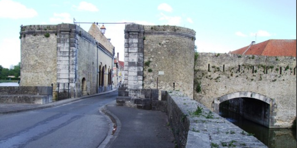
La siguiente ciudad es Bergues. Es una ciudad fortificada con hermosas murallas, puertas y una espaciosa plaza. Así que definitivamente vale la pena detenerse aquí para estirar las piernas y hacer turismo. Al salir de la ciudad, pasará por las Puertas de Dunkerque, parte de las antiguas murallas de la ciudad.
Después, seguimos el Canal de Colme y casi te sentirás en el norte de los Países Bajos, entre campos, granjas, carreteras rectas y canales. El paisaje no solo evoca los Países Bajos, sino que los topónimos, como Kapellebroek, Sint Pietersbroek y Ouderwijk (Audruicq), son más holandeses que franceses.
Continuamos por una carretera sinuosa hacia Audruicq y Ardres. Este último pueblo cuenta con una hermosa avenida bordeada de frondosos tilos, a la que se accede directamente. También hay una encantadora plaza triangular con casas antiguas, y varios restaurantes en el centro son ideales para planificar un almuerzo.
El último tramo, y también el más bonito, del viaje hacia Cap Blanc-Nez comienza en Gumes. Este tramo también está claramente señalizado después del pueblo. Recorreremos carreteras sinuosas a través de la zona norte del Parque Natural Regional de Caps et Marais d'Opale, pasando por Landrethun-de-Nord hasta St. Inglevert.
Cualquier persona interesada en la Segunda Guerra Mundial puede visitar Fort Mimoyecques. Ubicado exactamente a 150 kilómetros de Londres, fue concebido como base para el cohete V3, sucesor del V1 y el V2. Este cohete pretendía borrar Londres del mapa. Para ello, los alemanes inventaron inmensos cañones de 130 metros de largo, que debían instalarse bajo tierra. La enorme estructura fue literalmente destruida por una bomba "Tallboy" aliada en julio de 1944. El complejo ahora está abierto al público.
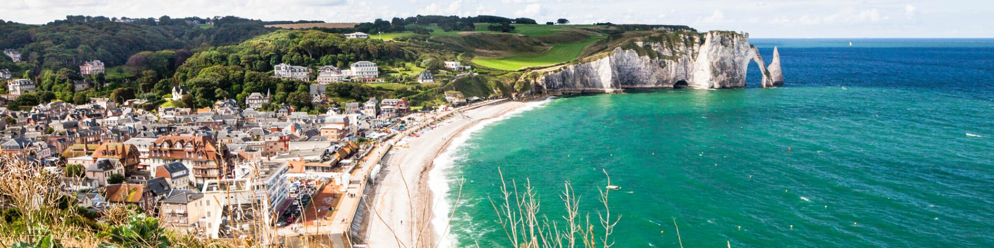
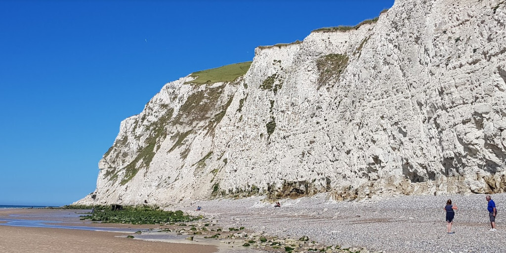
Después, continuamos conduciendo un poco más por la Costa de Ópalo hasta el Cabo Blanc-Nez, en el Canal de la Mancha. Su cima se eleva 134 metros sobre el nivel del mar. El Cabo Blanc-Nez se encuentra a 16 kilómetros al noreste del Cabo Gris-Nez. Se puede acceder al cabo a pie o en coche. Hay una ruta de senderismo desde la cima hasta la playa. ¡Desde aquí, la vista es impresionante! En un día despejado, se puede ver fácilmente la costa inglesa y los numerosos ferries que operan los servicios regulares. Este cabo debe su nombre (Cabo Nariz Blanca) a los acantilados de tiza blanca y a su forma similar a una nariz.
Nos dirigimos a nuestro destino final, Wissant, uno de los pueblos más bonitos de la Costa de Ópalo. Aún rezuma el ambiente de un pequeño y antiguo pueblo pesquero. Hay una playa enorme, que también ha sido descubierta por los windsurfistas. El ambiente es agradable y tranquilo. Aquí podrás relajarte en la playa después de este hermoso día antes de pasar la noche en uno de los muchos hoteles o en un camping.
 Enlaces
  Uso
Uso ¿Quiere descargar esta ruta?
Puede descargar la ruta gratis sin la cuenta de MyRoute-app. Para hacerlo, abra la ruta y haga clic en 'guardar como'. ¿Quiere editar esta ruta?
No hay problema, comience abriendo la ruta. Siga el tutorial y cree su cuenta personal de MyRoute-app. Después de registrarse, su prueba comienza automáticamente.  Descargo de responsabilidad
El uso de esta ruta GPS es por su cuenta y riesgo. La ruta ha sido cuidadosamente compuesta y verificada por un RouteXpert acreditado por MyRoute-app para su uso en TomTom, Garmin y MyRoute-app Navigation.
No obstante, es posible que se hayan producido cambios debido a circunstancias cambiantes, desvíos de carreteras o cierres estacionales. Por lo tanto, recomendamos comprobar cada ruta antes de utilizarla.
Utilice preferentemente el track de ruta en su sistema de navegación. Más información sobre el el uso de la aplicación MyRoute se puede encontrar en el sitio web en 'Comunidad' o 'Academia'.