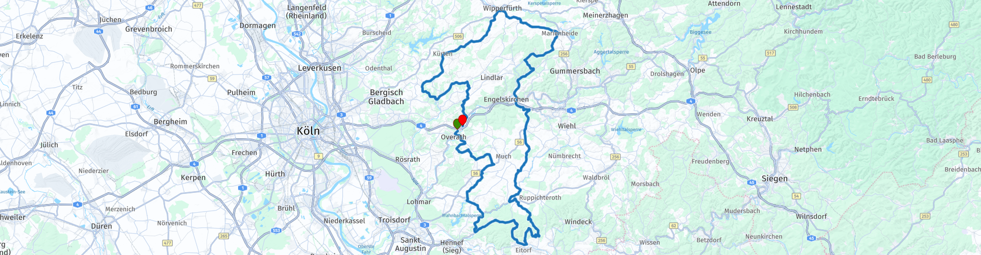
Rondrit Bergisches Land vanuit Overath

This route was brought to you by:
RouteXpert Hans van de Ven (Mr.MRA)
Last edit: 20-10-2021
 Route Summary
 Starting point: McDonalds Overath.
End point: Restaurant - Cafe Lüdenbach in Overath.
 Share this route


Animation

Verdict


Duration
2h 57m

Mode of travel
Car or motorcycle

Distance
154.14 km

Countries

 RouteXpert Review
 We left at 8 a.m. in Deurne, it was only 1 degree, but we still left with 6 motorbikes. After a 1 hour drive off the highway to drink coffee and warm up. Arrived in Overath, first refueling and then having coffee at the McDonalds, where our "guest" is already waiting for us with the coffee. He drove from Heerlen to Overath.
After coffee, we start the route, it goes through the beautiful Bergisches Land and goes over mostly beautiful roads and does not disappoint us, on the contrary, our guest will soon drive him again.
After an hour and a half we arrive at the lunch location, Bikertreff "Alte Schule", where we enjoy lunch outside in the sun. We were lucky according to the owner, because there was still snow in the morning. After lunch we will wind around the Bergisches Land for about an hour and a half to end up at Restaurant - Cafe Lüdenbach, where we will refuel after coffee, and then back onto the highway to Zeilberg, where the Toertocht ends as usual with us home base; The fun.
Because I have driven this route myself, this route gets a rating of 5 stars!
Route details:
rp 1 - McDonalds Overath (Gas station across the road)
rp 24 - Lunch location Bikertreff Alte Schule
rp 34 - Tank option on the route at Esso.
rp 39 - End point route Restaurant - Cafe Lüdenbach


 Links
Links  Usage
Usage Want to download this route?
You can download the route for free without MyRoute-app account. To do so, open the route and click 'save as'. Want to edit this route?
No problem, start by opening the route. Follow the tutorial and create your personal MyRoute-app account. After registration, your trial starts automatically.  Disclaimer
Use of this GPS route is at your own expense and risk. The route has been carefully composed and checked by a MyRoute-app accredited RouteXpert for use on TomTom, Garmin and MyRoute-app Navigation.
Changes may nevertheless have occurred due to changed circumstances, road diversions or seasonal closures. We therefore recommend checking each route before use.
Preferably use the route track in your navigation system. More information about the use of MyRoute-app can be found on the website under 'Community' or 'Academy'.