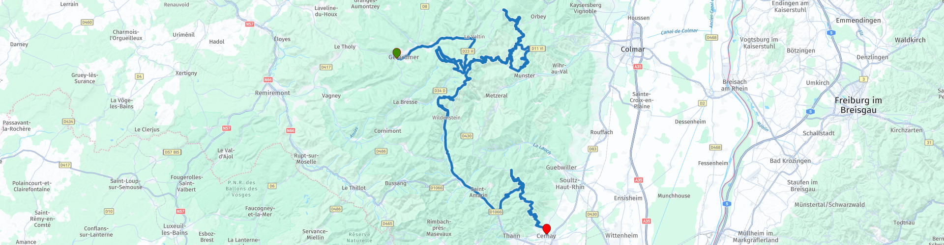
MTG1 03 Gerardmer Lac Blanc Le Hohneck Cernay

This route was brought to you by:
RouteXpert René Plücken (MRA Master)
Last edit: 20-08-2025
 Route Summary
 This route includes several beautiful cols, such as the Col de la Schlucht, Col du Calvaire, and Collet du Linge. You'll ride past mountain lakes with beautiful, clear water, through forests, over mountain ridges (crêtes), and through valleys with steep climbs and plenty of bends.
The ride takes you along beautiful, high-quality mountain roads with plenty of twists and turns. There's plenty to see along the way, and you can park at viewpoints. I rate this route 5 stars.
 Share this route


Animation

Verdict


Duration
6h 2m

Mode of travel
Car or motorcycle

Distance
144.29 km

Countries

 RouteXpert Review
 Bert Loorbach, the author, is an avid motorcyclist himself and lived in France for a year and a half. During that time, he dedicated himself to mapping France's lesser-known and beautiful back roads specifically for motorcyclists.
This is the third route in the book. It starts in Gérardmer and ends in Chernay.
There are hotels and campsites in the vicinity, these are included as POIs.
This route includes several beautiful passes (cols) such as the Col de La Schlucht, Col du Calvaire and Collet du Linge.
The ride starts in Gérardmer, nestled among mountains covered in dense pine forests, on the largest lake in the Vosges Mountains: Lac de Gérardmer. It's a great base for several rides, and this is one of three routes that start here.
This route follows mountain ridges (crêtes) and is more than half forested. The first pass is the Col de la Schlucht, an east-west oriented mountain pass located on the border of the Vosges and Haut-Rhin departments. The pass route begins in the west from Gérardmer at 660 meters above sea level and begins to climb significantly after Xonrupt-Longemer.
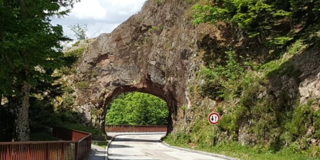
I've deviated slightly from the original route to include the natural bridge "Roche du Diable," the Devil's Stone. There's a small parking lot, a shop, and a lookout point with a beautiful view.
Follow the D61 "Le route de Crêtes," a beautiful route along the mountain ridges in Alsace. This narrow but scenic two-lane road winds partly through forests with beautiful views.
You'll drive past Lac Blank, where you should definitely stop to enjoy the beautiful mountain lake and the surrounding mountains. The next section has many bends and opportunities to stop at small parking areas to enjoy the view.
From Col de la Schlucht, you'll rejoin the Route des Crêtes, this time heading south. This last section is approximately 50 kilometers long, very winding, and a fantastic drive. There are many sights along the way. They're listed as points of interest, and if you have the time, it's definitely worth stopping and enjoying the views. I've included a link to a YouTube video with footage of the region and the Route des Crêtes.
Our lunch stop is the Hohneck mountain peak. At 1,364 meters, it's the third-highest peak in the Vosges Mountains after the Grand Ballon and the Storkenkopf. It lies on the border of Alsace and Lorraine. On the mountain, there's a mountain hut with a restaurant for lunch, a small shop, and a beautiful hiking trail.
Enjoy a ride up the Grand Ballon, the highest mountain in the Vosges Mountains. The mountain rises to 1,424 meters in the southern part of the ridge. The Grand Ballon is located in the Ballons des Vosges Natural Park, and its summit is just above the treeline.
The final stretch to Cernay is a challenging one with many twists and turns, and the occasional hairpin bend. Once again, there are stunning views of the mountains and valleys.
In Cernay, you can stay overnight in one of the hotels or at Camping Les Cigognes. Points of interest and links have been added.

 Links
Links  Usage
Usage Want to download this route?
You can download the route for free without MyRoute-app account. To do so, open the route and click 'save as'. Want to edit this route?
No problem, start by opening the route. Follow the tutorial and create your personal MyRoute-app account. After registration, your trial starts automatically.  Disclaimer
Use of this GPS route is at your own expense and risk. The route has been carefully composed and checked by a MyRoute-app accredited RouteXpert for use on TomTom, Garmin and MyRoute-app Navigation.
Changes may nevertheless have occurred due to changed circumstances, road diversions or seasonal closures. We therefore recommend checking each route before use.
Preferably use the route track in your navigation system. More information about the use of MyRoute-app can be found on the website under 'Community' or 'Academy'.