Fortified Churches Roundtour in the Ardennes from Signy le Petit

This route was brought to you by:
RouteXpert Jan Koelstra - Senior Rx
Last edit: 28-10-2024
 Route Summary
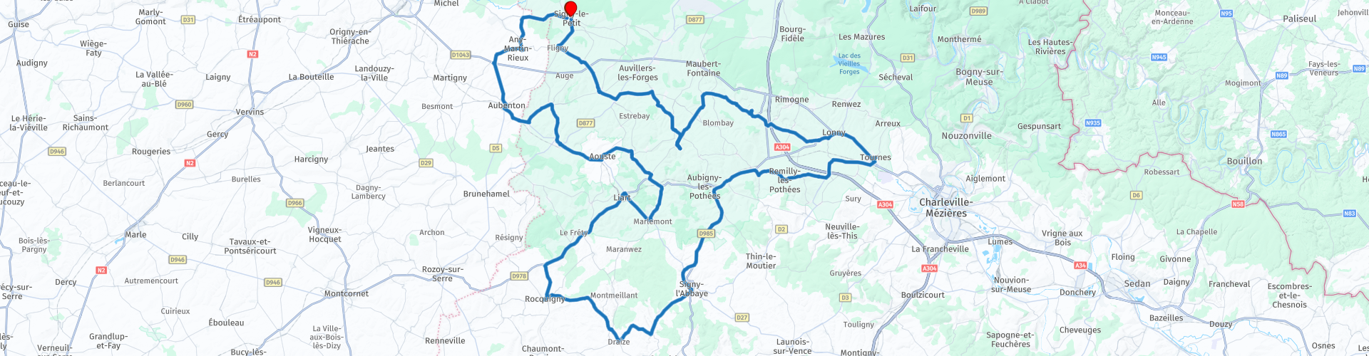
 You start the tour in Signy-le-Petit
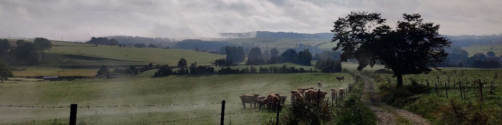
The tour gets a four-star rating. The roads are fine to ride, but the gray villages and the monotonous landscape are not really captivating. On the other hand, the great variety of the fortified churches provides a welcome surprise.
 Share this route


Animation

Verdict


Duration
8h 59m

Mode of travel
Car or motorcycle

Distance
147.24 km

Countries

 RouteXpert Review
 The villages are close together here and you can often see the church tower of the neighbouring village. In earlier times this was even life-saving. If an attack was imminent, the church bells were rung and could be heard far and wide. The next village also rang its bells and the villages after that, so that everyone could get to safety in time. The villagers and sometimes soldiers, went to church with their belongings.
People climbed up the narrow staircase into the tower, where they entered a larger space where they could stay for days. Some churches had multiple floors. Even the cattle were herded up the narrow staircase. The spaces were not particularly large and with many people it quickly became overcrowded. There was a flue so that cooking could be done and there were wooden partitions where the most valuable animals could be housed. Narrow (shooting) slots were made in the tower(s) where the villagers could shoot at the enemy or throw down pitch or oil to defend themselves somewhat.
This tour of fortified churches focuses on the eastern part of Thiéarche, located in the western part of the Ardennes department. The route starts and ends in Signy-le-Petit. Here you will find the Saint-Nicolas church, dating from the end of the 15th century. The walls, three metres thick at the foot of the tower, are made of quartz slate. Through the square portico tower flanked by two watchtowers with so-called pepper pots, you enter the vaulted nave of bricks on intersecting ribs of yellow stone.
Another magnificent fortified church can be found in Aouste with stylistic features of the 15th and 17th centuries. The only white stone building built as a refuge for the population. An underground cellar, now walled up with a large chimney, allowed for a fairly long period of isolation. escape. The tower is connected to a raised loft. A well and a bread oven completed the reception system. The tower was accessed by a staircase partly in the nave, partly in the semi-circular tower attached to it. Strong buttresses reinforce the construction. A hundred villagers and their cattle once lived in the church for over three years.
The fortified church of Jeantes is a historical monument and was rebuilt during the Wars of Religion, which caused many Huguenots to flee. It dates from the 16th century and has a façade flanked by two square brick towers. The interior of the church is decorated with murals and frescoes created by the Dutch painter Charles Eyck in 1962, as well as remarkable stained glass windows. The paintings represent scenes from the Gospel and landscapes by Thiérache, in a style close to expressionism and the work of Chagall, Picasso or Modigliani. The stained glass windows illustrate the life of Monique Carlin, founder of a religious congregation, and the four elements. The church has been listed as a historical monument since 1987.
The countryside is not that exciting though; you shift your focus to spotting a fortified church. Usually you can see them from a great distance. Because the villages are close together, the route promises to be unpredictable and the road generally runs inland, along church paths and farm roads. Extra time is included for the most beautiful examples and if the village lends itself to it, a stop for coffee or lunch. In this region, finding a petrol station is a challenge and you are advised to fill your tank at the start.
 Links
Links  Usage
Usage Want to download this route?
You can download the route for free without MyRoute-app account. To do so, open the route and click 'save as'. Want to edit this route?
No problem, start by opening the route. Follow the tutorial and create your personal MyRoute-app account. After registration, your trial starts automatically.  Disclaimer
Use of this GPS route is at your own expense and risk. The route has been carefully composed and checked by a MyRoute-app accredited RouteXpert for use on TomTom, Garmin and MyRoute-app Navigation.
Changes may nevertheless have occurred due to changed circumstances, road diversions or seasonal closures. We therefore recommend checking each route before use.
Preferably use the route track in your navigation system. More information about the use of MyRoute-app can be found on the website under 'Community' or 'Academy'.

Grand Est
About this region
Grand Est (French: [ɡʁɑ̃t‿ɛst] (listen); Alsatian: Grossa Oschta; Moselle Franconian/Luxembourgish: Grouss Osten;
Rhine Franconian: Groß Oschte; German: Großer Osten [ˈɡʁoːsɐ ˈʔɔstn̩]; English: "Greater East") is an administrative region in Northeastern France. It superseded three former administrative regions, Alsace, Champagne-Ardenne and Lorraine, on 1 January 2016 under the provisional name of Alsace-Champagne-Ardenne-Lorraine (pronounced [alzas ʃɑ̃paɲ aʁdɛn lɔʁɛn]; ACAL or, less commonly, ALCA), as a result of territorial reform which had been passed by the French Parliament in 2014.The region sits astride three water basins (Seine, Meuse and Rhine), spanning an area of 57,433 km2 (22,175 sq mi), the fifth largest in France; it includes two mountain ranges (Vosges and Ardennes). It shares borders with Belgium, Luxembourg, Germany and Switzerland. As of 2017, it had a population of 5,549,586 inhabitants. The prefecture and largest city, by far, is Strasbourg.
The East of France has a rich and diverse culture, being situated at a crossroads between the Latin and Germanic worlds. This history is reflected in the variety of languages spoken there (Alsatian, Champenois, and Lorraine Franconian). Most of today's Grand Est region was considered "Eastern" as early as the 8th century, when it constituted the southern part of the Francian territory of Austrasia. The city of Reims (in Champagne), where Frankish king Clovis I had been baptized in 496 AD, would later play a prominent ceremonial role in French monarchical history as the traditional site of the coronation of the kings of France. The Champagne fairs played a significant role in the economy of medieval Europe as well. Alsace and Lorraine thrived in the sphere of influence of the Holy Roman Empire for most of the Middle Ages and Renaissance, and subject to competing claims by France and German over the centuries.
The region has distinctive traditions such as the celebration of Saint Nicholas Day, Christmas markets, or traditions involving the Easter hare in Alsace and Lorraine. Alsace-Moselle are furthermore subject to local law for historical reasons. With a long industrial history and strong agriculture and tourism (arts, gastronomy, sightseeing), the East of France is one of the top economic producing regions in the country.
Read more on Wikipedia
Rhine Franconian: Groß Oschte; German: Großer Osten [ˈɡʁoːsɐ ˈʔɔstn̩]; English: "Greater East") is an administrative region in Northeastern France. It superseded three former administrative regions, Alsace, Champagne-Ardenne and Lorraine, on 1 January 2016 under the provisional name of Alsace-Champagne-Ardenne-Lorraine (pronounced [alzas ʃɑ̃paɲ aʁdɛn lɔʁɛn]; ACAL or, less commonly, ALCA), as a result of territorial reform which had been passed by the French Parliament in 2014.The region sits astride three water basins (Seine, Meuse and Rhine), spanning an area of 57,433 km2 (22,175 sq mi), the fifth largest in France; it includes two mountain ranges (Vosges and Ardennes). It shares borders with Belgium, Luxembourg, Germany and Switzerland. As of 2017, it had a population of 5,549,586 inhabitants. The prefecture and largest city, by far, is Strasbourg.
The East of France has a rich and diverse culture, being situated at a crossroads between the Latin and Germanic worlds. This history is reflected in the variety of languages spoken there (Alsatian, Champenois, and Lorraine Franconian). Most of today's Grand Est region was considered "Eastern" as early as the 8th century, when it constituted the southern part of the Francian territory of Austrasia. The city of Reims (in Champagne), where Frankish king Clovis I had been baptized in 496 AD, would later play a prominent ceremonial role in French monarchical history as the traditional site of the coronation of the kings of France. The Champagne fairs played a significant role in the economy of medieval Europe as well. Alsace and Lorraine thrived in the sphere of influence of the Holy Roman Empire for most of the Middle Ages and Renaissance, and subject to competing claims by France and German over the centuries.
The region has distinctive traditions such as the celebration of Saint Nicholas Day, Christmas markets, or traditions involving the Easter hare in Alsace and Lorraine. Alsace-Moselle are furthermore subject to local law for historical reasons. With a long industrial history and strong agriculture and tourism (arts, gastronomy, sightseeing), the East of France is one of the top economic producing regions in the country.
View region
 Statistics
  84
84Amount of RX reviews (Grand Est)
 42696
42696Amount of visitors (Grand Est)
 14338
14338Amount of downloads (Grand Est)
 Route Collections in this region
 25 Magnificent trails in France
This MRA route collection contains 25 beautiful motorcycle routes in different parts of France, such as the Ardennes, the Alsace, Vercors, the Drôme, the Ardèche, Cote d'Azure, Gorges du Verdon, the Ariège, the Dordogne and Brittany.
The routes have been carefully created by Bert Loorbach, who is an enthusiastic motorcyclist himself. He lived in France for a year and a half, during which time he devoted himself to mapping the unknown and beautiful back roads of France especially for motorcyclists.
The routes are bundled in the Motortourgids France part 1 of Kosmos publishing house and now also available in MyRouteApp.
I have taken over the routes in MRA and sometimes adjusted them slightly to make them even more interesting for the motorcyclist.
View Route Collection
11 day trip from the Netherlands
8 countries in 11 days; The Netherlands, Germany, Austria, Italy, Switzerland, France, Luxembourg and Belgium. This route collections consists of 10 routes that I have driven with friends in the summer of 2019.
The start is in Geldermalsen Netherlands, the first 7 days you drive through the Netherlands, Germany, Austria, Italy, Switzerland, France and a piece of Luxembourg with overnight stays in hotels.
The last three days you stay in Barweiler (D) in the Eifel and you drive two beautiful tours through the Eifel, Luxembourg and parts of the Belgian Ardennes.
There is no highway in the routes, only beautiful provincial and country roads, many beautiful passes with beautiful panoramas.
Be sure to check whether the passes are open before you leave.
These are routes for experienced drivers.
View Route Collection