Rondreis de hoogste bergtoppen van het zwarte woud

This route was brought to you by:
RouteXpert Stijn Claus
Last edit: 28-03-2019
 Route Summary
 The roads are mainly secondary roads. Most roads are of good quality.
 Share this route


Animation

Verdict


Duration
4h 46m

Mode of travel
Car or motorcycle

Distance
255.61 km

Countries

 RouteXpert Review
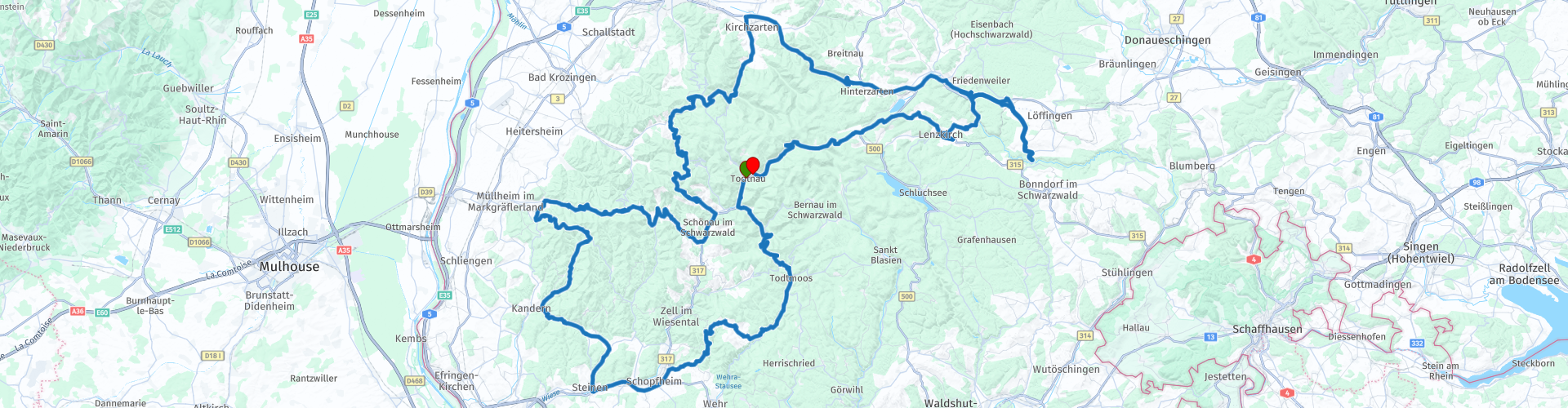
 Then this road winds at an altitude between 800 and 1,493 meters above sea level along the highest peaks of the Black Forest, including:
Hoghkopf (Rp 2) - 1263 m
Hohe Mohr (Rp 3) - 983 m
Hoghwildsberg (Rp 9) - 1084 m
Along the way we also pass the St. Trudpet Monastery. This is a former Benedictine monastery in the Münstertal in the southern Black Forest, Baden-Württemberg, Germany, now the main home of the sisters of St. Joseph of St. Trudpert and Lake Titisee.
The Titisee is a reservoir. This lake extends over an area of 1.3 km² and has an average depth of 20 meters. The lake was created by the Feldberg glacier. The outflow of the lake, at 840 meters above sea level, is the Wutach River.
From the Titisee we rise to the Feldberg (Rp 20). This is the highest point in the Black Forest. The mountain is 1493 meters high. In clear weather it is possible to see the Alps in the south from the Feldberg.
Afterwards we descend back to Todtnau to end up at the hotel again.


 Usage
Usage Want to download this route?
You can download the route for free without MyRoute-app account. To do so, open the route and click 'save as'. Want to edit this route?
No problem, start by opening the route. Follow the tutorial and create your personal MyRoute-app account. After registration, your trial starts automatically.  Disclaimer
Use of this GPS route is at your own expense and risk. The route has been carefully composed and checked by a MyRoute-app accredited RouteXpert for use on TomTom, Garmin and MyRoute-app Navigation.
Changes may nevertheless have occurred due to changed circumstances, road diversions or seasonal closures. We therefore recommend checking each route before use.
Preferably use the route track in your navigation system. More information about the use of MyRoute-app can be found on the website under 'Community' or 'Academy'.