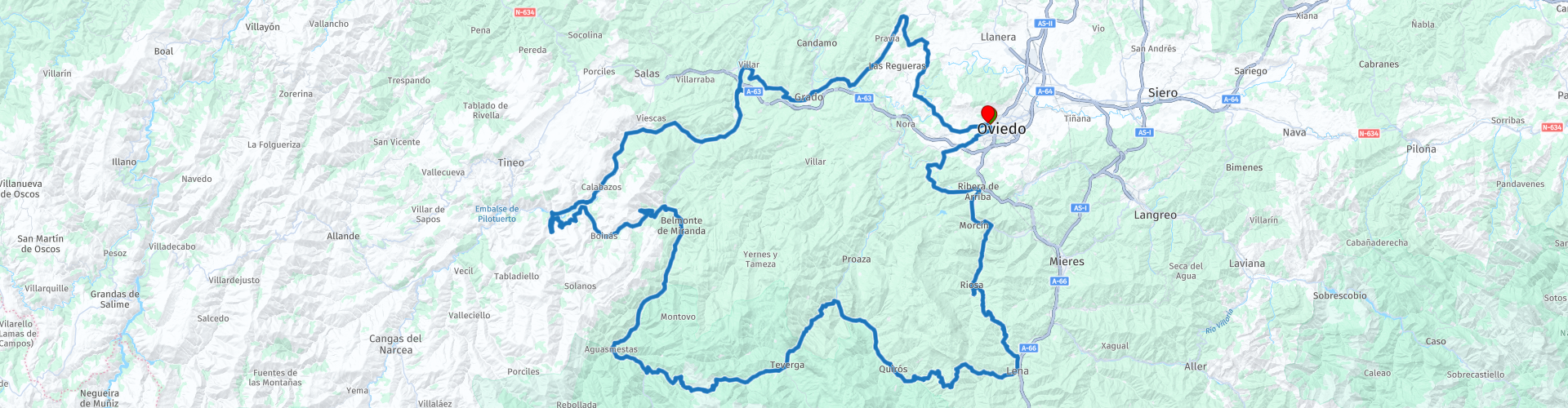
Round trip from Oviedo 1 Ubinas la Mesa Natural park

This route was brought to you by:
RouteXpert Nick Carthew - (MRA Master)
Last edit: 23-05-2022
 Route Summary
 A roundtour through the real countryside of Asturias. Some small rural roads that offer the best views. I awarded 4 stars **** for this route. The roads and scenery are very good and the attractions are good.
 Share this route


Animation

Verdict


Duration
7h 47m

Mode of travel
Car or motorcycle

Distance
224.31 km

Countries

 RouteXpert Review
 This route soon takes you into the countryside of the region of Asturias, some of the roads are small and very rural but they are all bitumen surfaced and by using these, you will see some of the real Asturian countryside with breathtaking scenery. A short but dramatically deep limestone gorge take you to La Foz and acts as a gateway to the mountains. The scenery becomes more beautiful as you approach Las Ubinas la Mesa Natural Park and start to climb higher. There are some good opportunities for photo's along most of this route but the most spectacular will be within the park.
I have suggested a lunch stop at San Martín, here you will find a good selection of restaurants.
After lunch, you'll climb the Puerto de San Lorenzo, the highest point of the route at 1347m the route. The pass links the villages of San Martín and La Riera. It is not especially long but is known among cyclists, the climb has been featured in the Spanish Vuelta race. The route continues to twist and turn passing through small villages, gorges and several strange looking wooden barns raised from the ground by pyramid shaped stone pillars. These are in fact grain stores known as hórreos, they are built this way to prevent vermin from entering the stores and eating the grain. They are quite common in the north of Spain and are seen in Portugal as well.
The Rio Narcea has been dammed to form the Barca Reservoir with the water being used for producing hydroelectricity. The route follows the Barca Reservoir and Rio Narcea for several kilometers as it meanders along the valley.
The medieval Bridge of Peñaflor is part of the Camino de Santiago trail and was the site of the Battle of Peñaflor in which soldiers and civilians, under the orders of Gregorio Jove-Valdés, fought against the advancing troops of Napoleon in 1808. A cafe on the other side is a great place to stop for a coffee.
A little challenging in places but the rewards of the scenery and twisty roads make it worth it.
Links for the hotel and the other 3 routes are below.
Enjoy


 Links
Links  Usage
Usage Want to download this route?
You can download the route for free without MyRoute-app account. To do so, open the route and click 'save as'. Want to edit this route?
No problem, start by opening the route. Follow the tutorial and create your personal MyRoute-app account. After registration, your trial starts automatically.  Disclaimer
Use of this GPS route is at your own expense and risk. The route has been carefully composed and checked by a MyRoute-app accredited RouteXpert for use on TomTom, Garmin and MyRoute-app Navigation.
Changes may nevertheless have occurred due to changed circumstances, road diversions or seasonal closures. We therefore recommend checking each route before use.
Preferably use the route track in your navigation system. More information about the use of MyRoute-app can be found on the website under 'Community' or 'Academy'.