De Nassfeldpass Italie Slovenie

This route was brought to you by:
RouteXpert Gerard Martens Route Expert
Last edit: 03-02-2019
 Route Summary
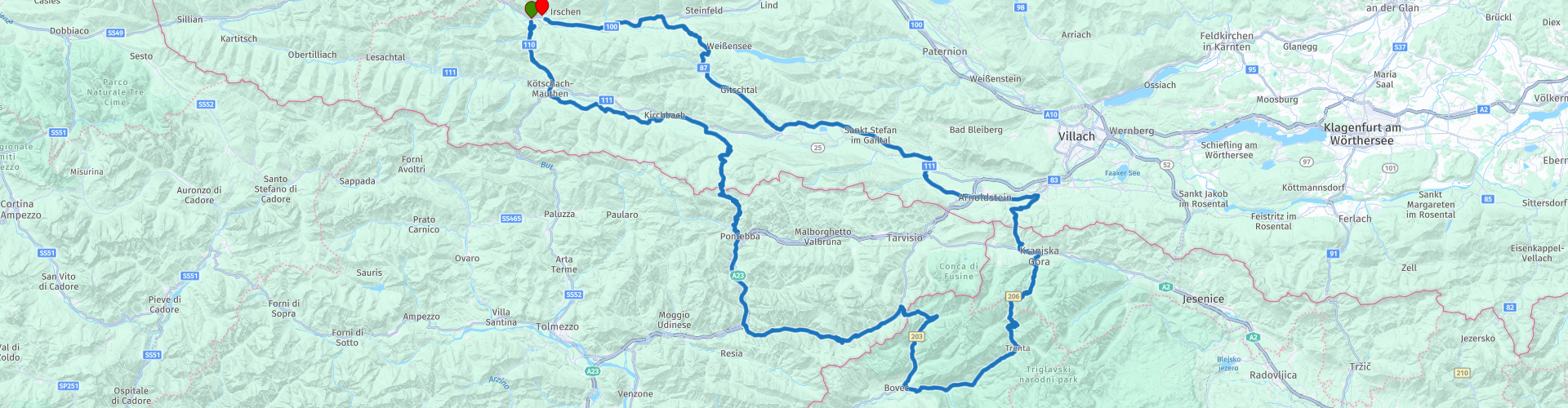
 You go over the Naßfeldpass through the Jullische Alpen and then drive back to Austria through the Triglavski Narodni Park.
 Share this route


Animation

Verdict


Duration
5h 33m

Mode of travel
Car or motorcycle

Distance
262.34 km

Countries


 RouteXpert Review
 In the Italian town of Pontebba we take a terrace, here you can order a real Italian cappuccino.
Then we drive another 45 km through the Julian Alps where we arrive at the border of Slovenia.
Here we drive through the Triglavski Narodni Park, The National Park Triglav is a national park in the Julian Alps. It is located in the Gorenjska region, in the northwestern border region of Slovenia. It is named after Mount Triglav which is also the national symbol.
At route point 10 we arrived at Hotel Alpine, which is a small hotel where you can have lunch.
At the end of the park you get a descent with 50 hairpin bends, then we drive back to where this route started.
I have given this route 4 stars because this route has everything that makes motorcycling fun hairpin bends mountain passes tunnels etc etc.
The photos are taken from a self-made video.


 Usage
Usage Want to download this route?
You can download the route for free without MyRoute-app account. To do so, open the route and click 'save as'. Want to edit this route?
No problem, start by opening the route. Follow the tutorial and create your personal MyRoute-app account. After registration, your trial starts automatically.  Disclaimer
Use of this GPS route is at your own expense and risk. The route has been carefully composed and checked by a MyRoute-app accredited RouteXpert for use on TomTom, Garmin and MyRoute-app Navigation.
Changes may nevertheless have occurred due to changed circumstances, road diversions or seasonal closures. We therefore recommend checking each route before use.
Preferably use the route track in your navigation system. More information about the use of MyRoute-app can be found on the website under 'Community' or 'Academy'.