Staller Sattel und Pragser Wildsee Rundtour

This route was brought to you by:
RouteXpert Chantal HV
Last edit: 12-04-2020
 Route Summary
 Almrausch and sky blue
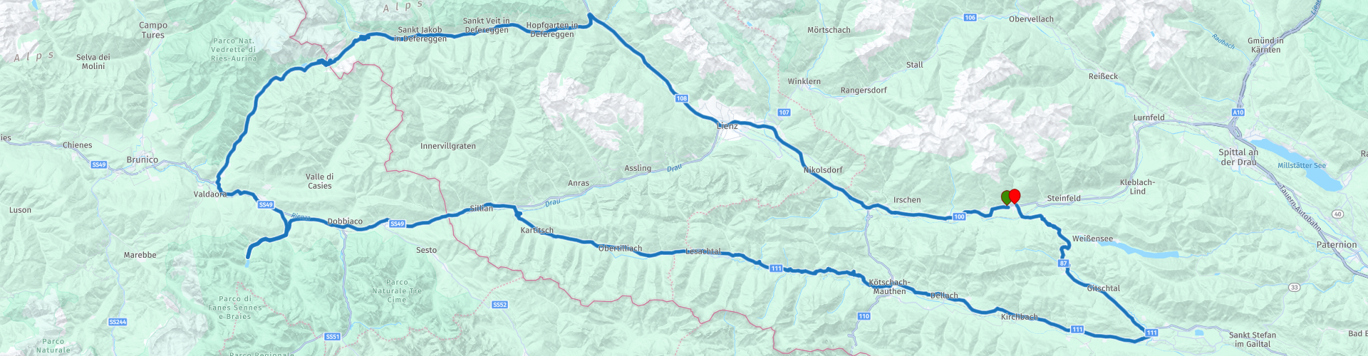
290 km around the Lienz Dolomites - cruising is announced - past untouched valleys, crystal clear waters and white peaks.
Drautal - Lienz - Huben - St. Jakob in the Defreggental - Staller saddle - upper grass - Niederdorf - Braies Lake - San Candido - Sillian - Roads - Kartitsch - Maria Luggau - Kötschach - Mauthen - Hermagor - Kreuzberg Pass
 Share this route


Animation

Verdict


Duration
5h 5m

Mode of travel
Car or motorcycle

Distance
274.44 km

Countries


 RouteXpert Review
 Beautiful wide winding roads, at the Staller saddle pass, narrower, but regulated by traffic lights with one-way traffic, so no problem. That's why I give this route 5 stars. This route falls under the category "medium" (Austria uses "easy, medium and heavy"). Sufficient stops on the way with a nice view or to eat or drink.
Starting point of the tour is the Upper Drautal. Along the B 100 we drive towards East Tyrol to Lienz. A beautiful, southern flair mediating city in the middle of the Lienz Dolomites.
Worth seeing is the Bruck Castle and the Egger Lienz Museum. In Lienz there are also cheap tank options. Continue to Matrei. After approx. 20 km in Huben turn left to St. Jakob in the Defreggental to the Staller Sattel (2052 m). Attention: Traffic light control on the Staller saddle! The journey to Italy is possible from 0 to 15 minutes and from Italy to Austria from the 30th to 45th minute of every hour.
** The Staller Sattel is a 2052 meter high mountain pass on the border between Austria and Italy. The pass connects St. Jakob in East Tyrol's Defereggental with Olang in the South Tyrolean Antholz Valley.
Continue into the Antholzertal, down to the Olang in South Tyrol. Turn left onto the E 66 towards Innichen. Halfway up, in a south-facing side valley, the Braies Lake at 1494 m altitude, in the middle of the imposing massif of Seekofel 2810 m. The route continues in the direction of San Candido and Sillian to Strassen, where you turn right towards Kartitsch to the Carnic Dolomites Road in the Lesachtal. Past Maria Luggau to Kötschach-Mauthen and through the Upper Gailtal to Hermagor. Turn left and cross the Kreuzbergpass (1077 m) to reach the Weissensee lake or back to the Upper Drautal valley.
Between RP 13 and 14 the Garmin and the TT do not match now, here skipping RP is used. Whether you go via Sterzen or via Gailtal Bundesstrasse does not matter
The tour is located in the following protected areas: Nature Park Rieserferner-Ahrn, Fauna-Flora-Habitat-area Möserner Moor, Fauna-Flora-Habitat-Area Upper Drau, bird sanctuary Upper Drau


 Links
Links  Usage
Usage Want to download this route?
You can download the route for free without MyRoute-app account. To do so, open the route and click 'save as'. Want to edit this route?
No problem, start by opening the route. Follow the tutorial and create your personal MyRoute-app account. After registration, your trial starts automatically.  Disclaimer
Use of this GPS route is at your own expense and risk. The route has been carefully composed and checked by a MyRoute-app accredited RouteXpert for use on TomTom, Garmin and MyRoute-app Navigation.
Changes may nevertheless have occurred due to changed circumstances, road diversions or seasonal closures. We therefore recommend checking each route before use.
Preferably use the route track in your navigation system. More information about the use of MyRoute-app can be found on the website under 'Community' or 'Academy'.