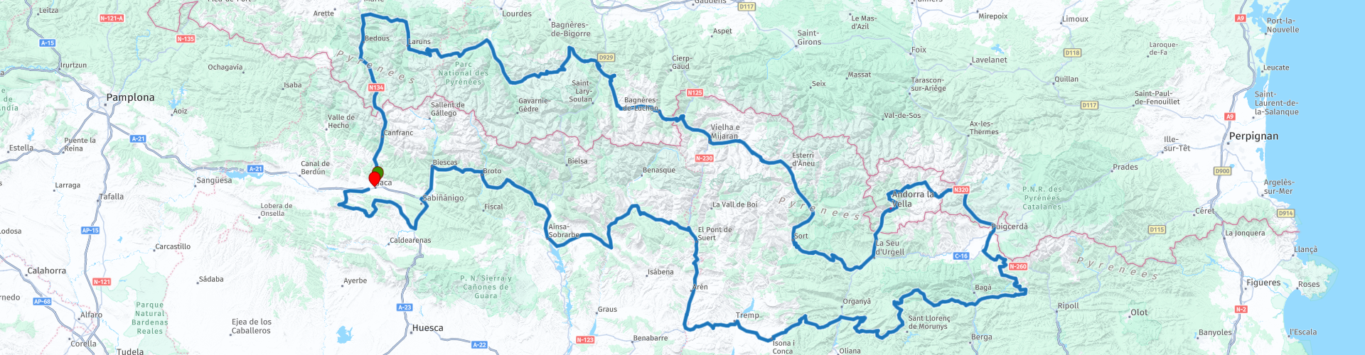
Highlights of the Pyrenees

This route was brought to you by:
RouteXpert Michel van Hagen (MRA-Founder)
Last edit: 01-06-2021
 Route Summary
  Share this route


Animation

Verdict


Duration
21h 40m

Mode of travel
Car or motorcycle

Distance
1,086.90 km

Countries


 RouteXpert Review
 Let's just count, as many as 28 steps are in this route. I would therefore not advise to drive this route in one day. No, it is not meant to be, this route is meant to serve as a basis for a multi-day ride in the Pyrenees. You can enjoy yourself for a week, at least 5 days, otherwise you will miss out too much. I would split this route into, for example, 5 daily stages, which can be very simple in MyRoute-app, the link to the instructions at the bottom of this page. You can then end each day stage at an overnight location, which you can also find in MyRoute-app, see the instruction of which the link is also at the bottom of this page. Finally, I would adjust the route to your liking every day, maybe adding sights that you find important, nice villages, beautiful castles or whatever. You already understand, you can also use MyRoute-app and of course the instructions as a link are added to this review. All that remains to me is to wish you a lot of fun planning your trip and driving this beautiful route.
Below an overview of the passes in this route:
RP 3: Puerto de Somport (1640 m)
RP 9: Col de Marie Blanque (1035 m)
RP 13: Col d'Aubisque (1709 m)
RP 14: Col de Soulor (1474 m)
RP 22: Col du Tourmalet (2115 m)
RP 24: Col d'Aspin (1490 m)
RP 30: Col de Peyresourde (1563 m)
RP 32: Coll del Portillon (1320 m)
RP 36: Port de la Bonaigua (2072 m)
RP 41: Coll del Canto (1725 m)
RP 54: Port d'Envalira (2408 m)
RP 56: Col de Puymorens (1915 m)
RP 60: Collada de Tosses (1800 m)
RP 63: Coll de la Merolla (1090 m)
RP 66: Coll de Josa (1620 m)
RP 68: Coll de Port (1669 m)
RP 69: Coll de Jou (1480 m)
RP 73: Coll de Nargo (753 m)
RP 74: Coll de Boixols (1380 m)
RP 75: Coll de Faidella (1235 m)
RP 81: Coll de Montllobar (1080 m)
RP 86: Coll de Espina (1407 m)
RP 87: Coll de Fadas (1471 m)
RP 90: Collado de Foradada (1020 m)
RP 96: Puerto de Fanlo (1383 m)
RP 98: Puerto de Cotefablo (1423 m)
RP 102: Puerto de Navasa (1068 m)
RP 105: Puerto de Oroel (1075 m)


 Links
Links  Usage
Usage Want to download this route?
You can download the route for free without MyRoute-app account. To do so, open the route and click 'save as'. Want to edit this route?
No problem, start by opening the route. Follow the tutorial and create your personal MyRoute-app account. After registration, your trial starts automatically.  Disclaimer
Use of this GPS route is at your own expense and risk. The route has been carefully composed and checked by a MyRoute-app accredited RouteXpert for use on TomTom, Garmin and MyRoute-app Navigation.
Changes may nevertheless have occurred due to changed circumstances, road diversions or seasonal closures. We therefore recommend checking each route before use.
Preferably use the route track in your navigation system. More information about the use of MyRoute-app can be found on the website under 'Community' or 'Academy'.