03 TAS Long Point Seymour to Port Arthur

This route was brought to you by:
RouteXpert Hans van de Ven (Mr.MRA)
Last edit: 28-09-2022
 Route Summary
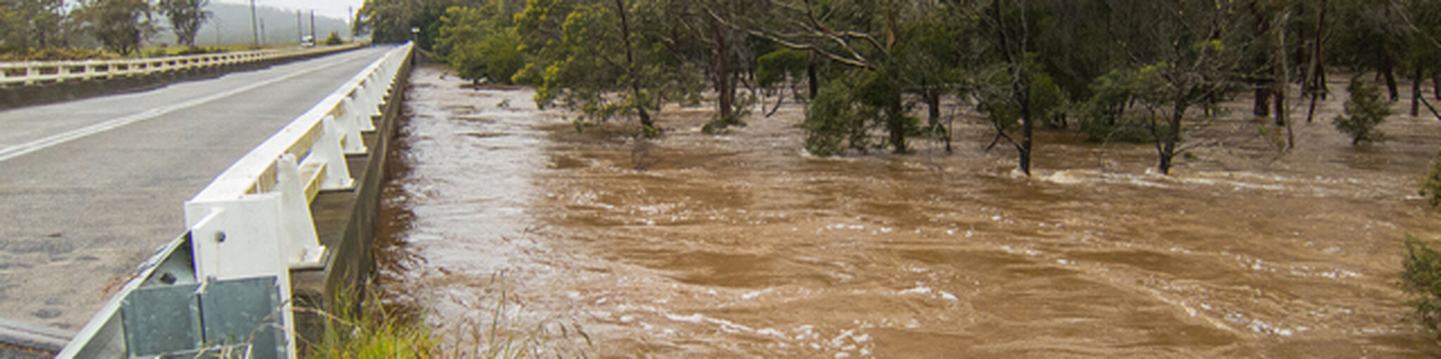
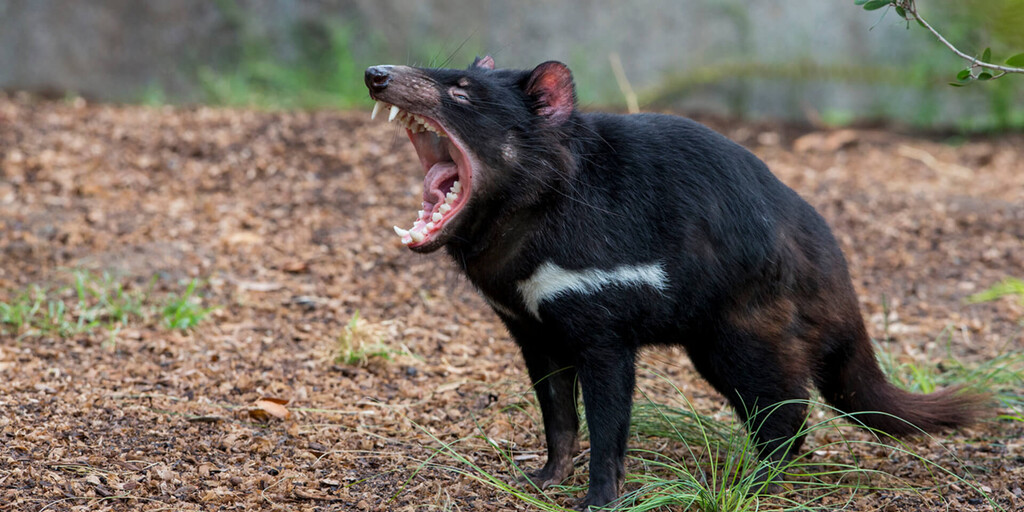
 Tasmania is known for its many national parks, green rugged landscapes and the Tasmanian Devil. Only a few living specimens of the Tasmanian Devil are known to exist. Much of the island is unspoilt and designated as a national or wildlife park. In addition, one can find many waterfalls in Tasmania. Tasmania's coastline is mountainous with a number of white sand beaches. In the waters around Tasmania one can ideally dive and snorkel to the colorful underwater life. Tasmania, has a diversity of flora and fauna; the most diverse types of plants, trees and animals, especially birds and many typical Australian marsupials, not found anywhere else in the world!
You're going to see and experience it all in this 5 star rated great tour of Tasmania, a tour that also visits the capital Hobart is one to remember!
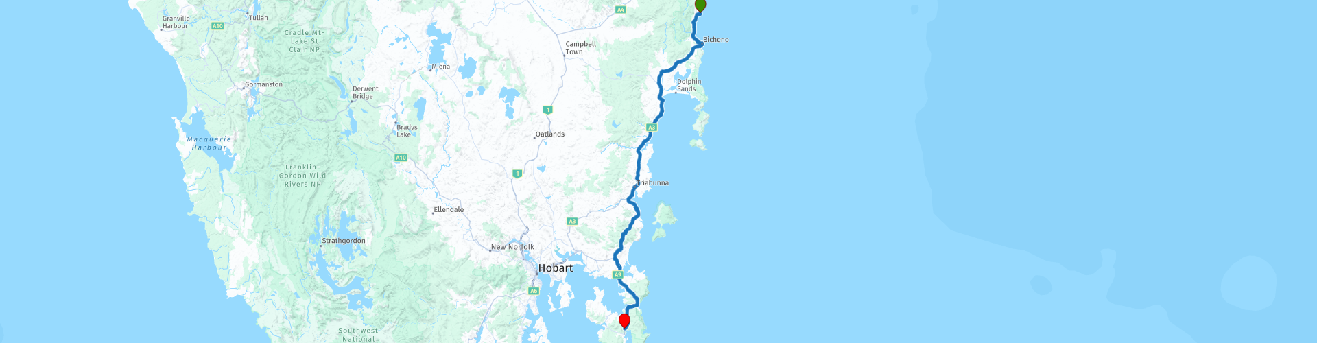
Starting point: Long Point Seymor, Coopers Ocean Cabin.
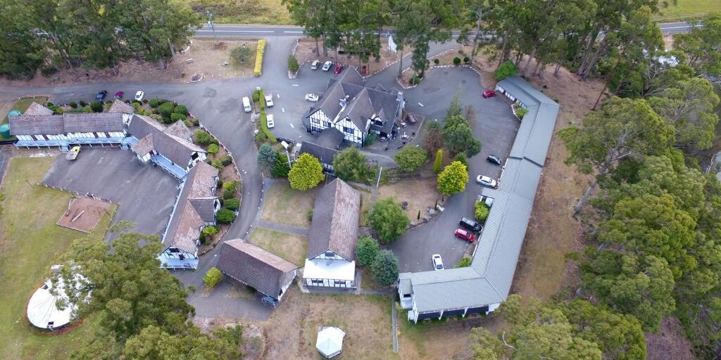
End point: Oakwood, Fox & Hounds Inn
ATTENTION: DRIVE LEFT!
 Share this route


Animation

Verdict


Duration
7h 57m

Mode of travel
Car or motorcycle

Distance
207.40 km

Countries

 RouteXpert Review
 After about 20 minutes after you leave, you will arrive in the town of Bicheno, here you can visit, among other things: Bicheno's Glass Bottom Boat, a boat with a glass bottom so you can view the underwater life. You can also walk to the Whalers Lookout and enjoy the view. But be sure to stop at the Bicheno Blowhole, please note, there is no fence to keep visitors away from the edge of the hole. If you don't want to get wet, don't get too close! It is advisable not to let young children get too close and to be careful on the rocks when it is slippery.
After these views it's time to move on, via the Tasman Highway you come to The Pondering Frog, be sure to stop for coffee or ice cream or something to eat. After this stop, enjoy the view at the Mayfield Bay lookout point.
Once you have arrived in Orford, you can decide during the stop whether you want to continue your journey on a gravel road or if you prefer to drive on the Tassman and Arthur Highway to Copping, both are beautiful, the route made is a bit more adventurous. If you decide not to drive a gravel road, skip waypoints 10 and 11, and let your navigation system navigate you to Copping (waypoint 12).
Once in Dunalley, cross the Denison Canal. The canal was inaugurated in 1905 and takes its name from former Governor William Denison. The canal was built to shorten the fishing and trade routes between the east coast and Hobart. Then successively a few view points where taking a picture is definitely recommended.
I would definitely visit the Tasmanian Devil Unzoo, there you get a nice impression of the wildlife on Tasmania and you come face to face with the Tasmanian Devil!
On the way to the end point, you can still enjoy the view at Long Bay. Once you have arrived at the Fox & Hounds Inn, you can review the beautiful moments of the day while enjoying a drink.
Information Tasmania:
Tasmania was connected to the Australian mainland for most of the past 100,000 years. As a result, it probably became populated fairly quickly after the arrival of the first explorers in Australia. The first Australians may have arrived on the continent as early as 60,000 years ago. Tasmanians looked like dark Africans. They were quite large: the men averaged 1.63 to 1.70 meters, but some were up to 2 meters tall. The oldest archaeological sites on the island are Warreen Cave, estimated to be 34,790 years old, and Parmerpar Meethaneer Cave, which is between 44,200 and 34,000 years old. The stone tools of the Tasmanians were quite primitive compared to those of other modern humans. The island again became separated from the mainland about 8,000 years ago. This subsequently underwent considerable development, while in Tasmania some techniques, such as those of handles with handles, were even lost. The Tasmanians lived as hunters and gatherers. They were, by estimate, between 3,000 and 10,000 people. There were different tribes who regularly fought among themselves. Like people elsewhere, the Tasmanians made art, including rock art.
The governor of the Dutch East Indies, Antonie van Diemen, ordered Abel Tasman to embark on a voyage of discovery to mainland Australia. On his journey, Tasman discovered the island later named after him on November 24, 1642. He named it after his client: Van Diemensland. At the end of the 18th century, the English colonized the island and housed English and Irish deportees there. After these deportations from England were stopped, the Vandiemenslanders changed the name of the island to 'Tasmania' on January 1, 1856, after its Dutch discoverer. The capital Hobart is, after Sydney, the oldest city in Australia. In 1803 the English governor, John Bowen, proclaimed martial law. The original Tasmanians (Aboriginal people) were almost completely wiped out until 1830. There are no direct descendants of Tasmanians anymore, only people who are descended from female Tasmanians and Europeans. The last full-blooded Tasmanian, Trucanini, died in May 1876. Although the island is the smallest state, there are about 500 self-contained protected areas, covering 40% of Tasmania's land area. For example, the Styx Valley is threatened by logging companies and many other nature reserves that are not protected are also threatened with total destruction. Nevertheless, the Tasmanian wilderness is on the World Heritage List in terms of nature and culture.
Tasmania has two species of predatory marsupials. The island is the only place where the Tasmanian devil still roams, a 60 cm long, carnivorous and black and white colored marsupial, known for its great gluttony and ferocity. Since the late 20th century, the number of Tasmanian devils has been declining rapidly. This is the result of, among other things, a tumor disease. Another marsupial predator mainly found in Tasmania is the spotted marten, a marsupial marten averaging 35 cm in length with a white-spotted, light brown color. Until the early 1930s, Tasmania was also the only area where the possum (or Tasmanian tiger) remained, but the last specimen of this marsupial predator died in 1936 at Hobart Zoo. Tasmania is home to a number of other animals that are not found anywhere else (anymore). The Pseudomys higginsi is an approximately 13 cm large rodent, which mainly lives in the higher forests. The red-bellied pademelon is a brownish kangaroo about 60 cm high that only jumps in Tasmania. The Tasmanian brush-tailed kangaroo rat is a 30 cm long, brown-grey kangaroo rat that only has Tasmania as its habitat and moves at night and on the ground.
The Tasmanians were the indigenous people of the Australian state of Tasmania. Today, however, they are considered extinct as there are no more Thoroughbred Tasmanians. The people disappeared (through murder and European diseases) in the years after the European colonization of Tasmania. The last full-blooded Tasmanian, a woman named Truganini, died in 1876.
The descendants of the Tasmanians still live in Tasmania, but much of their original culture and language has been lost. Since the 1970s, however, attempts have been made to revive this culture.
 Links
Links  Usage
Usage Want to download this route?
You can download the route for free without MyRoute-app account. To do so, open the route and click 'save as'. Want to edit this route?
No problem, start by opening the route. Follow the tutorial and create your personal MyRoute-app account. After registration, your trial starts automatically.  Disclaimer
Use of this GPS route is at your own expense and risk. The route has been carefully composed and checked by a MyRoute-app accredited RouteXpert for use on TomTom, Garmin and MyRoute-app Navigation.
Changes may nevertheless have occurred due to changed circumstances, road diversions or seasonal closures. We therefore recommend checking each route before use.
Preferably use the route track in your navigation system. More information about the use of MyRoute-app can be found on the website under 'Community' or 'Academy'.