Rondrit Vulkaaneifel vanuit Daun

This route was brought to you by:
RouteXpert Hans van de Ven (Mr.MRA)
Last edit: 30-10-2021
 Route Summary
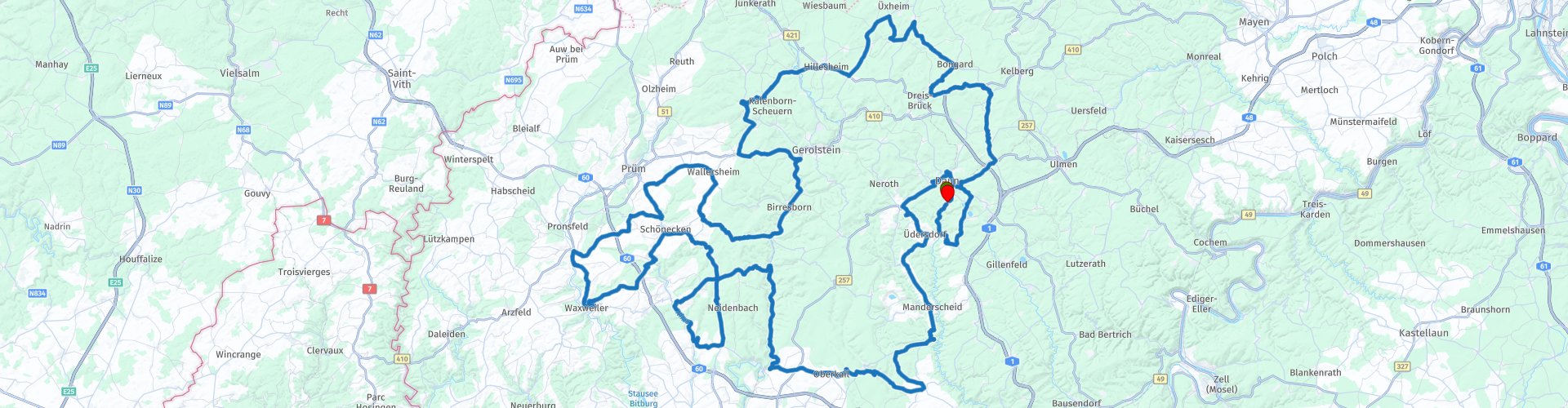
 Start and end point: Eifel Hotel Daun.
The route has been made the same for TomTom, Garmin and MyRoute-app Navigation users.
 Share this route


Animation

Verdict


Duration
6h 7m

Mode of travel
Car or motorcycle

Distance
244.56 km

Countries

 RouteXpert Review
 As indicated in the title, this route will start and end in Daun, at Eifel Hotel Daun.
This was the 2nd 3-day trip with my wife since she got her driver's license (2012).
Very nice route to drive through beautiful winding roads, interspersed with the occasional hairpin bend through the Vulkaan-Eifel. This route is also good for the novice motorcyclist to ride. There are plenty of opportunities to stop on the way.
Because I drove this route myself, I rate it with 5 stars.
Info Vulkaneifel:
The Volcanic Eifel is part of the Rhenish Slate Plateau, a low mountain range that also includes the Ardennes, Sauerland, Hunsrück and Taunus. It gets its name from the volcanic activity that shaped the landscape. Even today, clear traces can be seen in the form of craters, natural gases, lava formations and maars, lakes in craters formed by explosive volcanism.
From the Tertiary on there was a lot of volcanic activity. The last eruptions date back to only about 10,000 years ago. The volcanoes in the Eifel have formed above a hotspot, which is still active: the surface continues to rise by 1 to 2 mm every year. Between the eruptions there was in the past 10,000 to 20,000 years of relative calm, which leaves room for the suggestion that the Volcano-Eifel could become active again in the future.
Furthermore, there are many special buildings from the Celtic, Roman, medieval and later periods in the Volcano-Eifel.
A cold water geyser with the name Wallende Born can be found in the town of Wallenborn.
The location of the Vulkaneifel is roughly the same as the volcanic belt of the West Eifel. Scientists have identified about 350 eruption centers on a strip of about 30 km wide and 50 km long. In the landscape image, volcanic landforms such as maars or cone-shaped hills stand out. (Source: Wikipedia)


 Links
Links  Usage
Usage Want to download this route?
You can download the route for free without MyRoute-app account. To do so, open the route and click 'save as'. Want to edit this route?
No problem, start by opening the route. Follow the tutorial and create your personal MyRoute-app account. After registration, your trial starts automatically.  Disclaimer
Use of this GPS route is at your own expense and risk. The route has been carefully composed and checked by a MyRoute-app accredited RouteXpert for use on TomTom, Garmin and MyRoute-app Navigation.
Changes may nevertheless have occurred due to changed circumstances, road diversions or seasonal closures. We therefore recommend checking each route before use.
Preferably use the route track in your navigation system. More information about the use of MyRoute-app can be found on the website under 'Community' or 'Academy'.