Rondreis door de Vulkaaneifel via de Moezel en Trier

This route was brought to you by:
RouteXpert Stijn Claus
Last edit: 03-03-2019
 Route Summary
 The roads vary from secondary to narrow roads. Most roads are of good quality.
The versatility of this route, the changing landscapes, the easily accessible and winding roads make this route a high fun factor.
 Share this route


Animation

Verdict


Duration
4h 39m

Mode of travel
Car or motorcycle

Distance
260.64 km

Countries

 RouteXpert Review
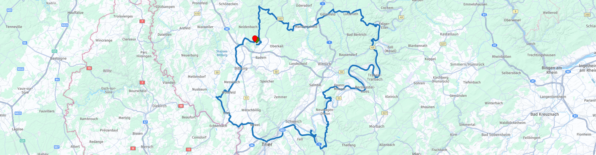
 From Malberg we cross the Volcanic Eifel to the east. Along the way we pass the Meerfelder, but the niederburcht of Manderscheid and the Pulvermaar to then descend to the banks of the Moselle via a hairpin combination.
Afterwards the route follows the meanders of the Mosel. On the banks of the Moselle we find cities such as Bernkastel Kues and Piesport. With countless hairpin bends we rise and descend along the Eifel plateau with beautiful views over the meanders of the Moselle and the vineyards.
The Moselle brings us to Trier. Trier is the oldest city in Germany and with remnants from Roman times and the Middle Ages we can sniff up the necessary culture. Places of interest in Trier are The Grand Place, Basilica of Constantine, St. Peters Cathedral, Our Lady's Church; Abbey of St. Matthias, Amphitheater Trier, Porta Nigra.
The route goes back from Trier to the south. On the way we pass the De Irreler Waterfall and the historic city of Bitburg to arrive again in Malberg.


 Links
Links  Usage
Usage Want to download this route?
You can download the route for free without MyRoute-app account. To do so, open the route and click 'save as'. Want to edit this route?
No problem, start by opening the route. Follow the tutorial and create your personal MyRoute-app account. After registration, your trial starts automatically.  Disclaimer
Use of this GPS route is at your own expense and risk. The route has been carefully composed and checked by a MyRoute-app accredited RouteXpert for use on TomTom, Garmin and MyRoute-app Navigation.
Changes may nevertheless have occurred due to changed circumstances, road diversions or seasonal closures. We therefore recommend checking each route before use.
Preferably use the route track in your navigation system. More information about the use of MyRoute-app can be found on the website under 'Community' or 'Academy'.