42 Maas Schwalm Nette route

This route was brought to you by:
RouteXpert Hans van de Ven (Mr.MRA)
Last edit: 28-08-2025
 Route Summary
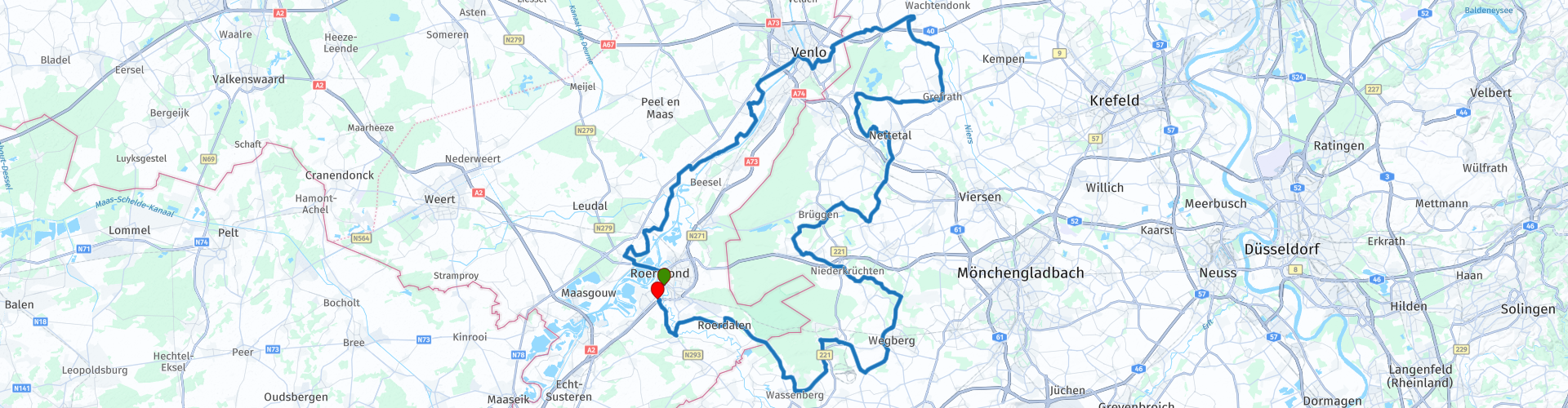
 Start and end point: Shell, Roermond
This 3-star route combines the Meuse Valley with the German border region, taking you past rivers, forests, lakes, and charming villages. The roads are varied and easy to drive, with quiet stretches to enjoy and twists and turns for pure enjoyment. The sights—from the Maasplassen and Krickenbecker Seen to De Meinweg National Park—give the ride an international allure.
As the name suggests, a tour through the Limburg countryside, along the Meuse.
This is the 42nd in a series of 43 Endangered ANWB routes. These were published in Promotors between April 2015 and September 2016.
 Share this route


Animation

Verdict


Duration
5h 10m

Mode of travel
Car or motorcycle

Distance
153.21 km

Countries


 RouteXpert Review
 You start in Roermond at the Shell gas station and follow the Meuse downstream past Horn and Buggenum. Dike roads and rural vistas alternate as you head towards Kessel and Baarlo. In Venlo, you'll experience the Meuse at its widest, with views of the city and its boulevard. After Venlo, you'll continue to Straelen and Wachtendonk in Germany, where a stop at Der Bäcker aus Lüllingen invites you for fresh rolls and coffee. Via Grefrath, you'll continue to the Krickenbecker Seen, a protected nature reserve with tranquil lakes and a rich bird life. The route then winds through Schwalmtal and Wegberg, where you'll stop at Restaurant & Bauerncafé Jakobs-Hof, a cozy farmhouse café housed in a former stable. Then, you'll cycle via Wassenberg and Niederkrüchten towards De Meinweg National Park. Here, forests, heathlands, and stream valleys create a unique landscape. Finally, you'll reach the Roer Valley, where the Roer River meanders through a verdant valley. Via Sint Odiliënberg and Melick, you'll return to Roermond, where you'll end the route at the Shell gas station.
The Maas Schwalm Nette route is a varied day trip: water, nature, and culture blend seamlessly here. The Meuse River forms the common thread, but the German border regions add an extra dimension. Perfect for a relaxing day of riding, with plenty of opportunities for coffee, lunch, and scenic stops.
Suggested breaks, information, fuel and viewpoints included in the route
• TSP – Tour Start Point: Shell, Roermond - Modern gas station with shop and coffee, open daily from 6:00 AM to 11:00 PM.
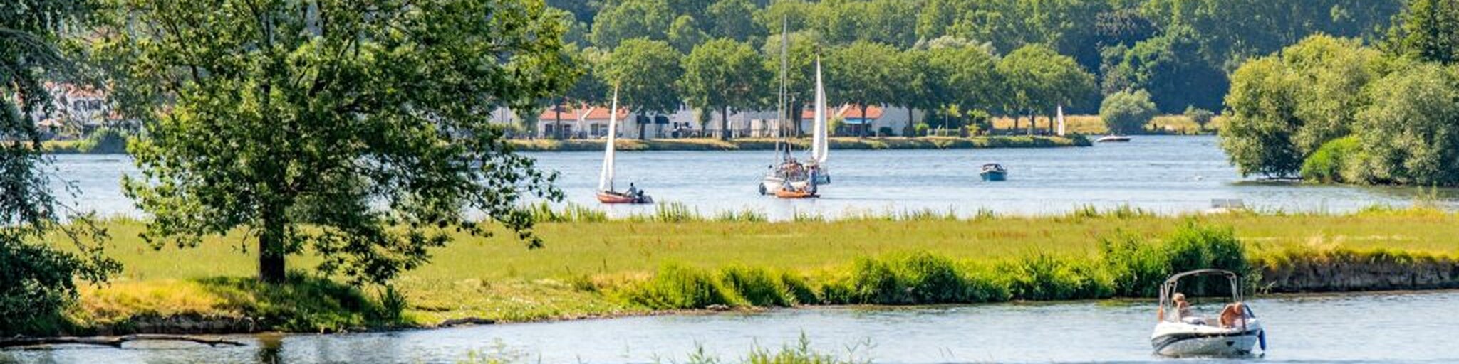
• TIP – Tour Info Point; The Maas (Roermond) - Wide river at the Maasplassen, popular for walking, cycling and water sports.
• TIP – Tour Info Point; The Maas (Venlo) - View of the river, boulevard and Maas bridge in Venlo, ideal for a short stop.
• TPP – Tour Pauze Punt; Der Bäcker aus Lüllingen - Bakery and café in Straelen, open early every day, also on Sunday mornings.
• TIP – Tour Info Point; Krickenbecker Seen - Nature reserve with four large lakes, historical relics and visitor centre.
• TPP – Tour Pauze Punt; Restaurant & Bauerncafé Jakobs-Hof - Farmhouse café with winter garden and large terrace, known for breakfast, lunch and home-made cakes.
• TIP – Tour Info Point; De Meinweg - National park with forests, heathland and stream valleys, freely accessible with various walking routes.
• TIP – Tour Info Point; The Roerdal - Green river valley near Sint Odiliënberg, picturesque and rich in nature.
• TEP – Tour End Point; Shell, Roermond - Convenient ending point with fuel, shop and coffee.


 Links
Links  Usage
Usage Want to download this route?
You can download the route for free without MyRoute-app account. To do so, open the route and click 'save as'. Want to edit this route?
No problem, start by opening the route. Follow the tutorial and create your personal MyRoute-app account. After registration, your trial starts automatically.  Disclaimer
Use of this GPS route is at your own expense and risk. The route has been carefully composed and checked by a MyRoute-app accredited RouteXpert for use on TomTom, Garmin and MyRoute-app Navigation.
Changes may nevertheless have occurred due to changed circumstances, road diversions or seasonal closures. We therefore recommend checking each route before use.
Preferably use the route track in your navigation system. More information about the use of MyRoute-app can be found on the website under 'Community' or 'Academy'.