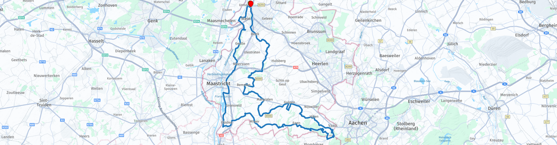
Dutch South Limburg Urmond Eijsden Vaals meandering

This route was brought to you by:
RouteXpert Dick Schaap
Last edit: 13-08-2021
 Route Summary
 Ascending, descending and meandering (hairpin bends) on well-paved road surfaces. Through Limburg nature with magnificent views. Along the way you will pass various old castles and homesteads.
Appreciation
A route that is unique by Dutch standards, hence the 5-star rating.
 Share this route


Animation

Verdict


Duration
4h 26m

Mode of travel
Car or motorcycle

Distance
130.86 km

Countries


 RouteXpert Review
 The South Limburgrit continues through and along the extreme south of this beautiful province. Meandering, ascending, descending and agility on narrow roads (so-called hollow roads). A unique part of the Netherlands.
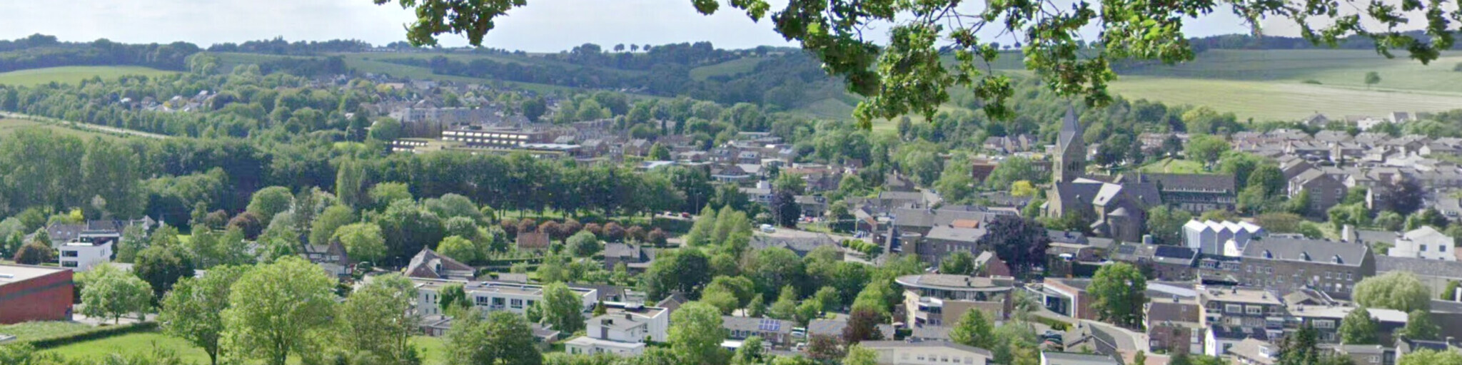
Start and end of this ride is at Hotel vd Valk in Stein-Urmond (L). Descend along the Maas and Juliana Canal towards Maastricht (a short stretch of A2) to Eijsden. There, take a look at the “Kasteel Eijsden”, after which the most beautiful parts of the Mergelland route are followed towards Vaals. Lunch is at the end of the infamous Epenerbaan (note: hairpin bends), in the Lodge 7 restaurant. There you can enjoy a beautiful view over the orchards towards Vaals and the Drielandenpunt. After lunch via an old (smuggling) route to Belgium to approach from there and the Drielandenpunt. On the Dutch side down again, past Vaalsbroek castle, towards Vijlen and over the Panoramaweg in Gulpen. The Panoramaweg has a unique view of Gulpen and the surrounding area for the Netherlands. Then towards Margraten, Cadier en Keer, Berg en Terblijt, Schimmert towards the end point, vd Valk in Stein-Urmond.
Castle Eijsden Vp13
Castle Eijsden is a castle and national monument in the Dutch Limburg municipality of Eijsden-Margraten. The castle is located on the river Maas near the place where the river Voer flows into it. On the east side of the castle is a stately driveway with a Lady Chapel with a murder cross at the other end. The castle was built in 1636, rebuilt in 1767 and restored historically in 1881-1886.
Castle Mheer Vp19
The current castle is located between the old roads from 's-Gravenisjes to Gulpen (via Libeek and Terlinden respectively) and probably originated during the reclamation of the Plateau of Margraten in the 11th-13th century. The oldest building parts (the foundation of the round tower) may date from that period. The first part of the castle house was built after the Battle of Woeringen (1288), when the Duke of Brabant assumed the lordship of the County of Dalhem and the Duchy of Limburg.
Tourist road / Epenerbaan Vp26
The Epenerbaan (connects to the Toeristenweg Vp26) was voted the most beautiful road in the Netherlands in 2015. The Epenerbaan has more alternative names than any other climb. He is also known as Holsetterbos or Eschberg, among others. This is the climb to get from Vaals to Epen. The climb starts fairly mild, but gets steeper (up to 11%). The hairpin bend gives the climb a lot of extra feeling. After the hairpin turn, don't forget to look to the right. You have a beautiful view of the surroundings around restaurant 'Lodge 7'. We drive the Epenerbaan opposite, so from Epen to Vaals.
Three-country point Vp 31
The Three-Country Point near Vaals is a three-country point where the borders between the Netherlands, Belgium and Germany converge. The point is located near the top of the Vaalserberg on the border of the municipalities of Vaals (Dutch Limburg), Blieberg and Kelmis (both in the Belgian province of Liège) and Aachen (in the German state of North Rhine-Westphalia).
From 1815, five different national borders ran at the current Drielandenpunt at Vaals. Yet never more than four boundaries converged at this point at the same time. From 1839 to 1919, the three-country point was a four-country point. The Netherlands, Belgium and Prussia (later Germany) bordered here at the mini-state Neutral Moresnet. After the First World War, various border corrections took place between Belgium and Germany and Neutral Moresnet was added to Belgium. Since then, the four-country point at Vaals has become a three-country point.
Vaalsbroek Castle Vp35
Vaalsbroek Castle is located on the provincial road Vaals-Maastricht in the vicinity of the hamlet of Raren. The oldest mention of the castle dates back to 1420, when it was the seat of the lords of Vaelsbroich. The name was derived from the words Vallis (valley) and Broich or Broek (swamp). In this early period, many Limburg family names were associated with the castle.
The last private owner, the von Massenbach-von der Molen family, remained the owner until 1944 when the goods were confiscated as enemy property and sold by the Nederlandsch Beheersinstituut.
In 1946, the Beambtenfonds Foundation of the NV Staatsmijnen in Limburg became the new owner, followed in 1974 by the Fund for Social Institutions (FSI) in Heerlen. After this, the castle and appurtenances were radically restored.
Today, the castle and estate are part of the Bilderberg hotel chain. The building and some aspects of the site are each national monument.
Start and end of the route:
Hotel Van Der Valk
Mauritslaan 82
6129 PA Urmond
Lunch:
Lodge 7
Epenerbaan 1
6291 NN Vaals


 Links
Links  Usage
Usage Want to download this route?
You can download the route for free without MyRoute-app account. To do so, open the route and click 'save as'. Want to edit this route?
No problem, start by opening the route. Follow the tutorial and create your personal MyRoute-app account. After registration, your trial starts automatically.  Disclaimer
Use of this GPS route is at your own expense and risk. The route has been carefully composed and checked by a MyRoute-app accredited RouteXpert for use on TomTom, Garmin and MyRoute-app Navigation.
Changes may nevertheless have occurred due to changed circumstances, road diversions or seasonal closures. We therefore recommend checking each route before use.
Preferably use the route track in your navigation system. More information about the use of MyRoute-app can be found on the website under 'Community' or 'Academy'.