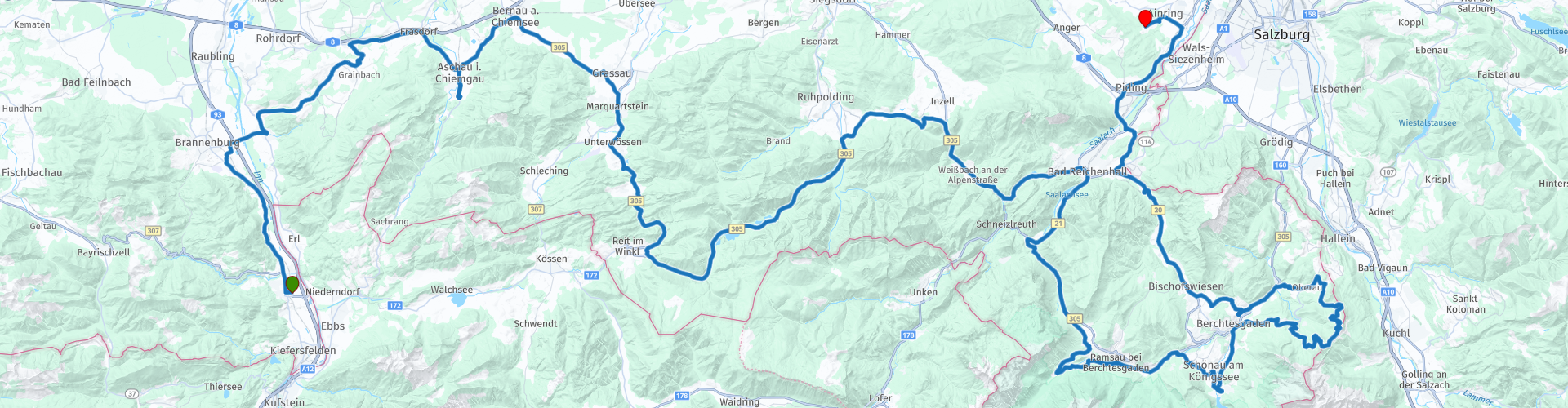
Oberaudorf to Ainring

This route was brought to you by:
RouteXpert Marcel Scherpenkate
Last edit: 13-04-2021
 Route Summary
 The route has been equalized for TomTom, Garmin and MyRoute-app Navigation users.
I rate this route with the maximum number of 5 stars, I have been allowed to drive this route myself and it is a succession of diversity of landscape via beautiful roads connected by equally authentic villages and panoramic views. Wonderful to drive through.
 Share this route


Animation

Verdict


Duration
6h 32m

Mode of travel
Car or motorcycle

Distance
208.37 km

Countries


 RouteXpert Review
 A tributary of the Danube and one of the main drainage routes of the Alps, the Inn is 517 km long and flows through three countries: Switzerland, Austria and Germany. Before it finally reaches the Black Sea, it flows through nine countries. No other river flows through so many European countries.
You cross the Autobahn and the Inn and drive through beautiful foothills of the Alps in the direction of Aschau am Chiemsee with a panoramic view of the Kampenwand from 1668 meters high.
The Kampenwand near Aschau is one of the best known and at the same time most popular peaks in the Chiemgau Alps and, with its jagged ridge, a landmark of the region.
The whimsical nut is reminiscent of a rooster's head. The summit cross (also called Chiemgaukreuz) on the east summit is the highest mountain cross in the Bavarian Alps with a height of 12 meters.
If you would like to admire this beautiful area from above, there is a cable car, the Kampenwandbahn, here you will be taken from 626 m to 1467 meters high in 14 minutes.
The route continues through a landscape with meadows and forests. The Salz & Moor museum is located between Rottau and Grassau. Here you can learn all about the 'world's first pipeline', a brine pipeline, which transported salt from the mines in the Berchtesgaden area to Rosenheim.
The Mohr part tells the history of living and life in the high moor. Due to the silting up of the Chiemsee, this unique landscape is called Kendlmuhlfilzen. Due to the large number of dead plants, a thick layer of peat was formed here, which was industrially extracted until the 1980s. The area was declared a nature reserve in 1992.
In Grassau you follow the Tiroler Ache river south to Marquartstein. After the villages of Unter- und Oberwössen the route only goes in one direction and that is uphill. For 6.5 km, it goes up to the Masereralm with an ascent of 12%. Along the way you have a beautiful view over the landscape far beyond the borders of the Chiemgau region.
You drive past Reit im Winkl in fact the southernmost corner of Germany.
The route then goes through a natural landscape typical of the Alps to the Three Lakes region. You pass the Weitsee, the Mittersee and the Lödensee. After these 3 lakes, the Zirnberg Alm looms on the right, where you can stretch your legs and have a cup of coffee.
After the stop you drive into the Berchtesgadener Land, an area with legendary mountains, rolling hills, and idyllic pastures. The untouched nature of 'National Park Berchtesgaden' and the panoramic views will stay with you for a long time. You drive on the Alpenstrasse through the beautiful landscape of the Berchtesgadener Alps towards Bad Reichenhall and over the 868 meter high Schwarzbachwacht. Here you can look for the first time at the Hochkalter 2,608 meters and the Watzmann at 2,713 meters.
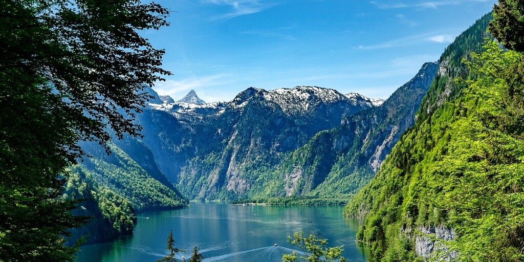
Please note, just over the top you quickly turn right into Alte Reichenallerstrasse. Here you can encounter stray cattle in the alpine pasture, so watch out again. You will pass the Hintersee, a very busy tourist spot on the lake, with really only restaurants. Eventually you will arrive at the Königssee, a lake on the border with Austria. It is the deepest lake in Germany with a depth of up to 190 m. Most of the lake is located in the Berchtesgaden National Park.
At the Königssee you have the opportunity to stop and have lunch before driving the last part of this route on the Rossfeld panoramastrasse.
The Rossfeld panoramastrasse is not only the highest one, but also one of the most famous toll roads in Germany. You drive through the beautiful Berchtesgadener Alps where you also drive partly through Austria. The Rossfeldstrasse is over 15 kilometers long and the top is at an altitude of 1540 meters.
As mentioned, you can enjoy the beautiful panoramic view in good weather, you can see Salzburg as well as Berchtesgaden and the Austrian Alps. There are plenty of places where you can put the engine aside to enjoy and take a picture. On the way you can visit the Dokumentation Obersalzberg. This is a museum of learning and remembrance. At this historic location you are offered the opportunity to take in the history of the Obersalzberg and that of National Socialism. There is also the possibility to visit the Kehlsteinhaus, also known as the Eagle's Nest. It is built on top of the Kehlstein.
The house has been in use as a mountain restaurant since 1952 and access is only possible with the special Kehlstein Line buses. These take you to a parking lot from where you make the final climb up through a tunnel and an elevator.
At an altitude of 1,834 meters, in clear weather and in noticeably pure mountain air, you even have a view of the imposing Hochkönig with its 2,941 meters.
After enjoying the beautiful views of the Obersalzberg you drive via Berchtesgaden to Ainring.
Here you can spend the night in Hotel De Reiteralm.

 Links
Links  Usage
Usage Want to download this route?
You can download the route for free without MyRoute-app account. To do so, open the route and click 'save as'. Want to edit this route?
No problem, start by opening the route. Follow the tutorial and create your personal MyRoute-app account. After registration, your trial starts automatically.  Disclaimer
Use of this GPS route is at your own expense and risk. The route has been carefully composed and checked by a MyRoute-app accredited RouteXpert for use on TomTom, Garmin and MyRoute-app Navigation.
Changes may nevertheless have occurred due to changed circumstances, road diversions or seasonal closures. We therefore recommend checking each route before use.
Preferably use the route track in your navigation system. More information about the use of MyRoute-app can be found on the website under 'Community' or 'Academy'.