Day 12 of 12 Day Roadtrip Iceland Borgarnes Reykjavik

This route was brought to you by:
RouteXpert René Plücken (MRA Master)
Last edit: 08-10-2025
 Route Summary
 Driving in Iceland is a great experience, whether you travel by car or, as described in this review, by motorcycle.
These itineraries are based on information about Iceland found online, particularly from the Guide to Iceland, where you'll find a wealth of information to help you prepare for your trip. The material on this site has been compiled with great care; the link can be found in the review of the first itinerary in this series.
You will drive through landscapes that are varied and beautiful, you will see glacier tongues, volcanic mountains, geothermal areas with active geysers, lava fields, craters, forests, waterfalls and incredibly rugged stretches of coastline.
The routes in the north are part of the Arctic Coast Way.
The main roads are of good quality, but you'll also be traveling on gravel roads, making them unsuitable for road motorcycles. Some of these roads are sometimes closed due to weather. It's therefore important to check the weather forecast and road conditions every day before you leave. This information can be found on the website of the Icelandic Meteorological Office and, for road conditions, on the website of the Icelandic Road and Coastal Administration. The links are in the review.
Due to the Icelandic climate, this trip can only be done in summer.
Route rating: ★★★★★
A beautiful end to an impressive road trip. You'll see hot springs, historic villages, waterfalls, folklore, and fjords – a perfect blend of nature and culture.
 Share this route


Animation

Verdict


Duration
9h 42m

Mode of travel
Car or motorcycle

Distance
270.96 km

Countries

 RouteXpert Review
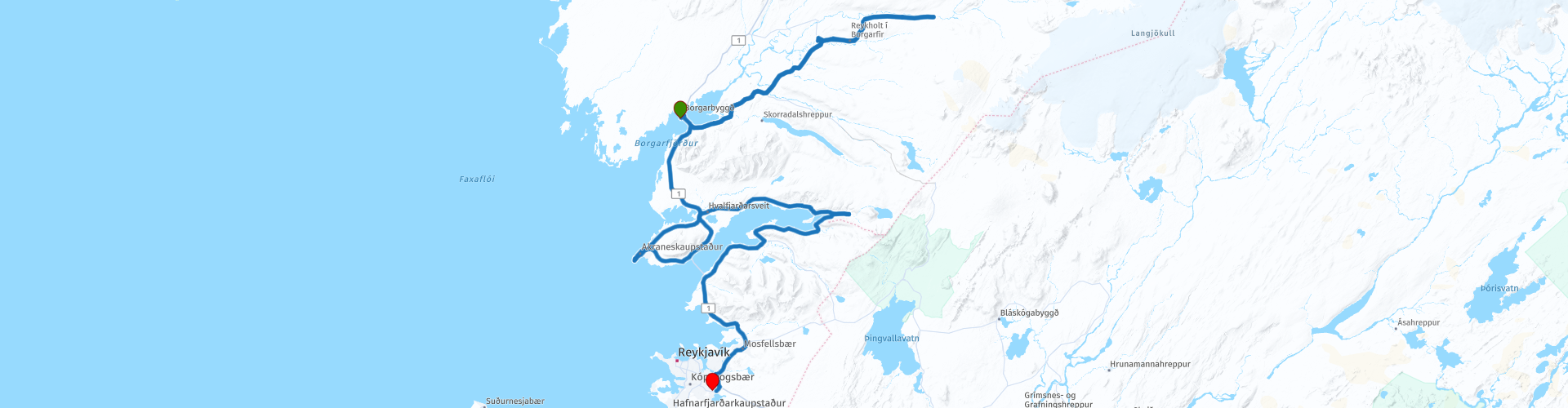
 On the final day of this road trip, you'll explore some of West Iceland's most impressive wonders. From Borgarnes, cross the Borgarfjörður fjord via Route 1 and follow Route 50 to the Deildartunguhver Thermal Springs.
Deildartunguhver is the hot spring with the highest flow rate in Europe: an impressive 180 liters per second of water at 100°C. Some of this water is used to provide geothermal energy to homes in West Iceland. Visit this impressive force of nature, or take a relaxing bath in the pristine waters at the Krauma Geothermal Nature Baths.
Next up is the historic village of Reykholt, one of Iceland's most significant historical sites. It is best known as the home of Snorri Sturluson (1206–1241), Iceland's most famous author. The geothermally heated Snorralaug swimming pool, named after him, is one of the few medieval structures still intact. Snorrastofa, the cultural centre and research institute, offers exhibitions, tours, and lectures. Reykholt Church regularly hosts music recitals.
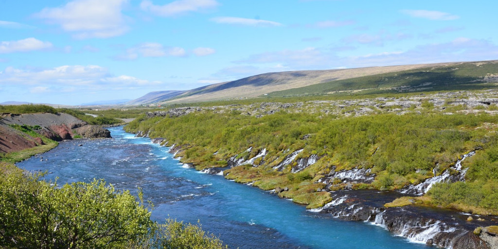
After Reykholt, continue east on Route 518 to the Barnafoss and Hraunfossar waterfalls. Barnafoss is a powerful waterfall flowing through a narrow gorge. Its name means "children's waterfall," referring to a tragic story about two boys who fell from a bridge. Hraunfossar is quieter and wider, with water trickling through the lava rocks in numerous streams. Both waterfalls are within walking distance of each other. Nearby, there's a café-restaurant for a delicious lunch.
You'll return via Route 518 and then south along Route 50 to the Trolls Waterfalls in Fossatún. This area is fun for both children and adults, with elf houses, troll statues, and information about Icelandic folklore.
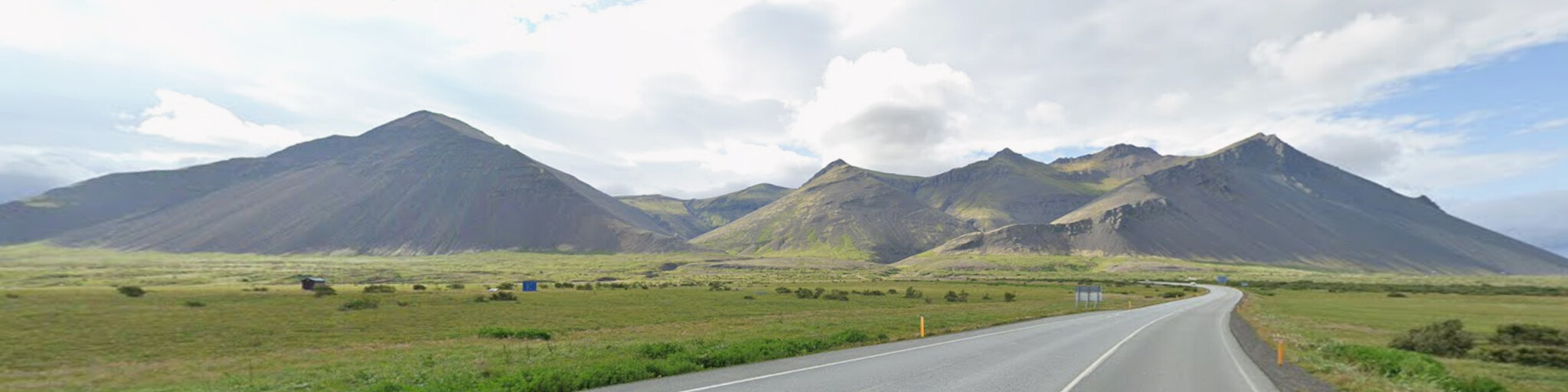
Then you'll drive back to Borgarnes via Route 50, taking Route 1 past the imposing Hafnarfjall mountain range. Your next stop is the Old Akranes Lighthouse. In the harbor, you'll see two lighthouses. The smaller one, built in 1918, is one of Iceland's oldest concrete lighthouses and was decommissioned in 1947. The larger one is still in use and open to the public.
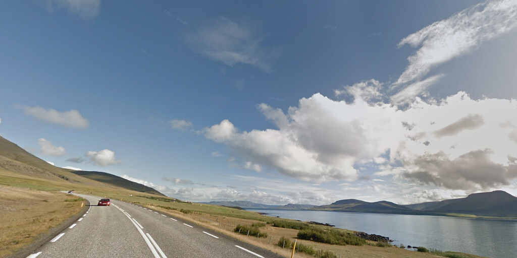
You'll continue along the green, mountainous Hvalfjörður fjord and briefly deviate from the route to visit Glymur Waterfall. From the parking lot, it's a short walk to this beautiful waterfall. At 196 meters, Glymur is Iceland's highest waterfall. It's located in the Botnsá River, which flows from the deep lake Hvalvatn into the fjord. The waterfall is less well-known because its lower section falls into a narrow gorge, making it difficult to see. The hike there is adventurous and offers stunning views. This is the last attraction of this 12-day road trip.
After visiting Glymur, follow Route 47 along the other side of the fjord until you reach Route 1 again, which takes you back to Reykjavík.
 Links
Links  Usage
Usage Want to download this route?
You can download the route for free without MyRoute-app account. To do so, open the route and click 'save as'. Want to edit this route?
No problem, start by opening the route. Follow the tutorial and create your personal MyRoute-app account. After registration, your trial starts automatically.  Disclaimer
Use of this GPS route is at your own expense and risk. The route has been carefully composed and checked by a MyRoute-app accredited RouteXpert for use on TomTom, Garmin and MyRoute-app Navigation.
Changes may nevertheless have occurred due to changed circumstances, road diversions or seasonal closures. We therefore recommend checking each route before use.
Preferably use the route track in your navigation system. More information about the use of MyRoute-app can be found on the website under 'Community' or 'Academy'.