Arctic Coast Way Day 2 Blonduos Grettislaug

This route was brought to you by:
RouteXpert René Plücken (MRA Master)
Last edit: 16-03-2021
 Route Summary
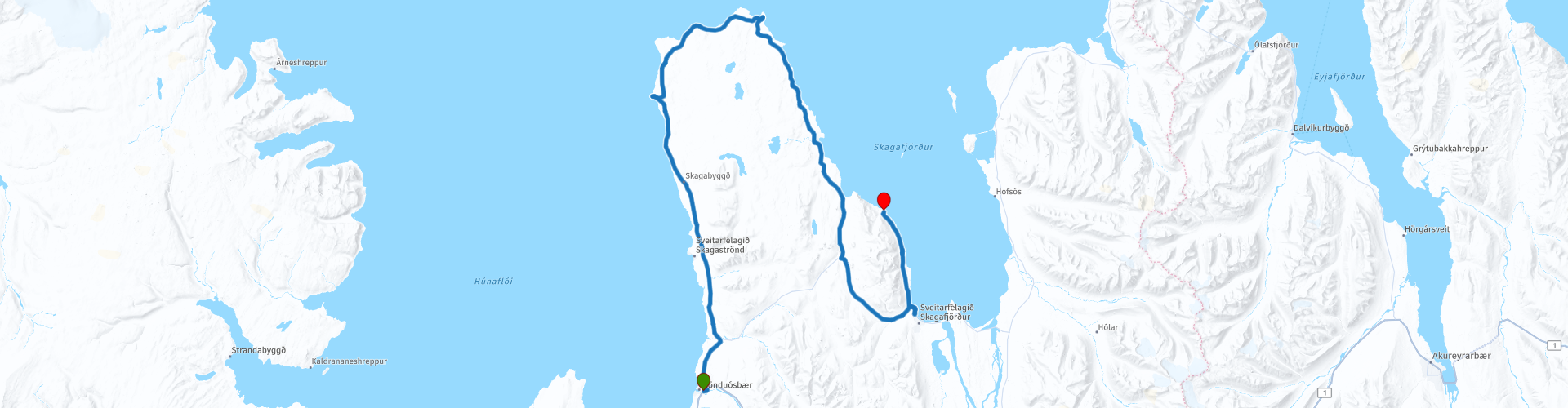
 The Arctic Coast Way starts in Hvammstangi in the North West and ends in Bakkafjörður in the North East. This approximately 900 kilometer long “Off the Beaten track” route passes through rugged North Iceland and follows the beautiful Fjord coast.
Driving the Arctic Coast Way is different from what you might be used to. It is a true off the beaten track route that takes you through beautiful remote landscapes. This means leaving civilization behind in the spirit of adventure and exploration.
We drive large parts on unpaved roads (about 1/3 part), sometimes with large holes, so this route is only suitable for Adventure or Off Road motorcycles or for cars with 4x4 drive. Drive slowly to enjoy the magical surroundings but because of the sheep and birds that can walk on the road.
The route runs close to the Arctic Circle and many stops are planned along the way to visit Iceland's many highlights. A number of examples are the many waterfalls, glaciers, fishing villages and fjords. In some cases you have to take a walk (hike), these can influence the planning of the rides, so keep that in mind. Due to the slower speed on the unpaved roads and the sights en route, the routes have been kept short.
Enjoy the freedom along the way, but respect nature and keep in mind that wild camping is prohibited, you are only allowed to camp on campsites or with the permission of the owner on his private property. All villages along the route have camping options. All campsites have rubbish bins and sanitary facilities. Do not drive off-road, but stay on the designated roads. Off-road driving is prohibited, with heavy fines.
This is the second day of the six day Arctic Coast Way Roadtrip which I rate with 5 ***** Stars for its beautiful nature, beautiful places to visit and the adventurous aspect.
Enjoy!
 Share this route


Animation

Verdict


Duration
10h 24m

Mode of travel
Car or motorcycle

Distance
140.66 km

Countries

 RouteXpert Review
 The first stop is at Kálfshamersnes Cape and Kálfshamarsvík-Bay (RP3), a small inlet at the Kálfshamarsnes cape. Kálfshamarsvík Bay is home to one of the most breathtaking basalt columns here in Iceland. A true natural jewel!
We continue on the gravel road to Skagatáarviti lighthouse (RP4). After a short walk you reach the small orange lighthouse, from where you have a beautiful view over the Cliffs and the sea.
The next stop is at the Ketubjörg cliffs (RP5). Stop to enjoy the great view, From the cliffs you can see the waterfall plunging itself into the ocean. One of the many natural gems in Iceland.
We drive south via the 745, on the right side you have a beautiful view of the fjord Skagafjörður, with a little luck you can spot a whale.
Then the highlight of this day is the Puffin boat trip to Drangey Island (RP8). The 4-hour boat trip to the island of Drangey starts in the marina Sauðárkrókur and takes us through the beautiful landscape of Skagafjordur. There is also a short 2-hour boat trip, which takes you around the island and does not go ashore.
Drangey Island is a bird watcher's paradise. The island is a breeding colony for thousands of seabirds, including puffins, guillemots, gannets, kittiwakes, petrels, shearwaters along with ravens and vulture falcons. The island is a steep palagonite rock of about 180 meters high and offers a beautiful view of the entire fjord. It is not a problem if someone does not want to take on the hiking part of the trip to the top of the island. Those who wish can stay on the boat or go ashore at the small harbor in Drangey, relax and enjoy the beautiful landscapes all around.
The trip to Drangey is a unique experience that combines sightseeing, bird watching, sailing, walking with personalized service and guidance. There is a man-made path to the top of the island along the cliffs. While walking you can get close to the puffins who often rest a few meters from the path. During the walk, our guides will share ancient stories of Grettir the Strong, a Viking who lived in exile on the island, and more recent stories of how the island's resources have been harvested from past to present.
During the summer months, June 20 - August 20, there are daily boat trips to Drangey from 10:00 am.
After the boat trip you have the choice to stay overnight in Sauðárkrókur or drive 16 km back to Camp Site Grettislaug (RP9), where you can reminisce in the Grettslaug Hot Spring Pool or enjoy a beautiful view of Reykjadiskur after a walk.


 Links
Links  Usage
Usage Want to download this route?
You can download the route for free without MyRoute-app account. To do so, open the route and click 'save as'. Want to edit this route?
No problem, start by opening the route. Follow the tutorial and create your personal MyRoute-app account. After registration, your trial starts automatically.  Disclaimer
Use of this GPS route is at your own expense and risk. The route has been carefully composed and checked by a MyRoute-app accredited RouteXpert for use on TomTom, Garmin and MyRoute-app Navigation.
Changes may nevertheless have occurred due to changed circumstances, road diversions or seasonal closures. We therefore recommend checking each route before use.
Preferably use the route track in your navigation system. More information about the use of MyRoute-app can be found on the website under 'Community' or 'Academy'.