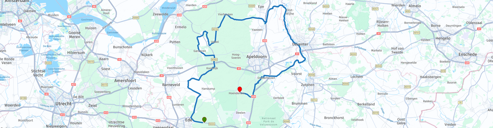
TTT 2009 02 Ede Hoenderloo

This route was brought to you by:
RouteXpert Hans van de Ven (Mr.MRA)
Last edit: 19-03-2019
 Route Summary
 The 173 ANWB Promoter TankTasTocht (TTT) were scanned by Henry ten Dam and signed by Leon Stolk in Mapsource and later placed as a Track in a .gpx file. These have been made available through the MrGPS website with the approval of the ANWB Promoter so that everyone can enjoy it. The 1st TTT is from 1992, so the route may differ slightly from the original.
I have checked all route points and, where necessary, placed them on the road. Also, if necessary, I have further spaced the start point and end point of the route to avoid navigating directly to the end point, and I added the POI files from the start and end point just like a possible stop.
Finally, I made the route the same for TomTom, Garmin and MyRoute-app Navigation users.
Thanks to Henry, Leon, MrGPS and Promoter.
 Share this route


Animation

Verdict


Duration
3h 4m

Mode of travel
Car or motorcycle

Distance
138.24 km

Countries

 RouteXpert Review
 * The Veluwe is a predominantly wooded region in the Dutch province of Gelderland and a former quarter of the Duchy of Gelre. The Veluwe measures around 1000 km². In contrast to the old quarter, the Veluwe has no clearly defined fixed boundaries. (Source: Wikipedia).
** The IJssel or Gelderse IJssel is a Dutch branch of the Rhine. At Westervoort, east of Arnhem, the river branches off from the Rhine at Kmr 878.6 and flows in a northeastern direction and later in a northerly direction to the Ketelmeer and IJsselmeer respectively. (Source: Wikipedia).
Because I have not (yet) driven this route myself, this route gets 3 stars.
Route details:
rp 20 - Lunch possibility in Oene at "de Rietstulp".


 Links
Links  Usage
Usage Want to download this route?
You can download the route for free without MyRoute-app account. To do so, open the route and click 'save as'. Want to edit this route?
No problem, start by opening the route. Follow the tutorial and create your personal MyRoute-app account. After registration, your trial starts automatically.  Disclaimer
Use of this GPS route is at your own expense and risk. The route has been carefully composed and checked by a MyRoute-app accredited RouteXpert for use on TomTom, Garmin and MyRoute-app Navigation.
Changes may nevertheless have occurred due to changed circumstances, road diversions or seasonal closures. We therefore recommend checking each route before use.
Preferably use the route track in your navigation system. More information about the use of MyRoute-app can be found on the website under 'Community' or 'Academy'.