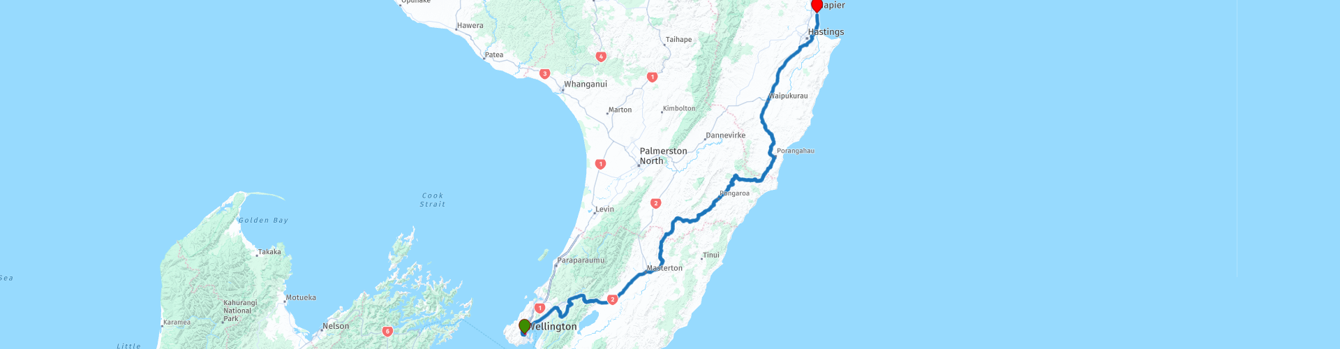
10 Wellington to Napier

This route was brought to you by:
RouteXpert Nick Carthew - (MRA Master)
Last edit: 12-04-2021
 Route Summary
 The excellent landscapes, very good roads and good attractions has earned this route 4**** stars.
 Share this route


Animation

Verdict


Duration
8h 30m

Mode of travel
Car or motorcycle

Distance
389.25 km

Countries

 RouteXpert Review
 Leave SH2 after 18 kms at RP 8, exit to Silverstream over the Te Awa Kairangi / Hutt River. I have suggested a stop here to buy a picnic from the New World supermarket to make a change from cafes and restaurants although I have still suggested stops on this route.
The road from Silverstream is very twisty as it climbs up an area known as Blue Mountains. You'll have some great views on some of the bends. The route then follows the Mangaroa River as it heads downstream through Whitemans Valley.
Join the SH2 again at Upper Hutt and stop for a view of the twin reservoirs at RP 15, Twin Lakes Lookout. Water is taken from the Hutt River and either goes directly to the treatment plant or is stored in the lakes for future use.
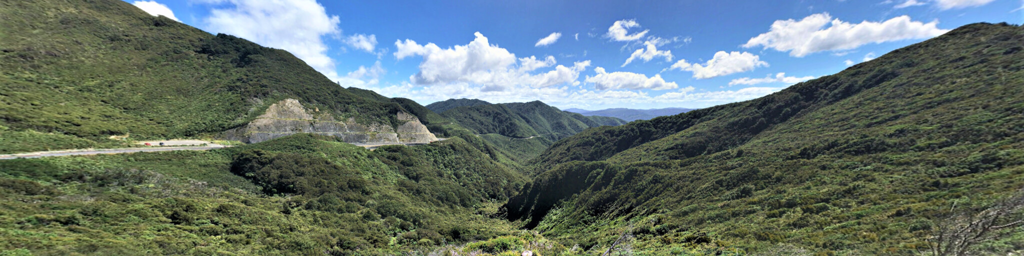
I have suggested a Coffee stop at Aston Norwood Cafe before you climb up and into the Rimutaka Range. The Rimutaka Pass at RP 18 is the highest point of this route at 555m and is a good spot for some photos.
Coming down from the Rimutaka Range you enter a flat landscape of farmland with lush, green pastures for livestock. There are 5 large rivers to cross over as you make your way to Masterton, these are the reason for the lush pasture land. At Masterton, leave the SH2 and join the Te Ore Ore Bideford Road to RP 24, here you'll join the Whangaehu Valley Road, this is a great riding road that changes it's name to Route 52 at the regional border, RP 26, Wellington to Manawatu-Wanganui. It changes it's name again at the next regional border Manawatu-Wanganui to Hawke's Bay RP 34 but the road and landscape remain the same until you rejoin the SH2.
From RP 24 the start of the Whangaehu Valley Road to RP 36 where you'll rejoin the SH2 is 185 kms of exquisite road to enjoy with many bends and stunning scenery. This section of the route is one of the reasons that so many of us enjoy motorcycling.
I have suggested a fuel and lunch stop at Pongaroa, birthplace of Dr Maurice Wilkins who won the Nobel Prize for his part in uncovering the secrets of DNA. A memorial to Dr Wilkins stands on the village green opposite the corner store.
A few kms after entering the Hawke's Bay region, you'll discover the longest place name in the world that has a staggering 85 characters, can you pronounce it!
Taumatawhakatangihangakoauauotamateaturipukakapikimaungahoronukupokaiwhenuakitanatahu.
Imagine living here and having to fill out your address on anything!
It's actually the name of a hill and translates roughly as "The summit where Tamatea, the man with the big knees, the slider, climber of mountains, the land-swallower who travelled about and played his flute to his loved one".
Anyway there's a signpost to stop for a photo at RP 35.
I have suggested another coffee stop just after you rejoin the SH2, from here you are an hour away from the end of the route at Napier on the coast of Hawkes Bay.
Napier:
Street after street of stunning and beautifully-restored Art Deco buildings have made Napier famous as one of the most complete collections of Art Deco buildings in the world. In 1931 a massive earthquake rocked Hawke's Bay for more than three minutes, killing nearly 260 and destroying the commercial centre of Napier.
Napier is home to many fine wineries, fabulous restaurants, bars and cafes. The boutique shops are a must-visit, as is the Sea Walls collection of magnificent murals painted on more than 50 walls around the city. Grab a map and walk or ride around the city to see them up close.
The route ends on Marine Parade outside of the Quality Inn hotel, being a 4+ star hotel, it isn't the cheapest but it does have off street parking and is a good location should you decide to stay more than one night. As with all cities, Napier has many different types of accommodation and I have selected a few below in the links.
Enjoy.


 Links
Links  Usage
Usage Want to download this route?
You can download the route for free without MyRoute-app account. To do so, open the route and click 'save as'. Want to edit this route?
No problem, start by opening the route. Follow the tutorial and create your personal MyRoute-app account. After registration, your trial starts automatically.  Disclaimer
Use of this GPS route is at your own expense and risk. The route has been carefully composed and checked by a MyRoute-app accredited RouteXpert for use on TomTom, Garmin and MyRoute-app Navigation.
Changes may nevertheless have occurred due to changed circumstances, road diversions or seasonal closures. We therefore recommend checking each route before use.
Preferably use the route track in your navigation system. More information about the use of MyRoute-app can be found on the website under 'Community' or 'Academy'.