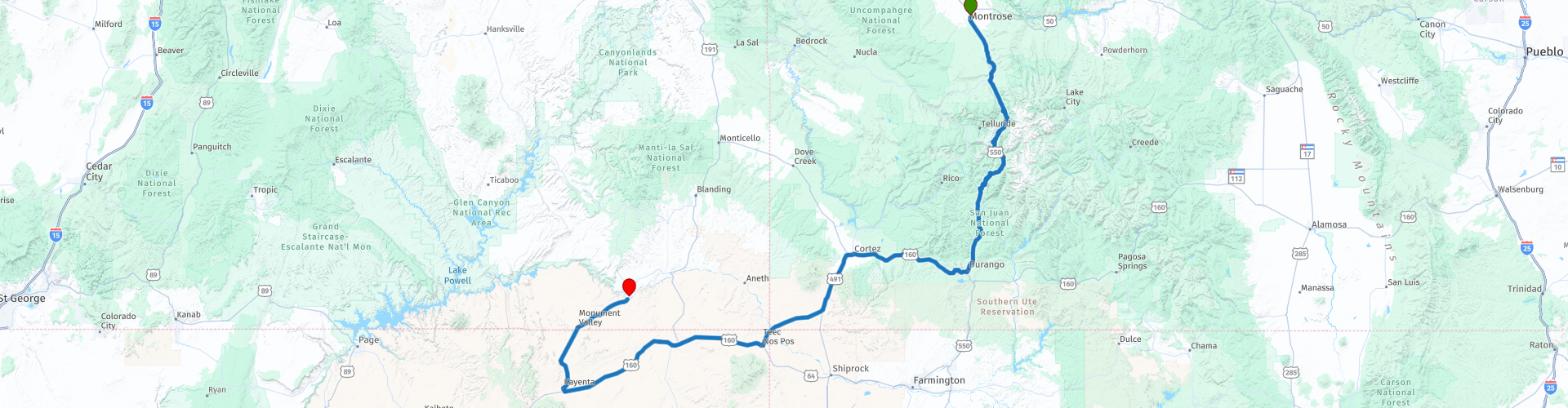
Montrose to Mexican Hat through Monument Valley

This route was brought to you by:
RouteXpert Paul Hedges - Adv RouteXpert
Last edit: 16-04-2020
 Route Summary
 Another day of extremes mountain roads leading to Movie scenery we have seen on countless cowboy films. Along the way travel through 4 States in one day. This day is what the Mid-West is all about.
4 Stars all day
 Share this route


Animation

Verdict


Duration
6h 20m

Mode of travel
Car or motorcycle

Distance
509.91 km

Countries

 RouteXpert Review
 Heading south out of Montrose along Highway 550 you will see the horizon constantly filled wit the mountains before you. The roads are a joy to ride with long sweeping curves as you arrive in Ouray.
Ouray, known as the "Little Switzerland of America," offers up picturesque mountain views on all side as you continue south along the Million Dollar Highway. While the official origin of the name isn't known for sure, local lore suggests it came from the cost it took to build the highway, the "million dollar" views you'll experience while driving it, or the amount of gold ore that remains in the roadway's fill. The Million Dollar Highway climbs up and over Red Mountain Pass, (WP8) with a summit of 11,075 feet before starting the decent into Silverton. Continuing South be sure to stop at the summit of Molas Pass (at 10,899 feet) for beautiful views of the surrounding San Juan Mountains. (WP11) and then climb over Coal Bank Pass, (WP13) which has a summit of 10,660 feet. The Million Dollar Highway is a charming name for a twisty challenging road that offers some of the best scenery in the state. Just be aware that most of this road has no guard rails so you attention cannot stray too far from the road at any time.
Leaving Durango and heading west you start to see a change in the landscape as the mountains and the greenery start to decline and as you head along the Navajo Trail the grasslands seem to take over. The mostly 4 lane road will have moving east quickly as you arrive in Cortez.
Passing through the Ute Mountain Reservation take time to stop and explore the Yucca National House Monument. (WP25)
Yucca House National Monument preserves a Montezuma Valley Ancestral Pueblo site and remains excavated, preserving its archaeological integrity and beauty for future generations of scientists and visitors. To the untrained eye, the site is simply a cluster of rocky mounds. But to archaeologists or those with a bit of an imagination, it holds the secrets of a large and active farming community that existed centuries ago. I know which one I am
Turning west we find ourselves at the state border, in fact state borders. At Four Corners Monument (WP31) you are at the meeting point of Colorado, New Mexico, Utah and Arizona.
The 160 continues to head west across wide open countryside until we arrive at the town of Kayenta and we head north. The long straight road reaches out into the distance and the wide open plains just seem to all look familiar. This is cowboy country Monument Valley, the scene of many great western films. They say you should not put your camera away for second as you pass through. In fact, stop repeatedly as the landscape around you changes every 50 feet and a new picture opportunity appears.
Crossing the San Juan river into Mexican Hat signals the end of a wonderful 4 star day of travel and landscapes


 Links
Links  Usage
Usage Want to download this route?
You can download the route for free without MyRoute-app account. To do so, open the route and click 'save as'. Want to edit this route?
No problem, start by opening the route. Follow the tutorial and create your personal MyRoute-app account. After registration, your trial starts automatically.  Disclaimer
Use of this GPS route is at your own expense and risk. The route has been carefully composed and checked by a MyRoute-app accredited RouteXpert for use on TomTom, Garmin and MyRoute-app Navigation.
Changes may nevertheless have occurred due to changed circumstances, road diversions or seasonal closures. We therefore recommend checking each route before use.
Preferably use the route track in your navigation system. More information about the use of MyRoute-app can be found on the website under 'Community' or 'Academy'.