TTT 2002 07 Rondje t Gooi

This route was brought to you by:
RouteXpert Hans van de Ven (Mr.MRA)
Last edit: 20-08-2024
 Route Summary
 The 173 ANWB Promoter TankTasTochten (TTT) were scanned by Henry ten Dam and signed by Leon Stolk in Mapsource and later placed as a Track in a .gpx file. These have been made available with the approval of ANWB Promotor via the website of MrGPS so that everyone can enjoy it. The 1st TTT is from 1992, so the route may be slightly different from the original.
I checked all route points and placed them neatly on the road. Also, if necessary, I have put the start point and end point of the route a bit further apart to avoid navigating directly to the end point and I have added the POI files from the start and end point just like a possible stopping point.
Finally, I created the route for TomTom, Garmin and MyRoute-app Navigation users.
With thanks to Henry, Leon, MrGPS and Promoter.
 Share this route


Animation

Verdict


Duration
3h 13m

Mode of travel
Car or motorcycle

Distance
123.86 km

Countries

 RouteXpert Review
 * Het Gooi is a Dutch region in the southeast of the province of Noord-Holland. The name, also written as' t Gooi, but sometimes also supplemented to Gooiland in a literary way or alternatively, goes back to the word Gooi, an old form of cemetery.
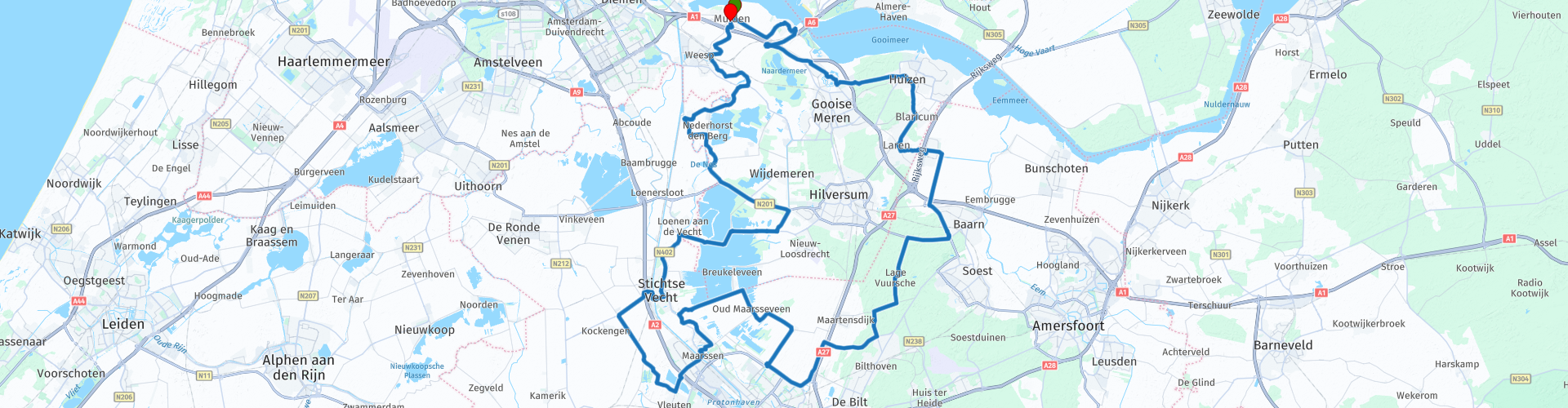
This route goes, except for a small piece of motorway between Muiderberg & Naarden, on beautiful roads. You will do the following places: Muiderberg, Naarden Fortress, Huizen, Blaricum, Laren, Eemnes, Baarn, Tienhoven, Maarssen, Breukelen, Nieuwersluis, Nederhorst ten Berg, Weesp and Muiden as last.
Because I have driven large parts of this route myself, this route gets 4 stars.
Route details:
There are plenty of options along the route for lunch and taking pictures.


 Links
Links  Usage
Usage Want to download this route?
You can download the route for free without MyRoute-app account. To do so, open the route and click 'save as'. Want to edit this route?
No problem, start by opening the route. Follow the tutorial and create your personal MyRoute-app account. After registration, your trial starts automatically.  Disclaimer
Use of this GPS route is at your own expense and risk. The route has been carefully composed and checked by a MyRoute-app accredited RouteXpert for use on TomTom, Garmin and MyRoute-app Navigation.
Changes may nevertheless have occurred due to changed circumstances, road diversions or seasonal closures. We therefore recommend checking each route before use.
Preferably use the route track in your navigation system. More information about the use of MyRoute-app can be found on the website under 'Community' or 'Academy'.