
Dreux to Argenton sur Creuse

This route was brought to you by:
RouteXpert Nick Carthew - (MRA Master)
Last edit: 12-09-2025
 Route Summary
 I have awarded 3 stars*** for this route as the roads, scenery and attractions are all good.
 Share this route


Animation

Verdict


Duration
7h 16m

Mode of travel
Car or motorcycle

Distance
321.13 km

Countries

 RouteXpert Review
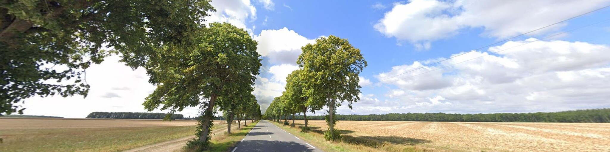
 Now the route travels through a thick forest.
The Forêt de Fréteval, is famous for being the site of Operation Marathon, a World War II escape line network that supported downed Allied airmen and members of the French Maquis. The amazing story is told in ‘The Hidden Army’, the first book to be written about the miracle of Operation Marathon. The Freteval forest was code named Sherwood.
In April and May 1944, de Blommaert and another Belgian, RAF officer Lucien Boussa, set up a headquarters in the town of Cloyes-sur-le-Loir near the Freteval Forest. De Blommaert persuaded the local armed Resistance group to avoid any activity in the area as it would attract German attention and jeopardize the airmen in the camp. He negotiated with farmers, bakers, and merchants to deliver food to Sherwood Camp and he arranged with Philippe d'Albert-Lake, head of the Comet Line in Paris, and his American wife, Virginia d'Albert-Lake, to set up a system of guides to get airmen from safe houses in Paris to the forest camp. Supplies such as tents were parachuted into the fields near the forest.
Look it up, it's an interesting read.
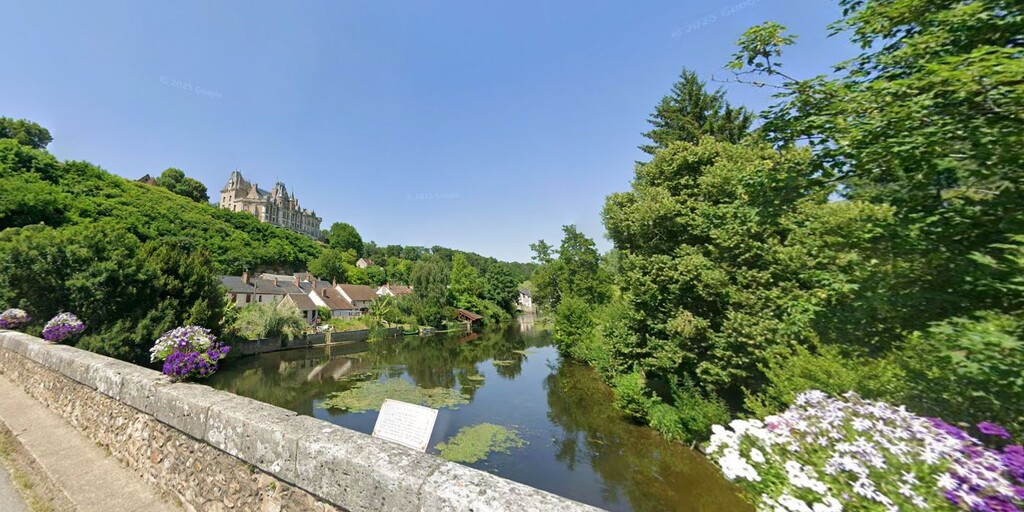
The route leaves the river at Vendôme and I have suggested a lunch stop here, there are several restaurants to choose from and you can also stretch your legs with a visit to the Trinity Abbey a former Benedictine monastery or sample som magnifent panoramic views over the town from the ruins of Château Vendôme .
Not long after lunch, the route meets the mighty La Loire, France's longest river at 1,012 km, it drains 117,054 square kilometres, more than one fifth of France's land mass. Sadly this route only follows La Loire for 8 km and crosses over it at Amboise. The route actually crosses twice, firstly onto an island called l'Ile d'Or. The island was chosen in 503 by Clovis, king of the Franks, and Alaric II, king of the Visigoths, to sign a peace treaty. The history continues on the other bank of the river and a great view of the Royal Château d'Amboise can be seen as you cross the second bridge. The Château was confiscated by the monarchy in the 15th century, it became a favoured royal residence and was extensively rebuilt. King Charles VIII died at the château in 1498 after hitting his head on a door lintel! Justice?
The Regional Natural Park of Brenne is next and is sometimes known as "The country of a 1000 lakes".
Brenne Natural Park is said to one of France’s best kept secrets. During the Middle Ages Brenne was a swamp. Legend has it that the monks of Méobecq and Saint Cyran started landscaping the marshes in the 8th century, clearing the land and building dykes to improve the local habitat. They introduced fish farming to improve the drainage and provide for their long term future. There are actually over 2,000 lakes and ponds making Brenne one of the most important fish farming areas of France. It is also a paradise for flora and fauna, especially migratory birds that stop there to reproduce. A dream destination for botany and ornithology fans, this haven of peace strewn with lakes and ponds, marshland, reed beds, moors, prairies and woods is home to no fewer than 2,300 animal and 1,200 plant species! Among its most emblematic are European pond turtles, purple herons and Eurasian Bitterns.
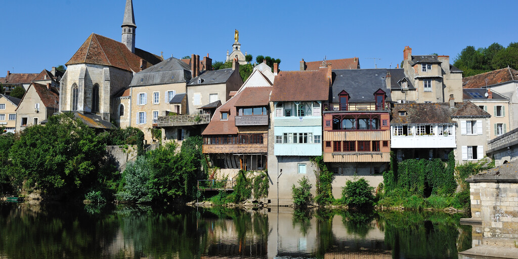
The third river followed by this route is La Creuse and this will take you to a smart little hotel in Argenton sur Creuse. There are a lot of roman ruins here which are worthy of a visit. The small town of Argenton sur Creuse is very picturesque with typical old houses with galleries and balustrades reflected in the water of the Creuse river. The best places to admire this beautiful scene are the old bridge over the river or the terrace of Bonne-Dame chapel perched on the hillside above, where the view over the rooftops and valley is stunning.
Enjoy
 Links
Links  Usage
Usage Want to download this route?
You can download the route for free without MyRoute-app account. To do so, open the route and click 'save as'. Want to edit this route?
No problem, start by opening the route. Follow the tutorial and create your personal MyRoute-app account. After registration, your trial starts automatically.  Disclaimer
Use of this GPS route is at your own expense and risk. The route has been carefully composed and checked by a MyRoute-app accredited RouteXpert for use on TomTom, Garmin and MyRoute-app Navigation.
Changes may nevertheless have occurred due to changed circumstances, road diversions or seasonal closures. We therefore recommend checking each route before use.
Preferably use the route track in your navigation system. More information about the use of MyRoute-app can be found on the website under 'Community' or 'Academy'.