Rondreis Hoge Venen en Eifel via Altenahr en Bad Munstereifel

This route was brought to you by:
RouteXpert Stijn Claus
Last edit: 10-02-2019
 Route Summary
  Share this route


Animation

Verdict


Duration
6h 24m

Mode of travel
Car or motorcycle

Distance
331.79 km

Countries


 RouteXpert Review
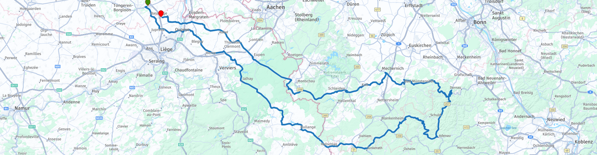
 The first part of our journey goes south-east, towards the High Fens. It will not be long before the urban agglomeration will change for the nature of the High Fens-Eifel National Park.
Before we cross the border with Germany, we pass the Gileppestuwdam, the highest point in Belgium, the 'signal de Botrange' and Lake Butgenbach.
Then we swing on the border of North and South Eifel, the necessary hairpin turns are not missing in this route. Via Altenahr and Bad Munstereifel we drive back to Belgium. Near Monschau we pass back the border with Belgium and drive over the infamous N67, which is better known as the highway to hell.
If we leave the East Cantons behind us, it is definitely worth stopping at the American military cemetery Henri-Chapelle Not only the cemetery but also the breathtaking view on the other side are definitely worth it
The route ends again near the highway E313. From here Antwerp, Maastricht or Brussels is easily accessible.


 Usage
Usage Want to download this route?
You can download the route for free without MyRoute-app account. To do so, open the route and click 'save as'. Want to edit this route?
No problem, start by opening the route. Follow the tutorial and create your personal MyRoute-app account. After registration, your trial starts automatically.  Disclaimer
Use of this GPS route is at your own expense and risk. The route has been carefully composed and checked by a MyRoute-app accredited RouteXpert for use on TomTom, Garmin and MyRoute-app Navigation.
Changes may nevertheless have occurred due to changed circumstances, road diversions or seasonal closures. We therefore recommend checking each route before use.
Preferably use the route track in your navigation system. More information about the use of MyRoute-app can be found on the website under 'Community' or 'Academy'.